Property Record
Technology Dr, Christiansburg, VA 24073

Property Detail
Technology Dr
100516
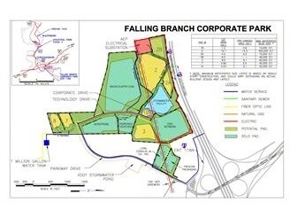
FALLING BRANCH CORP PARK PARCEL 8
Commercialnec
MONTGOMERY
I2
Virginia
B and X Area of moderate flood hazard, usually the area between the limits of the 100-year and 500-year floods.
8
2025
4.10 AC
2025
Blacksburg & Wytheville
021101
Other Market Areas
20,100 SF
Blacksburg-Christiansburg-Radford, VA
NEARBY LISTINGS FOR SALE OR LEASE
DEMOGRAPHICS near Technology Dr
1 mile
3 mile
5 mile
2025 Total Population
1,185
15,654
27,278
2030 Population
1,186
15,693
27,346
Pop Growth 2025-2030
+ 0.08%
+ 0.25%
+ 0.25%
Average Age
42
41
41
2025 Total Households
498
6,730
11,611
HH Growth 2025-2030
0.00%
+ 0.30%
+ 0.33%
Median Household Inc
$89,852
$71,062
$79,605
Avg Household Size
2.30
2.30
2.30
2025 Avg HH Vehicles
2.00
2.00
2.00
Median Home Value
$282,499
$247,919
$263,052
Median Year Built
1980
1981
1990
Nearby Places
Map Layers
Map Styles
 Street
 Aerial
Transit
 Traffic
 Biking
Places
Listings with unknown addresses are not visible on the map
- Restaurants
- Banks
- Shops
- Fitness
- Groceries
PUBLIC TRANSPORTATION
AIRPORT
Roanoke/Blacksburg Regional (Woodrum Field)
Drive
Walk
Distance
Roanoke/Blacksburg Regional (Woodrum Field)
45 min
32.1 mi
Freight Ports
Virginia Port Authority - Richmond
Drive
Walk
Distance
Virginia Port Authority - Richmond
248 min
215.9 mi
Nearby Properties
Address
Land Use
TOTAL SIZE
Lot Size
Zoning
Address
Land Use
TOTAL SIZE
Lot Size
Zoning
Address
Land Use
TOTAL SIZE
Lot Size
Zoning
190,465 SF
30.37 AC
R1
Address
Land Use
TOTAL SIZE
Lot Size
Zoning
315,000 SF
46.09 AC
I2
Address
Land Use
TOTAL SIZE
Lot Size
Zoning
16.65 AC
I2
Address
Land Use
TOTAL SIZE
Lot Size
Zoning
61,682 SF
21.65 AC
A
Address
Land Use
TOTAL SIZE
Lot Size
Zoning
147,552 SF
4.54 AC
I2
Address
Land Use
TOTAL SIZE
Lot Size
Zoning
49,525 SF
11.07 AC
B3
Address
Land Use
TOTAL SIZE
Lot Size
Zoning
281,082 SF
33.56 AC
I2
Address
Land Use
TOTAL SIZE
Lot Size
Zoning
128,416 SF
17.24 AC
B3
Address
Land Use
TOTAL SIZE
Lot Size
Zoning
46.46 AC
GB
Address
Land Use
TOTAL SIZE
Lot Size
Zoning
2.39 AC
B3
Address
Land Use
TOTAL SIZE
Lot Size
Zoning
7,800 SF
11.47 AC
B3
Address
Land Use
TOTAL SIZE
Lot Size
Zoning
52,475 SF
19.11 AC
B3
Address
Land Use
TOTAL SIZE
Lot Size
Zoning
2.02 AC
B3
Address
Land Use
TOTAL SIZE
Lot Size
Zoning
40,363 SF
12.30 AC
B3
Address
Land Use
TOTAL SIZE
Lot Size
Zoning
25,578 SF
6.99 AC
B3
Address
Land Use
TOTAL SIZE
Lot Size
Zoning
101,304 SF
19.33 AC
I2
Address
Land Use
TOTAL SIZE
Lot Size
Zoning
1.52 AC
B3
Address
Land Use
TOTAL SIZE
Lot Size
Zoning
13,848 SF
7.24 AC
R3
Address
Land Use
TOTAL SIZE
Lot Size
Zoning
87,104 SF
11.32 AC
R3
Address
Land Use
TOTAL SIZE
Lot Size
Zoning
24,096 SF
8.59 AC
R3
Address
Land Use
TOTAL SIZE
Lot Size
Zoning
90,701 SF
16.66 AC
R2
Address
Land Use
TOTAL SIZE
Lot Size
Zoning
1.71 AC
B3
Address
Land Use
TOTAL SIZE
Lot Size
Zoning
3.20 AC
B3
Address
Land Use
TOTAL SIZE
Lot Size
Zoning
48,036 SF
4.20 AC
B3
Address
Land Use
TOTAL SIZE
Lot Size
Zoning
40,736 SF
6.64 AC
I2
Address
Land Use
TOTAL SIZE
Lot Size
Zoning
46,116 SF
1.78 AC
B3
Address
Land Use
TOTAL SIZE
Lot Size
Zoning
35,474 SF
5.68 AC
B3
Address
Land Use
TOTAL SIZE
Lot Size
Zoning
Address
Land Use
TOTAL SIZE
Lot Size
Zoning
34,789 SF
3.79 AC
B3
The World's #1 Commercial Real Estate Marketplace
Connect with us
© 2026 CoStar Group
The information above has been obtained from sources believed reliable. While we do not doubt its accuracy we have not verified it and make no guarantee, warranty or representation about it. It is your responsibility to independently confirm its accuracy and completeness. Any projections, opinions, assumptions, or estimates used are for example only and do not represent the current or future performance of the property. The value of this transaction to you depends on tax and other factors which should be evaluated by your tax, financial, and legal advisors. You and your advisors should conduct a careful, independent investigation of the property to determine to your satisfaction the suitability of the property for your needs.