Property Record
Telegraph Rd, Carleton, MI 48117

NEARBY LISTINGS FOR SALE OR LEASE
-
-
View all Carleton listings for sale on LoopNet.com
Property Detail
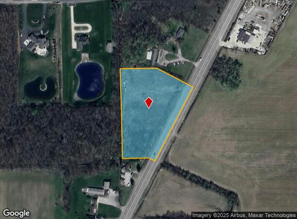
Telegraph Rd
01-013-026-20
1714-0637 SEC 13 T5S R9E 4.089 AC COM AT A PT S 402.96 FT FR NW COR OF SW 1/4 OF SEC 13 TH S 89 DEG 47'E 221.45 FT TH S 61
Commercialacreage
Monroe
X
Michigan
26115C0112E
4.09 AC
2024
Monroe County
2025
Detroit
830400
Monroe, MI
DEMOGRAPHICS near Telegraph Rd
1 Mile
3 Mile
5 Mile
2024 Total Population
674
7,756
39,392
2029 Population
695
7,807
39,054
Pop Growth 2024-2029
+ 3.12%
+ 0.66%
(0.86%)
Average Age
45
43
41
2024 Total Households
264
3,034
15,334
HH Growth 2024-2029
+ 3.41%
+ 0.92%
(0.80%)
Median Household Inc
$72,115
$73,882
$73,616
Avg Household Size
2.50
2.50
2.50
2024 Avg HH Vehicles
3.00
2.00
2.00
Median Home Value
$303,465
$256,722
$215,283
Median Year Built
1975
1988
1986
Nearby Places
Map Layers
Map Styles
 Street
 Aerial
- Restaurants
- Banks
- Shops
- Fitness
- Groceries
PUBLIC TRANSPORTATION
AIRPORT
Detroit Metro Wayne County
DRIVE
WALK
Distance
Detroit Metro Wayne County
22 min
15.1 mi
Windsor International
DRIVE
WALK
Distance
Windsor International
54 min
34.3 mi
Freight Ports
Port of Toledo
DRIVE
WALK
Distance
Port of Toledo
46 min
35.5 mi
SALE & LEASE HISTORY
LISTING DATE
SALE/LEASE

Sep 24, 2016
For Sale
Nearby Properties
Address
Land Use
TOTAL SIZE
Lot Size
Zoning
Address
Land Use
TOTAL SIZE
Lot Size
Zoning
249,836 SF
22.18 AC
AG
Address
Land Use
TOTAL SIZE
Lot Size
Zoning
3,520 SF
62.97 AC
MHP MOB
Address
Land Use
TOTAL SIZE
Lot Size
Zoning
41,920 SF
48.72 AC
Address
Land Use
TOTAL SIZE
Lot Size
Zoning
796,126 SF
54 AC
Address
Land Use
TOTAL SIZE
Lot Size
Zoning
18,520 SF
326.27 AC
Address
Land Use
TOTAL SIZE
Lot Size
Zoning
4,419 SF
64.34 AC
MHP
Address
Land Use
TOTAL SIZE
Lot Size
Zoning
13,488 SF
247.69 AC
Address
Land Use
TOTAL SIZE
Lot Size
Zoning
70,205 SF
12.66 AC
Address
Land Use
TOTAL SIZE
Lot Size
Zoning
49,606 SF
7.73 AC
Address
Land Use
TOTAL SIZE
Lot Size
Zoning
22,536 SF
275.85 AC
Address
Land Use
TOTAL SIZE
Lot Size
Zoning
11,700 SF
9.36 AC
Address
Land Use
TOTAL SIZE
Lot Size
Zoning
2,472 SF
46.65 AC
Address
Land Use
TOTAL SIZE
Lot Size
Zoning
30,278 SF
7.15 AC
Address
Land Use
TOTAL SIZE
Lot Size
Zoning
36,640 SF
5.45 AC
Address
Land Use
TOTAL SIZE
Lot Size
Zoning
7,184 SF
29.93 AC
Address
Land Use
TOTAL SIZE
Lot Size
Zoning
3,060 SF
9.58 AC
Address
Land Use
TOTAL SIZE
Lot Size
Zoning
6,000 SF
7.24 AC
Address
Land Use
TOTAL SIZE
Lot Size
Zoning
36.94 AC
Address
Land Use
TOTAL SIZE
Lot Size
Zoning
8,248 SF
12.17 AC
Address
Land Use
TOTAL SIZE
Lot Size
Zoning
12,000 SF
3.44 AC
Address
Land Use
TOTAL SIZE
Lot Size
Zoning
600 SF
32.66 AC
SP SPEC
Address
Land Use
TOTAL SIZE
Lot Size
Zoning
3.38 AC
Address
Land Use
TOTAL SIZE
Lot Size
Zoning
1,330 SF
55.20 AC
Address
Land Use
TOTAL SIZE
Lot Size
Zoning
2,114 SF
35.70 AC
Address
Land Use
TOTAL SIZE
Lot Size
Zoning
3,275 SF
5.46 AC
Address
Land Use
TOTAL SIZE
Lot Size
Zoning
2,076 SF
77.07 AC
Address
Land Use
TOTAL SIZE
Lot Size
Zoning
2,283 SF
49 AC
AG
Address
Land Use
TOTAL SIZE
Lot Size
Zoning
9.47 AC
Address
Land Use
TOTAL SIZE
Lot Size
Zoning
Address
Land Use
TOTAL SIZE
Lot Size
Zoning
9,950 SF
3.21 AC
The World's #1 Commercial Real Estate Marketplace
Connect with us
© 2025 CoStar Group
The information above has been obtained from sources believed reliable. While we do not doubt its accuracy we have not verified it and make no guarantee, warranty or representation about it. It is your responsibility to independently confirm its accuracy and completeness. Any projections, opinions, assumptions, or estimates used are for example only and do not represent the current or future performance of the property. The value of this transaction to you depends on tax and other factors which should be evaluated by your tax, financial, and legal advisors. You and your advisors should conduct a careful, independent investigation of the property to determine to your satisfaction the suitability of the property for your needs.