Property Record
Highway 27, , TX


Property Detail
Highway 27
Kerrville, TX
ABS A0287 SMITH, SUR 42,ACRES 25.31
R533463
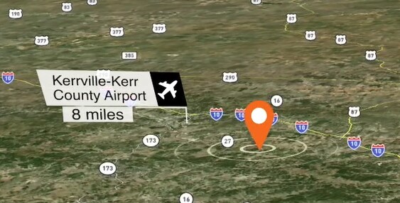
KERR
Agriculturalland
Texas
B and X Area of moderate flood hazard, usually the area between the limits of the 100-year and 500-year floods.
25.31 AC
2025
Texas Hill Country
2025
Other Market Areas
960800
NEARBY LISTINGS FOR SALE OR LEASE
-
-
View all listings for sale on LoopNet.com
DEMOGRAPHICS near Highway 27
1 mile
3 mile
5 mile
2024 Total Population
471
2,385
6,049
2029 Population
489
2,449
6,287
Pop Growth 2024-2029
+ 3.82%
+ 2.68%
+ 3.93%
Average Age
43
44
47
2024 Total Households
167
865
2,369
HH Growth 2024-2029
+ 3.59%
+ 2.54%
+ 4.05%
Median Household Inc
$79,412
$75,665
$71,866
Avg Household Size
2.50
2.50
2.40
2024 Avg HH Vehicles
3.00
3.00
2.00
Median Home Value
$211,765
$244,482
$279,025
Median Year Built
1986
1989
1990
Nearby Places
Map Layers
Map Styles
 Street
 Aerial
Transit
 Traffic
 Biking
Places
Listings with unknown addresses are not visible on the map
- Restaurants
- Banks
- Shops
- Fitness
- Groceries
SALE & LEASE HISTORY
LISTING DATE
SALE/LEASE

Apr 11, 2023
For Sale
Nearby Properties
Address
Land Use
TOTAL SIZE
Lot Size
Zoning
Address
Land Use
TOTAL SIZE
Lot Size
Zoning
52,042 SF
29.77 AC
Address
Land Use
TOTAL SIZE
Lot Size
Zoning
1,600 SF
32.99 AC
Address
Land Use
TOTAL SIZE
Lot Size
Zoning
28,027 SF
8.86 AC
Address
Land Use
TOTAL SIZE
Lot Size
Zoning
115.80 AC
Address
Land Use
TOTAL SIZE
Lot Size
Zoning
1,568 SF
163.30 AC
Address
Land Use
TOTAL SIZE
Lot Size
Zoning
38,248 SF
5 AC
Address
Land Use
TOTAL SIZE
Lot Size
Zoning
400 SF
13.61 AC
Address
Land Use
TOTAL SIZE
Lot Size
Zoning
32,284 SF
4.07 AC
Address
Land Use
TOTAL SIZE
Lot Size
Zoning
3,663 SF
5.23 AC
Address
Land Use
TOTAL SIZE
Lot Size
Zoning
9,368 SF
1.36 AC
Address
Land Use
TOTAL SIZE
Lot Size
Zoning
121.60 AC
Address
Land Use
TOTAL SIZE
Lot Size
Zoning
5,244 SF
4.21 AC
Address
Land Use
TOTAL SIZE
Lot Size
Zoning
13,711 SF
4.87 AC
Address
Land Use
TOTAL SIZE
Lot Size
Zoning
4,000 SF
138.20 AC
Address
Land Use
TOTAL SIZE
Lot Size
Zoning
40,218 SF
1 AC
Address
Land Use
TOTAL SIZE
Lot Size
Zoning
8,400 SF
0.99 AC
Address
Land Use
TOTAL SIZE
Lot Size
Zoning
3,459 SF
56.42 AC
Address
Land Use
TOTAL SIZE
Lot Size
Zoning
3,479 SF
5.22 AC
Address
Land Use
TOTAL SIZE
Lot Size
Zoning
600 SF
88.70 AC
Address
Land Use
TOTAL SIZE
Lot Size
Zoning
5,640 SF
Address
Land Use
TOTAL SIZE
Lot Size
Zoning
12,000 SF
14 AC
Address
Land Use
TOTAL SIZE
Lot Size
Zoning
16,330 SF
1 AC
Address
Land Use
TOTAL SIZE
Lot Size
Zoning
1,713 SF
7.01 AC
Address
Land Use
TOTAL SIZE
Lot Size
Zoning
16,400 SF
6.65 AC
Address
Land Use
TOTAL SIZE
Lot Size
Zoning
4,752 SF
1.03 AC
Address
Land Use
TOTAL SIZE
Lot Size
Zoning
66.20 AC
Address
Land Use
TOTAL SIZE
Lot Size
Zoning
812 SF
0.42 AC
Address
Land Use
TOTAL SIZE
Lot Size
Zoning
4,990 SF
1.02 AC
Address
Land Use
TOTAL SIZE
Lot Size
Zoning
30,928 SF
Address
Land Use
TOTAL SIZE
Lot Size
Zoning
1,268 SF
21.24 AC
FM
The World's #1 Commercial Real Estate Marketplace
Connect with us
© 2026 CoStar Group
The information above has been obtained from sources believed reliable. While we do not doubt its accuracy we have not verified it and make no guarantee, warranty or representation about it. It is your responsibility to independently confirm its accuracy and completeness. Any projections, opinions, assumptions, or estimates used are for example only and do not represent the current or future performance of the property. The value of this transaction to you depends on tax and other factors which should be evaluated by your tax, financial, and legal advisors. You and your advisors should conduct a careful, independent investigation of the property to determine to your satisfaction the suitability of the property for your needs.