Property Record
Thomas Sumter Hwy, Sumter, SC 29153

Save to a Folder
{{folder.Name}}
{{folder.ListingIds.length}} Properties
{{folder.ListingIds.length}} Property
Create a New Folder
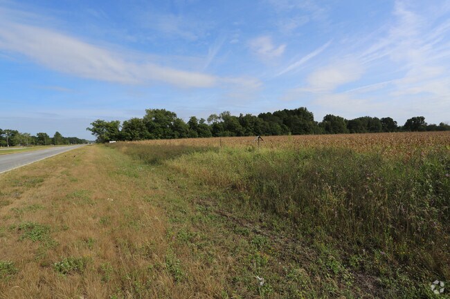
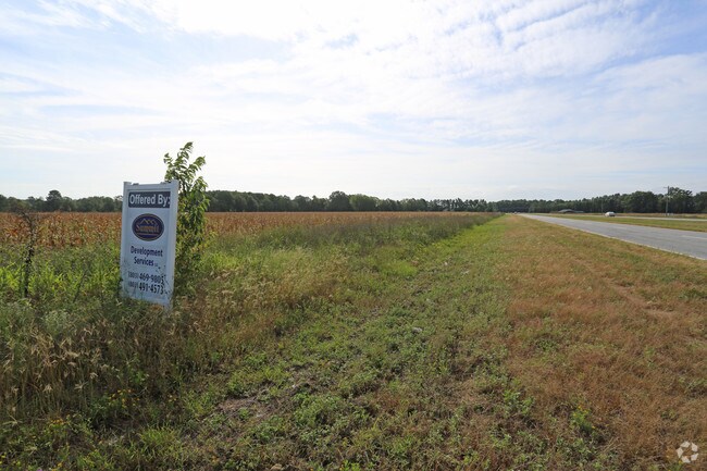
Property Detail
Thomas Sumter Hwy
Sumter, SC
PARCEL A 9.85 AC
188-00-02-039
SUMTER
Vacantlandnec
South Carolina
B and X Area of moderate flood hazard, usually the area between the limits of the 100-year and 500-year floods.
9.85 AC
2023
Orangeburg/Sumter
2025
Other Market Areas
000700
NEARBY LISTINGS FOR SALE OR LEASE
DEMOGRAPHICS near Thomas Sumter Hwy
1 mile
3 mile
5 mile
2025 Total Population
1,496
11,150
42,955
2030 Population
1,472
11,093
43,183
Pop Growth 2025-2030
(1.60%)
(0.51%)
+ 0.53%
Average Age
37
38
38
2025 Total Households
575
4,511
16,888
HH Growth 2025-2030
(1.57%)
(0.49%)
+ 0.36%
Median Household Inc
$124,999
$77,999
$63,949
Avg Household Size
2.60
2.40
2.40
2025 Avg HH Vehicles
3.00
2.00
2.00
Median Home Value
$202,482
$222,136
$224,174
Median Year Built
2002
1996
1990
Nearby Places
Map Layers
Map Styles
 Street
 Aerial
Layers
 Traffic
 Biking
Places
Listings with unknown addresses are not visible on the map
- Restaurants
- Banks
- Shops
- Fitness
- Groceries
SALE & LEASE HISTORY
LISTING DATE
SALE/LEASE

Sep 22, 2017
For Sale
Sep 12, 2017
For Sale
Sep 08, 2017
For Sale
Oct 13, 2017
For Sale
Nearby Properties
Address
Land Use
TOTAL SIZE
Lot Size
Zoning
Address
Land Use
TOTAL SIZE
Lot Size
Zoning
3,317.84 AC
Address
Land Use
TOTAL SIZE
Lot Size
Zoning
39,235 SF
707.49 AC
Address
Land Use
TOTAL SIZE
Lot Size
Zoning
69,350 SF
4.20 AC
B-1
Address
Land Use
TOTAL SIZE
Lot Size
Zoning
49,783 SF
23.75 AC
Address
Land Use
TOTAL SIZE
Lot Size
Zoning
52,556 SF
21.66 AC
Address
Land Use
TOTAL SIZE
Lot Size
Zoning
446.25 AC
Address
Land Use
TOTAL SIZE
Lot Size
Zoning
35,396 SF
6.44 AC
Address
Land Use
TOTAL SIZE
Lot Size
Zoning
11.78 AC
Address
Land Use
TOTAL SIZE
Lot Size
Zoning
15,128 SF
5.86 AC
PO
Address
Land Use
TOTAL SIZE
Lot Size
Zoning
1 SF
38.67 AC
Address
Land Use
TOTAL SIZE
Lot Size
Zoning
4,717 SF
1.68 AC
GC
Address
Land Use
TOTAL SIZE
Lot Size
Zoning
Address
Land Use
TOTAL SIZE
Lot Size
Zoning
70,091 SF
20 AC
Address
Land Use
TOTAL SIZE
Lot Size
Zoning
799,374 SF
40.54 AC
Address
Land Use
TOTAL SIZE
Lot Size
Zoning
62,500 SF
10.68 AC
R-15
Address
Land Use
TOTAL SIZE
Lot Size
Zoning
13,874 SF
3.60 AC
Address
Land Use
TOTAL SIZE
Lot Size
Zoning
1 SF
694.28 AC
Address
Land Use
TOTAL SIZE
Lot Size
Zoning
19,188 SF
5.90 AC
R-15
Address
Land Use
TOTAL SIZE
Lot Size
Zoning
266,586 SF
18 AC
Address
Land Use
TOTAL SIZE
Lot Size
Zoning
1 SF
10.87 AC
Address
Land Use
TOTAL SIZE
Lot Size
Zoning
7,522 SF
2 AC
Address
Land Use
TOTAL SIZE
Lot Size
Zoning
7,169 SF
1.27 AC
Address
Land Use
TOTAL SIZE
Lot Size
Zoning
202,056 SF
58.60 AC
Address
Land Use
TOTAL SIZE
Lot Size
Zoning
1 SF
10 AC
Address
Land Use
TOTAL SIZE
Lot Size
Zoning
80,878 SF
11.47 AC
Address
Land Use
TOTAL SIZE
Lot Size
Zoning
205,779 SF
22.77 AC
GC
Address
Land Use
TOTAL SIZE
Lot Size
Zoning
1,634 SF
3.39 AC
R-1
Address
Land Use
TOTAL SIZE
Lot Size
Zoning
7,617 SF
9.46 AC
Address
Land Use
TOTAL SIZE
Lot Size
Zoning
183 SF
22.05 AC
R-15
Address
Land Use
TOTAL SIZE
Lot Size
Zoning
38,901 SF
5.15 AC
R-15
The World's #1 Commercial Real Estate Marketplace
Connect with us
© 2026 CoStar Group
The information above has been obtained from sources believed reliable. While we do not doubt its accuracy we have not verified it and make no guarantee, warranty or representation about it. It is your responsibility to independently confirm its accuracy and completeness. Any projections, opinions, assumptions, or estimates used are for example only and do not represent the current or future performance of the property. The value of this transaction to you depends on tax and other factors which should be evaluated by your tax, financial, and legal advisors. You and your advisors should conduct a careful, independent investigation of the property to determine to your satisfaction the suitability of the property for your needs.