Property Record
Thouvenot Ln, O Fallon, IL 62269
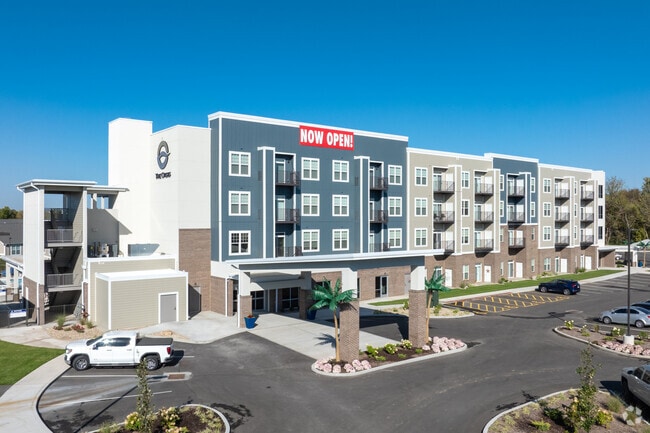


Property Detail
Thouvenot Ln
St. Louis
FINAL PLAT OF VILLAGES AT HARTMAN LAKES LOT 1 A02726484 EX PT FOR RD A02715610
St. Louis, MO-IL
ST. CLAIR
03-35-0-400-034
Illinois
Multifamilydwelling
1
2024
30.86 AC
2024
O'Fallon
504354
NEARBY LISTINGS FOR SALE OR LEASE
-
-
View all O Fallon listings for sale on LoopNet.com
DEMOGRAPHICS near Thouvenot Ln
1 mile
3 mile
5 mile
2025 Total Population
5,659
50,067
110,256
2030 Population
5,589
48,550
107,463
Pop Growth 2025-2030
(1.24%)
(3.03%)
(2.53%)
Average Age
42
41
41
2025 Total Households
2,551
20,602
45,590
HH Growth 2025-2030
(1.10%)
(3.07%)
(2.57%)
Median Household Inc
$105,632
$93,074
$80,667
Avg Household Size
2.20
2.40
2.40
2025 Avg HH Vehicles
2.00
2.00
2.00
Median Home Value
$310,177
$245,320
$214,216
Median Year Built
1999
1991
1982
Nearby Places
Map Layers
Map Styles
 Street
 Aerial
Layers
 Traffic
 Biking
Places
Listings with unknown addresses are not visible on the map
- Restaurants
- Banks
- Shops
- Fitness
- Groceries
PUBLIC TRANSPORTATION
COMMUTER RAIL
Memorial Hospital (Lambert Airport Shiloh-Scott - St. Louis MetroLink (MetroLink))
Drive
Walk
Distance
Memorial Hospital (Lambert Airport Shiloh-Scott - St. Louis MetroLink (MetroLink))
9 min
4.7 mi
Swansea (Lambert Airport Shiloh-Scott - St. Louis MetroLink (MetroLink))
Drive
Walk
Distance
Swansea (Lambert Airport Shiloh-Scott - St. Louis MetroLink (MetroLink))
10 min
5.1 mi
AIRPORT
Scott AFB/Midamerica St Louis
Drive
Walk
Distance
Scott AFB/Midamerica St Louis
21 min
8.8 mi
St Louis Lambert International
Drive
Walk
Distance
St Louis Lambert International
42 min
29.7 mi
Freight Ports
Port Milwaukee
Drive
Walk
Distance
Port Milwaukee
418 min
366.7 mi
Nearby Properties
Address
Land Use
TOTAL SIZE
Lot Size
Zoning
Address
Land Use
TOTAL SIZE
Lot Size
Zoning
Address
Land Use
TOTAL SIZE
Lot Size
Zoning
70,515 SF
27.95 AC
Address
Land Use
TOTAL SIZE
Lot Size
Zoning
21.84 AC
Address
Land Use
TOTAL SIZE
Lot Size
Zoning
Address
Land Use
TOTAL SIZE
Lot Size
Zoning
9,384 SF
15.93 AC
Address
Land Use
TOTAL SIZE
Lot Size
Zoning
2,484 SF
16.76 AC
Address
Land Use
TOTAL SIZE
Lot Size
Zoning
13,440 SF
14.07 AC
Address
Land Use
TOTAL SIZE
Lot Size
Zoning
2,937 SF
16.68 AC
Address
Land Use
TOTAL SIZE
Lot Size
Zoning
Address
Land Use
TOTAL SIZE
Lot Size
Zoning
17,676 SF
3.09 AC
Address
Land Use
TOTAL SIZE
Lot Size
Zoning
207,910 SF
13.42 AC
Address
Land Use
TOTAL SIZE
Lot Size
Zoning
143,464 SF
10.78 AC
Address
Land Use
TOTAL SIZE
Lot Size
Zoning
Address
Land Use
TOTAL SIZE
Lot Size
Zoning
167,235 SF
18.91 AC
Address
Land Use
TOTAL SIZE
Lot Size
Zoning
6,172 SF
7.31 AC
Address
Land Use
TOTAL SIZE
Lot Size
Zoning
Address
Land Use
TOTAL SIZE
Lot Size
Zoning
3.24 AC
Address
Land Use
TOTAL SIZE
Lot Size
Zoning
5,772 SF
11.48 AC
Address
Land Use
TOTAL SIZE
Lot Size
Zoning
29,906 SF
4.24 AC
Address
Land Use
TOTAL SIZE
Lot Size
Zoning
41,366 SF
12.07 AC
Address
Land Use
TOTAL SIZE
Lot Size
Zoning
140,850 SF
16.71 AC
Address
Land Use
TOTAL SIZE
Lot Size
Zoning
142,369 SF
12.01 AC
Address
Land Use
TOTAL SIZE
Lot Size
Zoning
1,863 SF
11.46 AC
Address
Land Use
TOTAL SIZE
Lot Size
Zoning
127,251 SF
12.15 AC
Address
Land Use
TOTAL SIZE
Lot Size
Zoning
8,141 SF
16.74 AC
Address
Land Use
TOTAL SIZE
Lot Size
Zoning
Address
Land Use
TOTAL SIZE
Lot Size
Zoning
1.94 AC
Address
Land Use
TOTAL SIZE
Lot Size
Zoning
81.90 AC
Address
Land Use
TOTAL SIZE
Lot Size
Zoning
7,004 SF
9.59 AC
The World's #1 Commercial Real Estate Marketplace
Connect with us
© 2026 CoStar Group
The information above has been obtained from sources believed reliable. While we do not doubt its accuracy we have not verified it and make no guarantee, warranty or representation about it. It is your responsibility to independently confirm its accuracy and completeness. Any projections, opinions, assumptions, or estimates used are for example only and do not represent the current or future performance of the property. The value of this transaction to you depends on tax and other factors which should be evaluated by your tax, financial, and legal advisors. You and your advisors should conduct a careful, independent investigation of the property to determine to your satisfaction the suitability of the property for your needs.