Property Record
Timlake Rd, Gravette, AR 72736
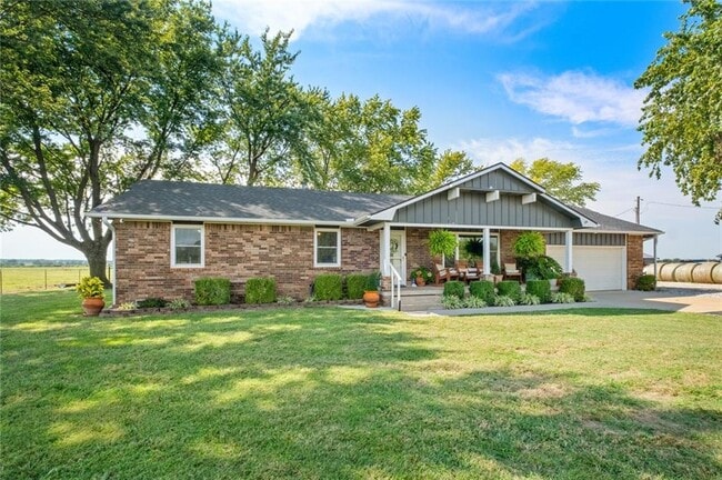

Property Detail
Timlake Rd
Fayetteville-Springdale-Rogers, AR
PART OF THE SW 1/4 OF THE SW 1/4 OF SECTION 34, TOWNSHIP 21 NORTH, RANGE 34 WEST, AND PART OF THE FRACTIONAL NW 1/4 OF THE NW 1/4 OF SECTION 3, TOWNSHIP 20 NORTH, RANGE 34 WEST, ALL BEING IN BENTON COUNTY, ARKANSAS, MORE PARTICULARLY DESCRIBED AS FOL
18-16495-000
BENTON
Residentialacreage
Arkansas
B and X Area of moderate flood hazard, usually the area between the limits of the 100-year and 500-year floods.
120 AC
2025
Outlying Benton County
2025
Fayetteville/Springdale/Rogers
020905
NEARBY LISTINGS FOR SALE OR LEASE
-
-
View all Gravette listings for sale on LoopNet.com
DEMOGRAPHICS near Timlake Rd
1 mile
3 mile
5 mile
2025 Total Population
64
582
3,109
2030 Population
71
628
3,287
Pop Growth 2025-2030
+ 10.94%
+ 7.90%
+ 5.73%
Average Age
39
39
39
2025 Total Households
23
204
1,082
HH Growth 2025-2030
+ 13.04%
+ 8.33%
+ 5.91%
Median Household Inc
$87,500
$74,499
$58,064
Avg Household Size
2.80
2.70
2.70
2025 Avg HH Vehicles
3.00
3.00
2.00
Median Home Value
$613,636
$531,250
$370,129
Median Year Built
1994
1992
1990
Nearby Places
Map Layers
Map Styles
 Street
 Aerial
Layers
 Traffic
 Biking
Places
Listings with unknown addresses are not visible on the map
- Restaurants
- Banks
- Shops
- Fitness
- Groceries
PUBLIC TRANSPORTATION
AIRPORT
Northwest Arkansas Ntl
Drive
Walk
Distance
Northwest Arkansas Ntl
66 min
33.0 mi
Freight Ports
Tulsa Port of Inola
Drive
Walk
Distance
Tulsa Port of Inola
98 min
82.9 mi
SALE & LEASE HISTORY
LISTING DATE
SALE/LEASE

Sep 18, 2025
For Sale
Nearby Properties
Address
Land Use
TOTAL SIZE
Lot Size
Zoning
Address
Land Use
TOTAL SIZE
Lot Size
Zoning
11,212 SF
320.64 AC
Address
Land Use
TOTAL SIZE
Lot Size
Zoning
2,176 SF
80 AC
Address
Land Use
TOTAL SIZE
Lot Size
Zoning
4.09 AC
Address
Land Use
TOTAL SIZE
Lot Size
Zoning
189.24 AC
Address
Land Use
TOTAL SIZE
Lot Size
Zoning
4,000 SF
14.13 AC
Address
Land Use
TOTAL SIZE
Lot Size
Zoning
376.88 AC
Address
Land Use
TOTAL SIZE
Lot Size
Zoning
1.50 AC
Address
Land Use
TOTAL SIZE
Lot Size
Zoning
145.63 AC
Address
Land Use
TOTAL SIZE
Lot Size
Zoning
3.66 AC
Address
Land Use
TOTAL SIZE
Lot Size
Zoning
107.62 AC
Address
Land Use
TOTAL SIZE
Lot Size
Zoning
7.66 AC
Address
Land Use
TOTAL SIZE
Lot Size
Zoning
152.35 AC
Address
Land Use
TOTAL SIZE
Lot Size
Zoning
160.41 AC
Address
Land Use
TOTAL SIZE
Lot Size
Zoning
Address
Land Use
TOTAL SIZE
Lot Size
Zoning
0.58 AC
Address
Land Use
TOTAL SIZE
Lot Size
Zoning
120.30 AC
Address
Land Use
TOTAL SIZE
Lot Size
Zoning
100.66 AC
Address
Land Use
TOTAL SIZE
Lot Size
Zoning
161.76 AC
Address
Land Use
TOTAL SIZE
Lot Size
Zoning
160 AC
Address
Land Use
TOTAL SIZE
Lot Size
Zoning
140 AC
Address
Land Use
TOTAL SIZE
Lot Size
Zoning
63.84 AC
Address
Land Use
TOTAL SIZE
Lot Size
Zoning
94.53 AC
Address
Land Use
TOTAL SIZE
Lot Size
Zoning
10 AC
Address
Land Use
TOTAL SIZE
Lot Size
Zoning
78.87 AC
Address
Land Use
TOTAL SIZE
Lot Size
Zoning
111.24 AC
Address
Land Use
TOTAL SIZE
Lot Size
Zoning
Address
Land Use
TOTAL SIZE
Lot Size
Zoning
80.33 AC
Address
Land Use
TOTAL SIZE
Lot Size
Zoning
81.06 AC
The World's #1 Commercial Real Estate Marketplace
Connect with us
© 2026 CoStar Group
The information above has been obtained from sources believed reliable. While we do not doubt its accuracy we have not verified it and make no guarantee, warranty or representation about it. It is your responsibility to independently confirm its accuracy and completeness. Any projections, opinions, assumptions, or estimates used are for example only and do not represent the current or future performance of the property. The value of this transaction to you depends on tax and other factors which should be evaluated by your tax, financial, and legal advisors. You and your advisors should conduct a careful, independent investigation of the property to determine to your satisfaction the suitability of the property for your needs.