Property Record
Tobacco Rd, Oxford, NC 27565

NEARBY LISTINGS FOR SALE OR LEASE
Property Detail
Tobacco Rd
192403007173
Property Of Philip C Paulsen
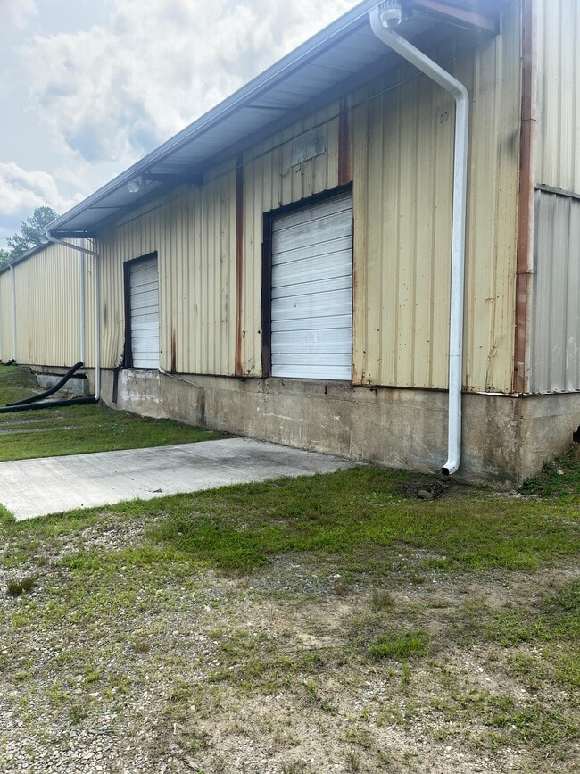
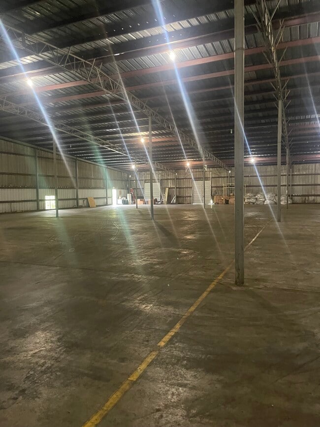
Warehouse
140 TOBACCO RD
X
Granville
3720192400K
North Carolina
2025
3 AC
2025
North Carolina Northeast Area
970200
Other Market Areas
29,054 SF
Oxford, NC
DEMOGRAPHICS near Tobacco Rd
1 Mile
3 Mile
5 Mile
2024 Total Population
1,759
11,201
15,505
2029 Population
1,941
12,340
17,048
Pop Growth 2024-2029
+ 10.35%
+ 10.17%
+ 9.95%
Average Age
42
42
43
2024 Total Households
680
4,576
6,273
HH Growth 2024-2029
+ 10.74%
+ 10.40%
+ 10.17%
Median Household Inc
$49,999
$46,615
$50,317
Avg Household Size
2.40
2.30
2.40
2024 Avg HH Vehicles
2.00
2.00
2.00
Median Home Value
$174,444
$178,598
$182,318
Median Year Built
1975
1973
1975
Nearby Places
Map Layers
Map Styles
 Street
 Aerial
- Restaurants
- Banks
- Shops
- Fitness
- Groceries
PUBLIC TRANSPORTATION
AIRPORT
Raleigh-Durham International
DRIVE
WALK
Distance
Raleigh-Durham International
55 min
41.0 mi
Nearby Properties
Address
Land Use
TOTAL SIZE
Lot Size
Zoning
Address
Land Use
TOTAL SIZE
Lot Size
Zoning
433,560 SF
122.96 AC
I1
Address
Land Use
TOTAL SIZE
Lot Size
Zoning
25,364 SF
266.74 AC
RAR6
Address
Land Use
TOTAL SIZE
Lot Size
Zoning
111,264 SF
5.81 AC
OI
Address
Land Use
TOTAL SIZE
Lot Size
Zoning
144,698 SF
42.10 AC
RA
Address
Land Use
TOTAL SIZE
Lot Size
Zoning
110,126 SF
40 AC
Address
Land Use
TOTAL SIZE
Lot Size
Zoning
65,740 SF
37.29 AC
RA
Address
Land Use
TOTAL SIZE
Lot Size
Zoning
8,640 SF
13.13 AC
Address
Land Use
TOTAL SIZE
Lot Size
Zoning
9,000 SF
36.08 AC
Address
Land Use
TOTAL SIZE
Lot Size
Zoning
14,634 SF
11.97 AC
B1
Address
Land Use
TOTAL SIZE
Lot Size
Zoning
5,294 SF
19.44 AC
B1
Address
Land Use
TOTAL SIZE
Lot Size
Zoning
186,443 SF
6 AC
I2
Address
Land Use
TOTAL SIZE
Lot Size
Zoning
176,080 SF
8.32 AC
Address
Land Use
TOTAL SIZE
Lot Size
Zoning
33,547 SF
10.03 AC
Address
Land Use
TOTAL SIZE
Lot Size
Zoning
34,972 SF
19.19 AC
B1
Address
Land Use
TOTAL SIZE
Lot Size
Zoning
37,999 SF
10.29 AC
Address
Land Use
TOTAL SIZE
Lot Size
Zoning
42,806 SF
0.96 AC
B1
Address
Land Use
TOTAL SIZE
Lot Size
Zoning
161,949 SF
69.03 AC
I2
Address
Land Use
TOTAL SIZE
Lot Size
Zoning
2,812 SF
8.37 AC
Address
Land Use
TOTAL SIZE
Lot Size
Zoning
18,729 SF
6.66 AC
B1
Address
Land Use
TOTAL SIZE
Lot Size
Zoning
129,168 SF
29.26 AC
I1
Address
Land Use
TOTAL SIZE
Lot Size
Zoning
1,454 SF
12.25 AC
R6
Address
Land Use
TOTAL SIZE
Lot Size
Zoning
70,040 SF
15.32 AC
B2
Address
Land Use
TOTAL SIZE
Lot Size
Zoning
41,289 SF
16 AC
AR40
Address
Land Use
TOTAL SIZE
Lot Size
Zoning
28,880 SF
41.25 AC
I1
Address
Land Use
TOTAL SIZE
Lot Size
Zoning
29,960 SF
8.70 AC
OI
Address
Land Use
TOTAL SIZE
Lot Size
Zoning
8,184 SF
280.85 AC
RA
Address
Land Use
TOTAL SIZE
Lot Size
Zoning
135,720 SF
10.31 AC
I2
Address
Land Use
TOTAL SIZE
Lot Size
Zoning
2,276 SF
3.35 AC
Address
Land Use
TOTAL SIZE
Lot Size
Zoning
18.78 AC
HB
Address
Land Use
TOTAL SIZE
Lot Size
Zoning
40,100 SF
11.01 AC
B1
The World's #1 Commercial Real Estate Marketplace
Connect with us
© 2026 CoStar Group
The information above has been obtained from sources believed reliable. While we do not doubt its accuracy we have not verified it and make no guarantee, warranty or representation about it. It is your responsibility to independently confirm its accuracy and completeness. Any projections, opinions, assumptions, or estimates used are for example only and do not represent the current or future performance of the property. The value of this transaction to you depends on tax and other factors which should be evaluated by your tax, financial, and legal advisors. You and your advisors should conduct a careful, independent investigation of the property to determine to your satisfaction the suitability of the property for your needs.