Property Record
Todhunter Rd, Monroe, OH 45050

Save to a Folder
{{folder.Name}}
{{folder.ListingIds.length}} Properties
{{folder.ListingIds.length}} Property
Create a New Folder
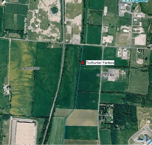
Property Detail
Todhunter Rd
Cincinnati, OH-KY-IN
1900 ENT SEE PARCEL 014T - YANKEE RD TIF
C1800-004-000-014
BUTLER
Agriculturalland
Ohio
B and X Area of moderate flood hazard, usually the area between the limits of the 100-year and 500-year floods.
71.45 AC
2024
Butler County
2025
Cincinnati/Dayton
011200
NEARBY LISTINGS FOR SALE OR LEASE
DEMOGRAPHICS near Todhunter Rd
1 mile
3 mile
5 mile
2025 Total Population
1,249
29,270
105,432
2030 Population
1,286
30,111
108,693
Pop Growth 2025-2030
+ 2.96%
+ 2.87%
+ 3.09%
Average Age
44
38
38
2025 Total Households
481
10,370
38,445
HH Growth 2025-2030
+ 2.91%
+ 2.88%
+ 3.19%
Median Household Inc
$106,250
$91,164
$79,689
Avg Household Size
2.50
2.70
2.60
2025 Avg HH Vehicles
2.00
2.00
2.00
Median Home Value
$285,616
$283,117
$267,069
Median Year Built
1996
1981
1977
Nearby Places
Map Layers
Map Styles
 Street
 Aerial
Layers
 Traffic
 Biking
Places
Listings with unknown addresses are not visible on the map
- Restaurants
- Banks
- Shops
- Fitness
- Groceries
PUBLIC TRANSPORTATION
AIRPORT
James M Cox Dayton International
Drive
Walk
Distance
James M Cox Dayton International
56 min
41.0 mi
Cincinnati/Northern Kentucky International
Drive
Walk
Distance
Cincinnati/Northern Kentucky International
64 min
43.6 mi
Nearby Properties
Address
Land Use
TOTAL SIZE
Lot Size
Zoning
Address
Land Use
TOTAL SIZE
Lot Size
Zoning
40.03 AC
Address
Land Use
TOTAL SIZE
Lot Size
Zoning
14,558 SF
26.81 AC
Address
Land Use
TOTAL SIZE
Lot Size
Zoning
34.66 AC
Address
Land Use
TOTAL SIZE
Lot Size
Zoning
369,922 SF
28.10 AC
Address
Land Use
TOTAL SIZE
Lot Size
Zoning
746,883 SF
40.03 AC
Address
Land Use
TOTAL SIZE
Lot Size
Zoning
12,040 SF
49.57 AC
Address
Land Use
TOTAL SIZE
Lot Size
Zoning
1,380,095 SF
47.11 AC
Address
Land Use
TOTAL SIZE
Lot Size
Zoning
833,210 SF
57.88 AC
Address
Land Use
TOTAL SIZE
Lot Size
Zoning
57.88 AC
Address
Land Use
TOTAL SIZE
Lot Size
Zoning
3,956 SF
186.57 AC
Address
Land Use
TOTAL SIZE
Lot Size
Zoning
99.22 AC
Address
Land Use
TOTAL SIZE
Lot Size
Zoning
334,640 SF
41.28 AC
Address
Land Use
TOTAL SIZE
Lot Size
Zoning
542,679 SF
24.92 AC
Address
Land Use
TOTAL SIZE
Lot Size
Zoning
369,922 SF
28.10 AC
Address
Land Use
TOTAL SIZE
Lot Size
Zoning
189,571 SF
10.79 AC
ADV
Address
Land Use
TOTAL SIZE
Lot Size
Zoning
478,217 SF
61.13 AC
Address
Land Use
TOTAL SIZE
Lot Size
Zoning
612,886 SF
30.51 AC
Address
Land Use
TOTAL SIZE
Lot Size
Zoning
148,762 SF
5.01 AC
Address
Land Use
TOTAL SIZE
Lot Size
Zoning
402,440 SF
25.46 AC
Address
Land Use
TOTAL SIZE
Lot Size
Zoning
41.28 AC
Address
Land Use
TOTAL SIZE
Lot Size
Zoning
86.47 AC
ADV
Address
Land Use
TOTAL SIZE
Lot Size
Zoning
57,248 SF
224.87 AC
Address
Land Use
TOTAL SIZE
Lot Size
Zoning
235,831 SF
15.01 AC
Address
Land Use
TOTAL SIZE
Lot Size
Zoning
485,080 SF
15.10 AC
Address
Land Use
TOTAL SIZE
Lot Size
Zoning
371,743 SF
24.58 AC
ADV
Address
Land Use
TOTAL SIZE
Lot Size
Zoning
9,069 SF
115.70 AC
Address
Land Use
TOTAL SIZE
Lot Size
Zoning
142,005 SF
12.06 AC
Address
Land Use
TOTAL SIZE
Lot Size
Zoning
73,178 SF
5.12 AC
Address
Land Use
TOTAL SIZE
Lot Size
Zoning
Address
Land Use
TOTAL SIZE
Lot Size
Zoning
71,525 SF
6.87 AC
The World's #1 Commercial Real Estate Marketplace
Connect with us
© 2026 CoStar Group
The information above has been obtained from sources believed reliable. While we do not doubt its accuracy we have not verified it and make no guarantee, warranty or representation about it. It is your responsibility to independently confirm its accuracy and completeness. Any projections, opinions, assumptions, or estimates used are for example only and do not represent the current or future performance of the property. The value of this transaction to you depends on tax and other factors which should be evaluated by your tax, financial, and legal advisors. You and your advisors should conduct a careful, independent investigation of the property to determine to your satisfaction the suitability of the property for your needs.