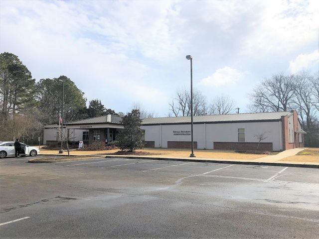
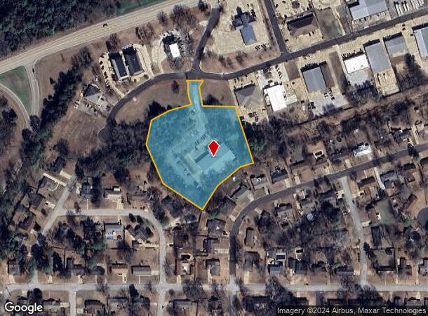
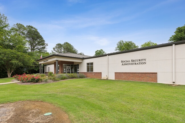
Property Record
Traceland Dr, Tupelo, MS 38801
Property Detail
Traceland Dr
077N-35-028-09
LOT SW1/4 SW1/4
Officebuilding
LEE
B and X Area of moderate flood hazard, usually the area between the limits of the 100-year and 500-year floods.
Mississippi
2025
3.70 AC
2025
Tupelo/North Area
950901
Other Market Areas
13,740 SF
Tupelo, MS
NEARBY LISTINGS FOR SALE OR LEASE
DEMOGRAPHICS near Traceland Dr
1 mile
3 mile
5 mile
2025 Total Population
4,125
24,205
38,202
2030 Population
4,029
24,022
37,921
Pop Growth 2025-2030
(2.33%)
(0.76%)
(0.74%)
Average Age
39
38
39
2025 Total Households
1,601
9,964
15,572
HH Growth 2025-2030
(2.69%)
(0.75%)
(0.71%)
Median Household Inc
$69,226
$64,452
$68,076
Avg Household Size
2.40
2.30
2.40
2025 Avg HH Vehicles
2.00
2.00
2.00
Median Home Value
$198,557
$194,870
$213,685
Median Year Built
1979
1978
1981
Nearby Places
Map Layers
Map Styles
 Street
 Aerial
Layers
 Traffic
 Biking
Places
Listings with unknown addresses are not visible on the map
- Restaurants
- Banks
- Shops
- Fitness
- Groceries
SALE & LEASE HISTORY
LISTING DATE
SALE/LEASE

Nov 07, 2024
For Sale
Mar 29, 2021
For Sale
Jun 05, 2024
For Sale
Jul 11, 2024
For Sale
Apr 30, 2025
For Sale
Nearby Properties
Address
Land Use
TOTAL SIZE
Lot Size
Zoning
Address
Land Use
TOTAL SIZE
Lot Size
Zoning
200,000 SF
9 AC
Address
Land Use
TOTAL SIZE
Lot Size
Zoning
277,992 SF
13.80 AC
Address
Land Use
TOTAL SIZE
Lot Size
Zoning
154,645 SF
15.58 AC
Address
Land Use
TOTAL SIZE
Lot Size
Zoning
99,125 SF
10.30 AC
Address
Land Use
TOTAL SIZE
Lot Size
Zoning
30,716 SF
5.40 AC
Address
Land Use
TOTAL SIZE
Lot Size
Zoning
66,758 SF
17.10 AC
Address
Land Use
TOTAL SIZE
Lot Size
Zoning
59,200 SF
4.90 AC
Address
Land Use
TOTAL SIZE
Lot Size
Zoning
43,471 SF
14.30 AC
Address
Land Use
TOTAL SIZE
Lot Size
Zoning
56,097 SF
14.80 AC
Address
Land Use
TOTAL SIZE
Lot Size
Zoning
47,219 SF
11.90 AC
Address
Land Use
TOTAL SIZE
Lot Size
Zoning
20,368 SF
1.03 AC
Address
Land Use
TOTAL SIZE
Lot Size
Zoning
5,712 SF
4.31 AC
Address
Land Use
TOTAL SIZE
Lot Size
Zoning
55,180 SF
5.90 AC
Address
Land Use
TOTAL SIZE
Lot Size
Zoning
133,524 SF
16.80 AC
Address
Land Use
TOTAL SIZE
Lot Size
Zoning
16,639 SF
0.52 AC
Address
Land Use
TOTAL SIZE
Lot Size
Zoning
23,968 SF
1.88 AC
Address
Land Use
TOTAL SIZE
Lot Size
Zoning
21,608 SF
4.80 AC
Address
Land Use
TOTAL SIZE
Lot Size
Zoning
6,048 SF
1.97 AC
Address
Land Use
TOTAL SIZE
Lot Size
Zoning
31,256 SF
2.60 AC
Address
Land Use
TOTAL SIZE
Lot Size
Zoning
15,139 SF
2.81 AC
Address
Land Use
TOTAL SIZE
Lot Size
Zoning
40,199 SF
1.80 AC
Address
Land Use
TOTAL SIZE
Lot Size
Zoning
19,835 SF
2.95 AC
Address
Land Use
TOTAL SIZE
Lot Size
Zoning
180,994 SF
20.70 AC
Address
Land Use
TOTAL SIZE
Lot Size
Zoning
17,944 SF
2.83 AC
Address
Land Use
TOTAL SIZE
Lot Size
Zoning
77,613 SF
6.47 AC
Address
Land Use
TOTAL SIZE
Lot Size
Zoning
10,481 SF
0.30 AC
Address
Land Use
TOTAL SIZE
Lot Size
Zoning
10,038 SF
20 AC
Address
Land Use
TOTAL SIZE
Lot Size
Zoning
11,201 SF
0.95 AC
Address
Land Use
TOTAL SIZE
Lot Size
Zoning
106,964 SF
24.80 AC
The World's #1 Commercial Real Estate Marketplace
Connect with us
© 2026 CoStar Group
The information above has been obtained from sources believed reliable. While we do not doubt its accuracy we have not verified it and make no guarantee, warranty or representation about it. It is your responsibility to independently confirm its accuracy and completeness. Any projections, opinions, assumptions, or estimates used are for example only and do not represent the current or future performance of the property. The value of this transaction to you depends on tax and other factors which should be evaluated by your tax, financial, and legal advisors. You and your advisors should conduct a careful, independent investigation of the property to determine to your satisfaction the suitability of the property for your needs.