Property Record
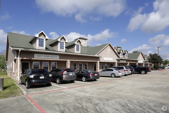
7924 Broadway St, Pearland, TX 77581


Property Detail
7924 Broadway St
0242-0015-001
A0242 H T & B R R BLOCK 1 TRACT RESERVE A (COMMERCIAL) (STEPPING STONE NO 3) ACRES 5.4358
Commercialnec
Brazoria
B and X Area of moderate flood hazard, usually the area between the limits of the 100-year and 500-year floods.
Texas
2024
5.44 AC
2025
South
660705
Houston
41,656 SF
Houston-Pasadena-The Woodlands, TX
NEARBY LISTINGS FOR SALE OR LEASE
DEMOGRAPHICS near 7924 Broadway St
1 mile
3 mile
5 mile
2025 Total Population
8,977
66,191
166,924
2030 Population
9,788
72,192
182,304
Pop Growth 2025-2030
+ 9.03%
+ 9.07%
+ 9.21%
Average Age
36
38
36
2025 Total Households
3,096
22,457
56,588
HH Growth 2025-2030
+ 9.40%
+ 9.27%
+ 9.40%
Median Household Inc
$89,147
$113,104
$104,675
Avg Household Size
2.90
2.90
2.90
2025 Avg HH Vehicles
2.00
2.00
2.00
Median Home Value
$313,232
$341,848
$338,559
Median Year Built
2001
2000
2004
Nearby Places
Map Layers
Map Styles
 Street
 Aerial
Transit
 Traffic
 Biking
Places
Listings with unknown addresses are not visible on the map
- Restaurants
- Banks
- Shops
- Fitness
- Groceries
PUBLIC TRANSPORTATION
AIRPORT
William P Hobby
Drive
Walk
Distance
William P Hobby
19 min
9.5 mi
George Bush Intcntl/Houston
Drive
Walk
Distance
George Bush Intcntl/Houston
48 min
35.6 mi
Freight Ports
Port of Houston
Drive
Walk
Distance
Port of Houston
30 min
17.9 mi
SALE & LEASE HISTORY
LISTING DATE
SALE/LEASE

Sep 21, 2020
For Lease
Oct 23, 2025
For Lease
Nov 18, 2019
For Lease
Nov 16, 2016
For Lease
Nearby Properties
Address
Land Use
TOTAL SIZE
Lot Size
Zoning
Address
Land Use
TOTAL SIZE
Lot Size
Zoning
66.85 AC
0047
Address
Land Use
TOTAL SIZE
Lot Size
Zoning
42,360 SF
13.01 AC
Address
Land Use
TOTAL SIZE
Lot Size
Zoning
421,680 SF
23.44 AC
Address
Land Use
TOTAL SIZE
Lot Size
Zoning
372,209 SF
17.91 AC
Address
Land Use
TOTAL SIZE
Lot Size
Zoning
379,071 SF
20.02 AC
Address
Land Use
TOTAL SIZE
Lot Size
Zoning
321,409 SF
13.90 AC
Address
Land Use
TOTAL SIZE
Lot Size
Zoning
334,628 SF
13.87 AC
Address
Land Use
TOTAL SIZE
Lot Size
Zoning
387,389 SF
21.40 AC
Address
Land Use
TOTAL SIZE
Lot Size
Zoning
323,168 SF
12.80 AC
Address
Land Use
TOTAL SIZE
Lot Size
Zoning
240,616 SF
10.01 AC
Address
Land Use
TOTAL SIZE
Lot Size
Zoning
225,854 SF
10.44 AC
Address
Land Use
TOTAL SIZE
Lot Size
Zoning
252,472 SF
13.28 AC
Address
Land Use
TOTAL SIZE
Lot Size
Zoning
79.45 AC
1000
Address
Land Use
TOTAL SIZE
Lot Size
Zoning
16,677 SF
12.38 AC
Address
Land Use
TOTAL SIZE
Lot Size
Zoning
62,055 SF
5.46 AC
Address
Land Use
TOTAL SIZE
Lot Size
Zoning
241,488 SF
9.81 AC
Address
Land Use
TOTAL SIZE
Lot Size
Zoning
215,063 SF
19.13 AC
Address
Land Use
TOTAL SIZE
Lot Size
Zoning
228,276 SF
9.43 AC
0036
Address
Land Use
TOTAL SIZE
Lot Size
Zoning
221,401 SF
11 AC
Address
Land Use
TOTAL SIZE
Lot Size
Zoning
65,854 SF
18.96 AC
Address
Land Use
TOTAL SIZE
Lot Size
Zoning
344,782 SF
14.14 AC
Address
Land Use
TOTAL SIZE
Lot Size
Zoning
106,627 SF
8.40 AC
Address
Land Use
TOTAL SIZE
Lot Size
Zoning
81,170 SF
50 AC
Address
Land Use
TOTAL SIZE
Lot Size
Zoning
67,755 SF
19.53 AC
Address
Land Use
TOTAL SIZE
Lot Size
Zoning
79,587 SF
5 AC
Address
Land Use
TOTAL SIZE
Lot Size
Zoning
84,604 SF
8.29 AC
0039
Address
Land Use
TOTAL SIZE
Lot Size
Zoning
103,316 SF
Address
Land Use
TOTAL SIZE
Lot Size
Zoning
210,939 SF
18.74 AC
0001
Address
Land Use
TOTAL SIZE
Lot Size
Zoning
77,272 SF
Address
Land Use
TOTAL SIZE
Lot Size
Zoning
47,820 SF
The World's #1 Commercial Real Estate Marketplace
Connect with us
© 2026 CoStar Group
The information above has been obtained from sources believed reliable. While we do not doubt its accuracy we have not verified it and make no guarantee, warranty or representation about it. It is your responsibility to independently confirm its accuracy and completeness. Any projections, opinions, assumptions, or estimates used are for example only and do not represent the current or future performance of the property. The value of this transaction to you depends on tax and other factors which should be evaluated by your tax, financial, and legal advisors. You and your advisors should conduct a careful, independent investigation of the property to determine to your satisfaction the suitability of the property for your needs.