Property Record
Trebein Rd, Xenia, OH 45385


This Property Is For Sale
NEARBY LISTINGS FOR SALE OR LEASE
Property Detail
Trebein Rd
B03-0002-0043-0-0156-00
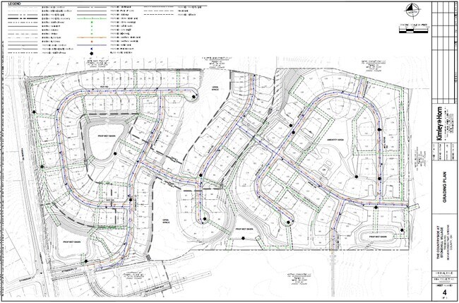
7-3-8 & 14 80.200AC TREBEIN RD
Farms
Greene
X
Ohio
39057C0130E
80.20 AC
2024
Southeast Dayton
2024
Cincinnati/Dayton
240200
Dayton, OH
DEMOGRAPHICS near Trebein Rd
1 Mile
3 Mile
5 Mile
2024 Total Population
1,622
17,216
74,793
2029 Population
1,663
17,538
76,519
Pop Growth 2024-2029
+ 2.53%
+ 1.87%
+ 2.31%
Average Age
42
41
42
2024 Total Households
577
6,363
30,025
HH Growth 2024-2029
+ 2.43%
+ 1.84%
+ 2.31%
Median Household Inc
$148,304
$105,257
$86,217
Avg Household Size
2.80
2.60
2.40
2024 Avg HH Vehicles
3.00
2.00
2.00
Median Home Value
$392,227
$276,464
$221,999
Median Year Built
2001
1977
1976
Nearby Places
Map Layers
Map Styles
 Street
 Aerial
- Restaurants
- Banks
- Shops
- Fitness
- Groceries
PUBLIC TRANSPORTATION
AIRPORT
James M Cox Dayton International
DRIVE
WALK
Distance
James M Cox Dayton International
38 min
26.5 mi
Freight Ports
Port of Toledo
DRIVE
WALK
Distance
Port of Toledo
197 min
166.7 mi
Nearby Properties
Address
Land Use
TOTAL SIZE
Lot Size
Zoning
Address
Land Use
TOTAL SIZE
Lot Size
Zoning
286,260 SF
47.65 AC
Address
Land Use
TOTAL SIZE
Lot Size
Zoning
145,500 SF
32.62 AC
A1
Address
Land Use
TOTAL SIZE
Lot Size
Zoning
35,370 SF
23.27 AC
Address
Land Use
TOTAL SIZE
Lot Size
Zoning
6.13 AC
Address
Land Use
TOTAL SIZE
Lot Size
Zoning
217,579 SF
22.16 AC
Address
Land Use
TOTAL SIZE
Lot Size
Zoning
320 SF
65.47 AC
Address
Land Use
TOTAL SIZE
Lot Size
Zoning
26.91 AC
Address
Land Use
TOTAL SIZE
Lot Size
Zoning
43,510 SF
13.10 AC
Address
Land Use
TOTAL SIZE
Lot Size
Zoning
2,400 SF
37.61 AC
Address
Land Use
TOTAL SIZE
Lot Size
Zoning
136,915 SF
16.23 AC
Address
Land Use
TOTAL SIZE
Lot Size
Zoning
78,330 SF
35.06 AC
Address
Land Use
TOTAL SIZE
Lot Size
Zoning
67,660 SF
5.45 AC
Address
Land Use
TOTAL SIZE
Lot Size
Zoning
41,778 SF
6.82 AC
Address
Land Use
TOTAL SIZE
Lot Size
Zoning
77,673 SF
16.02 AC
A1
Address
Land Use
TOTAL SIZE
Lot Size
Zoning
1,012 SF
464.56 AC
Address
Land Use
TOTAL SIZE
Lot Size
Zoning
30,056 SF
8.18 AC
Address
Land Use
TOTAL SIZE
Lot Size
Zoning
33,300 SF
20.35 AC
Address
Land Use
TOTAL SIZE
Lot Size
Zoning
7,000 SF
5.42 AC
Address
Land Use
TOTAL SIZE
Lot Size
Zoning
48,523 SF
6.26 AC
Address
Land Use
TOTAL SIZE
Lot Size
Zoning
15,160 SF
7.48 AC
Address
Land Use
TOTAL SIZE
Lot Size
Zoning
27,059 SF
8.99 AC
Address
Land Use
TOTAL SIZE
Lot Size
Zoning
110,592 SF
7.22 AC
Address
Land Use
TOTAL SIZE
Lot Size
Zoning
49,686 SF
10 AC
MULTIPLE
Address
Land Use
TOTAL SIZE
Lot Size
Zoning
2,440 SF
405.31 AC
Address
Land Use
TOTAL SIZE
Lot Size
Zoning
5,788 SF
9.69 AC
Address
Land Use
TOTAL SIZE
Lot Size
Zoning
7,824 SF
27.30 AC
Address
Land Use
TOTAL SIZE
Lot Size
Zoning
26,942 SF
4.77 AC
Address
Land Use
TOTAL SIZE
Lot Size
Zoning
94,000 SF
7.64 AC
Address
Land Use
TOTAL SIZE
Lot Size
Zoning
3,200 SF
167.63 AC
Address
Land Use
TOTAL SIZE
Lot Size
Zoning
1,819 SF
73.06 AC
The World's #1 Commercial Real Estate Marketplace
Connect with us
© 2025 CoStar Group
The information above has been obtained from sources believed reliable. While we do not doubt its accuracy we have not verified it and make no guarantee, warranty or representation about it. It is your responsibility to independently confirm its accuracy and completeness. Any projections, opinions, assumptions, or estimates used are for example only and do not represent the current or future performance of the property. The value of this transaction to you depends on tax and other factors which should be evaluated by your tax, financial, and legal advisors. You and your advisors should conduct a careful, independent investigation of the property to determine to your satisfaction the suitability of the property for your needs.