Property Record
Tree Farm Rd, High Hill, MO 63350
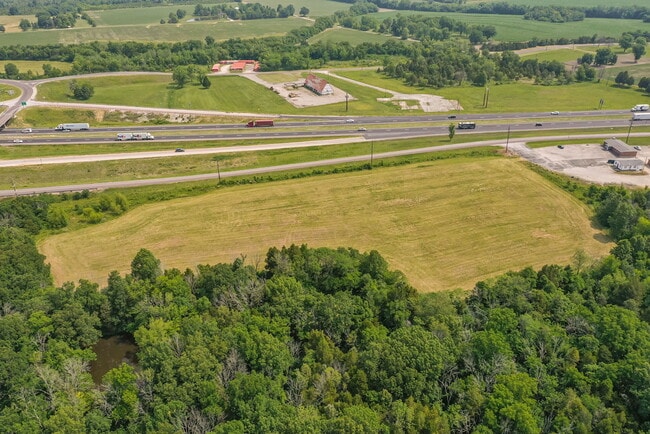

Property Detail
Tree Farm Rd
15-2.0-04-000-000-031.000
4-47-4 PT E12 NW
Commercialofficeresidentialmixeduse
MONTGOMERY
B and X Area of moderate flood hazard, usually the area between the limits of the 100-year and 500-year floods.
Missouri
2024
6.46 AC
2025
Missouri North Area
970400
Other Market Areas
NEARBY LISTINGS FOR SALE OR LEASE
-
-
View all High Hill listings for sale on LoopNet.com
DEMOGRAPHICS near Tree Farm Rd
1 mile
3 mile
5 mile
2025 Total Population
313
724
2,907
2030 Population
318
739
2,983
Pop Growth 2025-2030
+ 1.60%
+ 2.07%
+ 2.61%
Average Age
42
43
44
2025 Total Households
121
285
1,163
HH Growth 2025-2030
+ 1.65%
+ 2.11%
+ 2.67%
Median Household Inc
$74,249
$70,446
$65,952
Avg Household Size
2.40
2.40
2.40
2025 Avg HH Vehicles
2.00
2.00
2.00
Median Home Value
$194,117
$215,625
$223,461
Median Year Built
1977
1980
1985
Nearby Places
Map Layers
Map Styles
 Street
 Aerial
Layers
 Traffic
 Biking
Places
Listings with unknown addresses are not visible on the map
- Restaurants
- Banks
- Shops
- Fitness
- Groceries
SALE & LEASE HISTORY
LISTING DATE
SALE/LEASE

Jun 16, 2023
For Sale
Nearby Properties
Address
Land Use
TOTAL SIZE
Lot Size
Zoning
Address
Land Use
TOTAL SIZE
Lot Size
Zoning
10.26 AC
Address
Land Use
TOTAL SIZE
Lot Size
Zoning
0.06 AC
Address
Land Use
TOTAL SIZE
Lot Size
Zoning
14.81 AC
Address
Land Use
TOTAL SIZE
Lot Size
Zoning
18.10 AC
Address
Land Use
TOTAL SIZE
Lot Size
Zoning
12.04 AC
Address
Land Use
TOTAL SIZE
Lot Size
Zoning
4.82 AC
Address
Land Use
TOTAL SIZE
Lot Size
Zoning
3.35 AC
Address
Land Use
TOTAL SIZE
Lot Size
Zoning
58.29 AC
Address
Land Use
TOTAL SIZE
Lot Size
Zoning
2.41 AC
Address
Land Use
TOTAL SIZE
Lot Size
Zoning
Address
Land Use
TOTAL SIZE
Lot Size
Zoning
1.05 AC
Address
Land Use
TOTAL SIZE
Lot Size
Zoning
Address
Land Use
TOTAL SIZE
Lot Size
Zoning
Address
Land Use
TOTAL SIZE
Lot Size
Zoning
768 SF
413.75 AC
Address
Land Use
TOTAL SIZE
Lot Size
Zoning
2,698 SF
0.62 AC
Address
Land Use
TOTAL SIZE
Lot Size
Zoning
2,387 SF
3.39 AC
Address
Land Use
TOTAL SIZE
Lot Size
Zoning
1,955 SF
0.36 AC
Address
Land Use
TOTAL SIZE
Lot Size
Zoning
2,199 SF
0.55 AC
Address
Land Use
TOTAL SIZE
Lot Size
Zoning
2,574 SF
0.73 AC
Address
Land Use
TOTAL SIZE
Lot Size
Zoning
2,538 SF
0.22 AC
Address
Land Use
TOTAL SIZE
Lot Size
Zoning
15.51 AC
Address
Land Use
TOTAL SIZE
Lot Size
Zoning
416 SF
0.54 AC
Address
Land Use
TOTAL SIZE
Lot Size
Zoning
2,272 SF
0.15 AC
Address
Land Use
TOTAL SIZE
Lot Size
Zoning
0.29 AC
Address
Land Use
TOTAL SIZE
Lot Size
Zoning
Address
Land Use
TOTAL SIZE
Lot Size
Zoning
2,272 SF
0.72 AC
Address
Land Use
TOTAL SIZE
Lot Size
Zoning
2,177 SF
0.37 AC
Address
Land Use
TOTAL SIZE
Lot Size
Zoning
1,898 SF
0.51 AC
Address
Land Use
TOTAL SIZE
Lot Size
Zoning
2,122 SF
0.36 AC
Address
Land Use
TOTAL SIZE
Lot Size
Zoning
The World's #1 Commercial Real Estate Marketplace
Connect with us
© 2026 CoStar Group
The information above has been obtained from sources believed reliable. While we do not doubt its accuracy we have not verified it and make no guarantee, warranty or representation about it. It is your responsibility to independently confirm its accuracy and completeness. Any projections, opinions, assumptions, or estimates used are for example only and do not represent the current or future performance of the property. The value of this transaction to you depends on tax and other factors which should be evaluated by your tax, financial, and legal advisors. You and your advisors should conduct a careful, independent investigation of the property to determine to your satisfaction the suitability of the property for your needs.