Property Record
5310 Tejon St, Denver, CO 80221
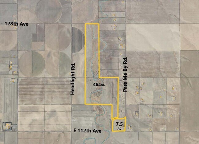
NEARBY LISTINGS FOR SALE OR LEASE
Property Detail
5310 Tejon St
Denver-Aurora-Lakewood, CO
Agriculture Prop
1731-02-1-00-004
SECT,TWN,RNG:2-2-62 DESC: E2 E2 EXC PARC AND EXC RDS AND EXC PT PLATTED 54/251A
Agriculturalland
Adams
X
Colorado
08001C0450H
54.25 AC
2024
Outlying Adams County
2024
Denver
009752
DEMOGRAPHICS near 5310 Tejon St
1 Mile
3 Mile
5 Mile
2024 Total Population
65
165
234
2029 Population
66
168
237
Pop Growth 2024-2029
+ 1.54%
+ 1.82%
+ 1.28%
Average Age
41
41
41
2024 Total Households
23
58
82
HH Growth 2024-2029
0.00%
+ 1.72%
+ 2.44%
Median Household Inc
$118,749
$110,714
$112,500
Avg Household Size
2.80
2.80
2.80
2024 Avg HH Vehicles
4.00
3.00
3.00
Median Home Value
$734,375
$724,359
$722,727
Median Year Built
1996
1996
1996
Nearby Places
Map Layers
Map Styles
 Street
 Aerial
- Restaurants
- Banks
- Shops
- Fitness
- Groceries
PUBLIC TRANSPORTATION
COMMUTER RAIL
Pecos Junction Station Track 1 (Union Station to Westminster Station - Regional Transportation District, Union Station to Wheat Ridge Ward Station - Regional Transportation District)
DRIVE
WALK
Distance
Pecos Junction Station Track 1 (Union Station to Westminster Station - Regional Transportation District, Union Station to Wheat Ridge Ward Station - Regional Transportation District)
3 min
1.3 mi
Clear Creek - Federal Station Track 1 (Union Station to Wheat Ridge Ward Station - Regional Transportation District)
DRIVE
WALK
Distance
Clear Creek - Federal Station Track 1 (Union Station to Wheat Ridge Ward Station - Regional Transportation District)
5 min
1.8 mi
AIRPORT
Denver International
DRIVE
WALK
Distance
Denver International
31 min
24.1 mi
Freight Ports
Tulsa Port Of Catoosa
DRIVE
WALK
Distance
Tulsa Port Of Catoosa
728 min
709.6 mi
SALE & LEASE HISTORY
LISTING DATE
SALE/LEASE

Jul 29, 2024
For Sale
Nearby Properties
Address
Land Use
TOTAL SIZE
Lot Size
Zoning
Address
Land Use
TOTAL SIZE
Lot Size
Zoning
611,828 SF
0.94 AC
PUD
Address
Land Use
TOTAL SIZE
Lot Size
Zoning
150,202 SF
13.24 AC
T-MU-30
Address
Land Use
TOTAL SIZE
Lot Size
Zoning
298,387 SF
0.88 AC
PUD
Address
Land Use
TOTAL SIZE
Lot Size
Zoning
405,974 SF
1.78 AC
PUD
Address
Land Use
TOTAL SIZE
Lot Size
Zoning
290,821 SF
1.16 AC
PUD
Address
Land Use
TOTAL SIZE
Lot Size
Zoning
334,746 SF
1.25 AC
D-LD
Address
Land Use
TOTAL SIZE
Lot Size
Zoning
888,385 SF
20.40 AC
I-A
Address
Land Use
TOTAL SIZE
Lot Size
Zoning
860,132 SF
68.50 AC
R-5
Address
Land Use
TOTAL SIZE
Lot Size
Zoning
424,862 SF
32.28 AC
G-MU-3
Address
Land Use
TOTAL SIZE
Lot Size
Zoning
303,752 SF
1.26 AC
D-LD
Address
Land Use
TOTAL SIZE
Lot Size
Zoning
281,209 SF
1.66 AC
C-MX-12
Address
Land Use
TOTAL SIZE
Lot Size
Zoning
225,749 SF
1.27 AC
D-LD
Address
Land Use
TOTAL SIZE
Lot Size
Zoning
218,176 SF
0.62 AC
T-MU-30
Address
Land Use
TOTAL SIZE
Lot Size
Zoning
265,054 SF
1.39 AC
C-MX-5
Address
Land Use
TOTAL SIZE
Lot Size
Zoning
203,148 SF
1.36 AC
C-MX-5
Address
Land Use
TOTAL SIZE
Lot Size
Zoning
222,000 SF
2.98 AC
PUD-G
Address
Land Use
TOTAL SIZE
Lot Size
Zoning
212,252 SF
0.93 AC
D-LD
Address
Land Use
TOTAL SIZE
Lot Size
Zoning
268,690 SF
1.23 AC
PUD
Address
Land Use
TOTAL SIZE
Lot Size
Zoning
25,000 SF
40.42 AC
I-A
Address
Land Use
TOTAL SIZE
Lot Size
Zoning
3,188 SF
81.17 AC
I-B
Address
Land Use
TOTAL SIZE
Lot Size
Zoning
230,246 SF
0.79 AC
I-MX-8
Address
Land Use
TOTAL SIZE
Lot Size
Zoning
921,863 SF
2.01 AC
C-MX
Address
Land Use
TOTAL SIZE
Lot Size
Zoning
178,845 SF
0.59 AC
PUD
Address
Land Use
TOTAL SIZE
Lot Size
Zoning
798,837 SF
1.67 AC
C-MX
Address
Land Use
TOTAL SIZE
Lot Size
Zoning
159,202 SF
1.03 AC
C-MX-5
Address
Land Use
TOTAL SIZE
Lot Size
Zoning
8,295 SF
2.57 AC
C-RX
Address
Land Use
TOTAL SIZE
Lot Size
Zoning
35,364 SF
1.12 AC
T-MU
Address
Land Use
TOTAL SIZE
Lot Size
Zoning
398,180 SF
33.31 AC
R1C
Address
Land Use
TOTAL SIZE
Lot Size
Zoning
238,888 SF
1.13 AC
C-MX-12
Address
Land Use
TOTAL SIZE
Lot Size
Zoning
177,366 SF
3.85 AC
C-MX-8
The World's #1 Commercial Real Estate Marketplace
Connect with us
© 2025 CoStar Group
The information above has been obtained from sources believed reliable. While we do not doubt its accuracy we have not verified it and make no guarantee, warranty or representation about it. It is your responsibility to independently confirm its accuracy and completeness. Any projections, opinions, assumptions, or estimates used are for example only and do not represent the current or future performance of the property. The value of this transaction to you depends on tax and other factors which should be evaluated by your tax, financial, and legal advisors. You and your advisors should conduct a careful, independent investigation of the property to determine to your satisfaction the suitability of the property for your needs.