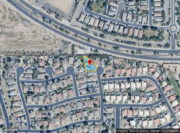
Property Record
20978 N 99Th Dr, Peoria, AZ 85382
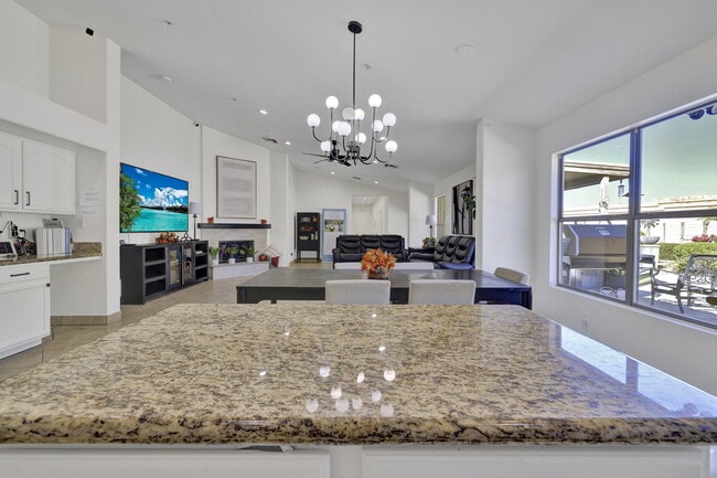
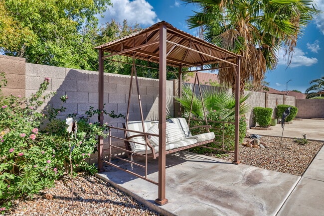
This Property Is For Sale
NEARBY LISTINGS FOR SALE OR LEASE
Property Detail
20978 N 99Th Dr
Phoenix-Mesa-Scottsdale, AZ
Parkridge 3
200-14-473
Maricopa
Sfr
Arizona
X
0.34 AC
04013C1245L
Arrowhead
2,313 SF
Phoenix
DEMOGRAPHICS near 20978 N 99Th Dr
1 Mile
3 Mile
5 Mile
2024 Total Population
14,874
84,236
210,595
2029 Population
16,235
91,454
228,627
Pop Growth 2024-2029
+ 9.15%
+ 8.57%
+ 8.56%
Average Age
44
47
48
2024 Total Households
5,673
34,635
88,839
HH Growth 2024-2029
+ 9.25%
+ 8.76%
+ 8.75%
Median Household Inc
$99,209
$80,591
$78,170
Avg Household Size
2.60
2.40
2.30
2024 Avg HH Vehicles
2.00
2.00
2.00
Median Home Value
$362,093
$365,303
$367,533
Median Year Built
1998
1994
1993
Nearby Places
Map Layers
Map Styles
 Street
 Aerial
- Restaurants
- Banks
- Shops
- Fitness
- Groceries
PUBLIC TRANSPORTATION
AIRPORT
Phoenix Sky Harbor International
DRIVE
WALK
Distance
Phoenix Sky Harbor International
48 min
35.5 mi
Freight Ports
Port of San Diego
DRIVE
WALK
Distance
Port of San Diego
405 min
361.3 mi
Nearby Properties
Address
Land Use
TOTAL SIZE
Lot Size
Zoning
Address
Land Use
TOTAL SIZE
Lot Size
Zoning
248,777 SF
51.46 AC
AG
Address
Land Use
TOTAL SIZE
Lot Size
Zoning
235,399 SF
41.79 AC
M-M
Address
Land Use
TOTAL SIZE
Lot Size
Zoning
399,561 SF
16.30 AC
Address
Land Use
TOTAL SIZE
Lot Size
Zoning
133,377 SF
17.52 AC
PAD
Address
Land Use
TOTAL SIZE
Lot Size
Zoning
280,356 SF
12.73 AC
PAD
Address
Land Use
TOTAL SIZE
Lot Size
Zoning
375,604 SF
6.31 AC
M-M
Address
Land Use
TOTAL SIZE
Lot Size
Zoning
394,394 SF
15.24 AC
PAD
Address
Land Use
TOTAL SIZE
Lot Size
Zoning
284,715 SF
7.15 AC
M-M
Address
Land Use
TOTAL SIZE
Lot Size
Zoning
122,780 SF
18.75 AC
PAD
Address
Land Use
TOTAL SIZE
Lot Size
Zoning
112,300 SF
13.72 AC
PAD
Address
Land Use
TOTAL SIZE
Lot Size
Zoning
283,107 SF
14.60 AC
M-M
Address
Land Use
TOTAL SIZE
Lot Size
Zoning
96,045 SF
13.69 AC
PAD
Address
Land Use
TOTAL SIZE
Lot Size
Zoning
113,189 SF
15 AC
R-6
Address
Land Use
TOTAL SIZE
Lot Size
Zoning
311,614 SF
19.03 AC
PAD
Address
Land Use
TOTAL SIZE
Lot Size
Zoning
187,392 SF
10.36 AC
PAD
Address
Land Use
TOTAL SIZE
Lot Size
Zoning
18.76 AC
M1
Address
Land Use
TOTAL SIZE
Lot Size
Zoning
82,688 SF
18.70 AC
PAD
Address
Land Use
TOTAL SIZE
Lot Size
Zoning
Address
Land Use
TOTAL SIZE
Lot Size
Zoning
96,954 SF
13.47 AC
PAD
Address
Land Use
TOTAL SIZE
Lot Size
Zoning
127,616 SF
27.49 AC
PAD
Address
Land Use
TOTAL SIZE
Lot Size
Zoning
217,564 SF
22.91 AC
PAD
Address
Land Use
TOTAL SIZE
Lot Size
Zoning
123,090 SF
11.22 AC
PAD
Address
Land Use
TOTAL SIZE
Lot Size
Zoning
139,095 SF
13.67 AC
PAD
Address
Land Use
TOTAL SIZE
Lot Size
Zoning
93,234 SF
11.90 AC
C-C
Address
Land Use
TOTAL SIZE
Lot Size
Zoning
201,549 SF
22.46 AC
PAD
Address
Land Use
TOTAL SIZE
Lot Size
Zoning
65,825 SF
10.26 AC
PAD
Address
Land Use
TOTAL SIZE
Lot Size
Zoning
82,014 SF
14.64 AC
M-M
Address
Land Use
TOTAL SIZE
Lot Size
Zoning
195,142 SF
10.06 AC
C-C
Address
Land Use
TOTAL SIZE
Lot Size
Zoning
255,933 SF
15.20 AC
PAD
The World's #1 Commercial Real Estate Marketplace
Connect with us
© 2026 CoStar Group
The information above has been obtained from sources believed reliable. While we do not doubt its accuracy we have not verified it and make no guarantee, warranty or representation about it. It is your responsibility to independently confirm its accuracy and completeness. Any projections, opinions, assumptions, or estimates used are for example only and do not represent the current or future performance of the property. The value of this transaction to you depends on tax and other factors which should be evaluated by your tax, financial, and legal advisors. You and your advisors should conduct a careful, independent investigation of the property to determine to your satisfaction the suitability of the property for your needs.