Property Record
Tyler Island Rd, Isleton, CA 95641

This Property Is For Sale
Property Detail
Tyler Island Rd
156-0070-001
POR OF 1077.07 AC TRACT OF LAND ON TYLER ISLANDDES IN BK 68-01-15, PG 434 O R SACTO CO LYING NOF A DITCH RUNNING NWLY AND
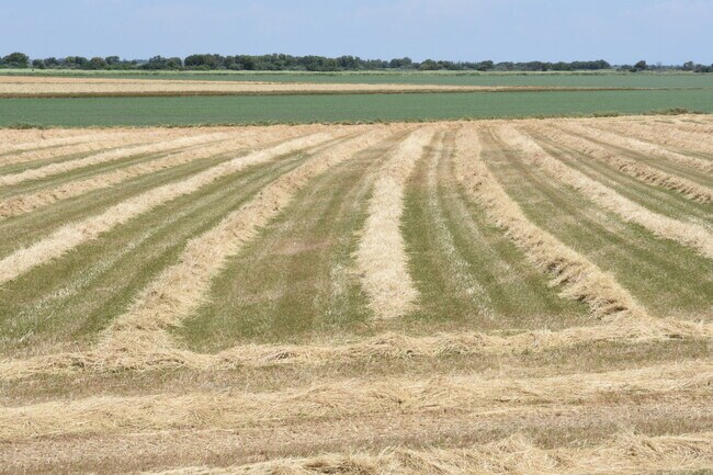
Farms
SACRAMENTO
AG-80
California
AE The base floodplain where base flood elevations are provided. AE Zones are now used on new format FIRMs instead of A1-A30 Zones.
622.35 AC
2024
Outer Sacramento County
2025
Sacramento
009900
Sacramento-Roseville-Folsom, CA
NEARBY LISTINGS FOR SALE OR LEASE
-
-
View all Isleton listings for sale on LoopNet.com
DEMOGRAPHICS near Tyler Island Rd
1 mile
3 mile
5 mile
2025 Total Population
563
1,296
2,418
2030 Population
540
1,239
2,360
Pop Growth 2025-2030
(4.09%)
(4.40%)
(2.40%)
Average Age
46
46
47
2025 Total Households
229
528
1,063
HH Growth 2025-2030
(4.37%)
(4.36%)
(2.45%)
Median Household Inc
$92,360
$96,036
$72,538
Avg Household Size
2.40
2.40
2.20
2025 Avg HH Vehicles
2.00
2.00
2.00
Median Home Value
$376,190
$394,564
$436,666
Median Year Built
1972
1972
1977
Nearby Places
Map Layers
Map Styles
 Street
 Aerial
Transit
 Traffic
 Biking
Places
Listings with unknown addresses are not visible on the map
- Restaurants
- Banks
- Shops
- Fitness
- Groceries
PUBLIC TRANSPORTATION
AIRPORT
Stockton Metro
Drive
Walk
Distance
Stockton Metro
50 min
33.6 mi
Freight Ports
Port of Stockton
Drive
Walk
Distance
Port of Stockton
40 min
26.0 mi
Nearby Properties
Address
Land Use
TOTAL SIZE
Lot Size
Zoning
Address
Land Use
TOTAL SIZE
Lot Size
Zoning
153,371 SF
15.46 AC
C-O
Address
Land Use
TOTAL SIZE
Lot Size
Zoning
530.29 AC
AG-80
Address
Land Use
TOTAL SIZE
Lot Size
Zoning
AG80 F
Address
Land Use
TOTAL SIZE
Lot Size
Zoning
513.57 AC
AG-80
Address
Land Use
TOTAL SIZE
Lot Size
Zoning
Address
Land Use
TOTAL SIZE
Lot Size
Zoning
378.70 AC
SPA AG-80
Address
Land Use
TOTAL SIZE
Lot Size
Zoning
288.37 AC
AG-80
Address
Land Use
TOTAL SIZE
Lot Size
Zoning
349.12 AC
AG-80 SPA
Address
Land Use
TOTAL SIZE
Lot Size
Zoning
374.77 AC
AG40
Address
Land Use
TOTAL SIZE
Lot Size
Zoning
2,070 SF
333 AC
AG40
Address
Land Use
TOTAL SIZE
Lot Size
Zoning
Address
Land Use
TOTAL SIZE
Lot Size
Zoning
Address
Land Use
TOTAL SIZE
Lot Size
Zoning
Address
Land Use
TOTAL SIZE
Lot Size
Zoning
146 AC
AG-80
Address
Land Use
TOTAL SIZE
Lot Size
Zoning
Address
Land Use
TOTAL SIZE
Lot Size
Zoning
2,438 SF
25.10 AC
DW AG-80
Address
Land Use
TOTAL SIZE
Lot Size
Zoning
206.31 AC
AG-80
Address
Land Use
TOTAL SIZE
Lot Size
Zoning
198 AC
SPA AG-80
Address
Land Use
TOTAL SIZE
Lot Size
Zoning
Address
Land Use
TOTAL SIZE
Lot Size
Zoning
Address
Land Use
TOTAL SIZE
Lot Size
Zoning
6.90 AC
DW-R
Address
Land Use
TOTAL SIZE
Lot Size
Zoning
24.03 AC
SPA
Address
Land Use
TOTAL SIZE
Lot Size
Zoning
116.27 AC
AG-80
Address
Land Use
TOTAL SIZE
Lot Size
Zoning
3.06 AC
PDI
Address
Land Use
TOTAL SIZE
Lot Size
Zoning
9.09 AC
C-O
Address
Land Use
TOTAL SIZE
Lot Size
Zoning
6,048 SF
0.36 AC
CC
Address
Land Use
TOTAL SIZE
Lot Size
Zoning
Address
Land Use
TOTAL SIZE
Lot Size
Zoning
4,251 SF
0.20 AC
DW-S C-O
Address
Land Use
TOTAL SIZE
Lot Size
Zoning
Address
Land Use
TOTAL SIZE
Lot Size
Zoning
19,998 SF
10.25 AC
SPA
The World's #1 Commercial Real Estate Marketplace
Connect with us
© 2026 CoStar Group
The information above has been obtained from sources believed reliable. While we do not doubt its accuracy we have not verified it and make no guarantee, warranty or representation about it. It is your responsibility to independently confirm its accuracy and completeness. Any projections, opinions, assumptions, or estimates used are for example only and do not represent the current or future performance of the property. The value of this transaction to you depends on tax and other factors which should be evaluated by your tax, financial, and legal advisors. You and your advisors should conduct a careful, independent investigation of the property to determine to your satisfaction the suitability of the property for your needs.