Property Record
Tyrone Rd, Tyrone, GA 30290

Property Detail
Tyrone Rd
07-27-00-062
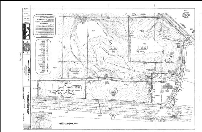
2.16 ACRES TYRONE RD
Commercialacreage
FAYETTE
C C1
Georgia
B and X Area of moderate flood hazard, usually the area between the limits of the 100-year and 500-year floods.
2.16 AC
2024
Fayette/Coweta County
2025
Atlanta
140203
Atlanta-Sandy Springs-Roswell, GA
NEARBY LISTINGS FOR SALE OR LEASE
DEMOGRAPHICS near Tyrone Rd
1 mile
3 mile
5 mile
2025 Total Population
2,237
14,909
57,094
2030 Population
2,320
15,531
59,845
Pop Growth 2025-2030
+ 3.71%
+ 4.17%
+ 4.82%
Average Age
43
42
41
2025 Total Households
769
5,226
20,630
HH Growth 2025-2030
+ 3.90%
+ 4.15%
+ 4.71%
Median Household Inc
$120,672
$116,900
$109,743
Avg Household Size
2.90
2.80
2.70
2025 Avg HH Vehicles
2.00
2.00
2.00
Median Home Value
$448,011
$478,318
$457,981
Median Year Built
1994
1996
1998
Nearby Places
Map Layers
Map Styles
 Street
 Aerial
Layers
 Traffic
 Biking
Places
Listings with unknown addresses are not visible on the map
- Restaurants
- Banks
- Shops
- Fitness
- Groceries
PUBLIC TRANSPORTATION
AIRPORT
Hartsfield - Jackson Atlanta International
Drive
Walk
Distance
Hartsfield - Jackson Atlanta International
29 min
19.2 mi
Nearby Properties
Address
Land Use
TOTAL SIZE
Lot Size
Zoning
Address
Land Use
TOTAL SIZE
Lot Size
Zoning
412,253 SF
134.50 AC
Address
Land Use
TOTAL SIZE
Lot Size
Zoning
194,839 SF
25.40 AC
C GC
Address
Land Use
TOTAL SIZE
Lot Size
Zoning
39,195 SF
14.06 AC
C GC
Address
Land Use
TOTAL SIZE
Lot Size
Zoning
96,409 SF
12.74 AC
C GC
Address
Land Use
TOTAL SIZE
Lot Size
Zoning
80,800 SF
9.39 AC
C C2
Address
Land Use
TOTAL SIZE
Lot Size
Zoning
93,925 SF
5.18 AC
C GC
Address
Land Use
TOTAL SIZE
Lot Size
Zoning
80,956 SF
60.90 AC
Address
Land Use
TOTAL SIZE
Lot Size
Zoning
72,376 SF
30.30 AC
Address
Land Use
TOTAL SIZE
Lot Size
Zoning
125,421 SF
12.99 AC
C GC
Address
Land Use
TOTAL SIZE
Lot Size
Zoning
14,636 SF
6.50 AC
C OI
Address
Land Use
TOTAL SIZE
Lot Size
Zoning
52,615 SF
4.15 AC
C LUC
Address
Land Use
TOTAL SIZE
Lot Size
Zoning
35,455 SF
2.30 AC
C GC
Address
Land Use
TOTAL SIZE
Lot Size
Zoning
36,900 SF
8.12 AC
C OI
Address
Land Use
TOTAL SIZE
Lot Size
Zoning
49,935 SF
3.99 AC
C GC
Address
Land Use
TOTAL SIZE
Lot Size
Zoning
60.89 AC
I M1
Address
Land Use
TOTAL SIZE
Lot Size
Zoning
30,397 SF
24.50 AC
Address
Land Use
TOTAL SIZE
Lot Size
Zoning
66,390 SF
3.61 AC
I M1
Address
Land Use
TOTAL SIZE
Lot Size
Zoning
12,859 SF
50.50 AC
Address
Land Use
TOTAL SIZE
Lot Size
Zoning
15,440 SF
10.86 AC
C C1
Address
Land Use
TOTAL SIZE
Lot Size
Zoning
17,248 SF
3.47 AC
C OI
Address
Land Use
TOTAL SIZE
Lot Size
Zoning
49,680 SF
2.92 AC
I M2
Address
Land Use
TOTAL SIZE
Lot Size
Zoning
26,022 SF
3.48 AC
C C2
Address
Land Use
TOTAL SIZE
Lot Size
Zoning
72,227 SF
7.40 AC
Address
Land Use
TOTAL SIZE
Lot Size
Zoning
24,100 SF
4.30 AC
C C3
Address
Land Use
TOTAL SIZE
Lot Size
Zoning
1,080 SF
37.60 AC
I M1
Address
Land Use
TOTAL SIZE
Lot Size
Zoning
27,270 SF
3.28 AC
C C2
Address
Land Use
TOTAL SIZE
Lot Size
Zoning
18,400 SF
2.35 AC
C C1
Address
Land Use
TOTAL SIZE
Lot Size
Zoning
60,099 SF
3.60 AC
Address
Land Use
TOTAL SIZE
Lot Size
Zoning
14,375 SF
1.85 AC
C C1
Address
Land Use
TOTAL SIZE
Lot Size
Zoning
17,330 SF
4.16 AC
C OI
The World's #1 Commercial Real Estate Marketplace
Connect with us
© 2026 CoStar Group
The information above has been obtained from sources believed reliable. While we do not doubt its accuracy we have not verified it and make no guarantee, warranty or representation about it. It is your responsibility to independently confirm its accuracy and completeness. Any projections, opinions, assumptions, or estimates used are for example only and do not represent the current or future performance of the property. The value of this transaction to you depends on tax and other factors which should be evaluated by your tax, financial, and legal advisors. You and your advisors should conduct a careful, independent investigation of the property to determine to your satisfaction the suitability of the property for your needs.