Property Record
Unassigned, Corvallis, OR 97330
Property Detail
Unassigned
045702
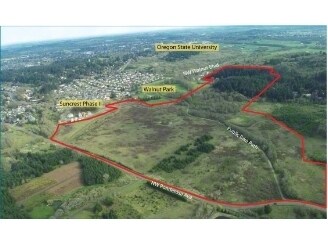
SUNCREST PHASE IIB
Residentialacreage
BENTON
PD(RS-6)
Oregon
B and X Area of moderate flood hazard, usually the area between the limits of the 100-year and 500-year floods.
9.98 AC
2024
Oregon West Area
2025
Other Market Areas
000400
Corvallis, OR
NEARBY LISTINGS FOR SALE OR LEASE
-
-
Un-Assigned Un-Assigned TL: #200 Tax Account: #156749
Corvallis, OR 97330
$6,496,200
108.27 AC Lots
Land
-
-
View all Corvallis listings for sale on LoopNet.com
DEMOGRAPHICS near Unassigned
1 mile
3 mile
5 mile
2025 Total Population
3,859
40,709
76,087
2030 Population
3,929
42,212
79,022
Pop Growth 2025-2030
+ 1.81%
+ 3.69%
+ 3.86%
Average Age
46
37
38
2025 Total Households
1,563
16,168
30,439
HH Growth 2025-2030
+ 1.73%
+ 3.92%
+ 4.14%
Median Household Inc
$147,484
$70,725
$65,842
Avg Household Size
2.40
2.30
2.20
2025 Avg HH Vehicles
2.00
2.00
2.00
Median Home Value
$693,041
$585,126
$519,973
Median Year Built
1983
1976
1979
Nearby Places
Map Layers
Map Styles
 Street
 Aerial
Transit
 Traffic
 Biking
Places
Listings with unknown addresses are not visible on the map
- Restaurants
- Banks
- Shops
- Fitness
- Groceries
Nearby Properties
Address
Land Use
TOTAL SIZE
Lot Size
Zoning
Address
Land Use
TOTAL SIZE
Lot Size
Zoning
1,687,456 SF
178.96 AC
OSU
Address
Land Use
TOTAL SIZE
Lot Size
Zoning
84,026 SF
29.97 AC
OSU
Address
Land Use
TOTAL SIZE
Lot Size
Zoning
552,129 SF
25.99 AC
RS-12
Address
Land Use
TOTAL SIZE
Lot Size
Zoning
247,098 SF
16.39 AC
OSU
Address
Land Use
TOTAL SIZE
Lot Size
Zoning
321,584 SF
21.48 AC
RS-9
Address
Land Use
TOTAL SIZE
Lot Size
Zoning
45.23 AC
OSU
Address
Land Use
TOTAL SIZE
Lot Size
Zoning
195,325 SF
26.28 AC
RS-3.5
Address
Land Use
TOTAL SIZE
Lot Size
Zoning
120,379 SF
11.85 AC
OSU
Address
Land Use
TOTAL SIZE
Lot Size
Zoning
91,272 SF
1.27 AC
OSU
Address
Land Use
TOTAL SIZE
Lot Size
Zoning
122,130 SF
5.64 AC
OSU
Address
Land Use
TOTAL SIZE
Lot Size
Zoning
215,337 SF
16.20 AC
RS-20
Address
Land Use
TOTAL SIZE
Lot Size
Zoning
297,220 SF
2.67 AC
OSU
Address
Land Use
TOTAL SIZE
Lot Size
Zoning
166,415 SF
3.04 AC
OSU
Address
Land Use
TOTAL SIZE
Lot Size
Zoning
68,500 SF
10 AC
OSU
Address
Land Use
TOTAL SIZE
Lot Size
Zoning
116,863 SF
2.10 AC
OSU
Address
Land Use
TOTAL SIZE
Lot Size
Zoning
81,113 SF
1.81 AC
PD(RS-20)
Address
Land Use
TOTAL SIZE
Lot Size
Zoning
107,412 SF
9.16 AC
RTC
Address
Land Use
TOTAL SIZE
Lot Size
Zoning
129,103 SF
6.95 AC
PD(RS-12)
Address
Land Use
TOTAL SIZE
Lot Size
Zoning
146,932 SF
6.41 AC
MUCS
Address
Land Use
TOTAL SIZE
Lot Size
Zoning
34,966 SF
63.57 AC
P
Address
Land Use
TOTAL SIZE
Lot Size
Zoning
67,925 SF
4.84 AC
RTC
Address
Land Use
TOTAL SIZE
Lot Size
Zoning
74,046 SF
9.53 AC
PD(RS-3.5)
Address
Land Use
TOTAL SIZE
Lot Size
Zoning
124,682 SF
10.62 AC
PD(RS-12)
Address
Land Use
TOTAL SIZE
Lot Size
Zoning
218,015 SF
11.69 AC
PD(RS-12)
Address
Land Use
TOTAL SIZE
Lot Size
Zoning
112,216 SF
11.30 AC
PD(NC-MAJO
Address
Land Use
TOTAL SIZE
Lot Size
Zoning
122,984 SF
2.56 AC
RS-20
Address
Land Use
TOTAL SIZE
Lot Size
Zoning
95,797 SF
6.03 AC
PD(P-AO)
Address
Land Use
TOTAL SIZE
Lot Size
Zoning
3,486 SF
14 AC
OSU
Address
Land Use
TOTAL SIZE
Lot Size
Zoning
165,589 SF
13.92 AC
RS-20
Address
Land Use
TOTAL SIZE
Lot Size
Zoning
15.04 AC
RI
The World's #1 Commercial Real Estate Marketplace
Connect with us
© 2026 CoStar Group
The information above has been obtained from sources believed reliable. While we do not doubt its accuracy we have not verified it and make no guarantee, warranty or representation about it. It is your responsibility to independently confirm its accuracy and completeness. Any projections, opinions, assumptions, or estimates used are for example only and do not represent the current or future performance of the property. The value of this transaction to you depends on tax and other factors which should be evaluated by your tax, financial, and legal advisors. You and your advisors should conduct a careful, independent investigation of the property to determine to your satisfaction the suitability of the property for your needs.