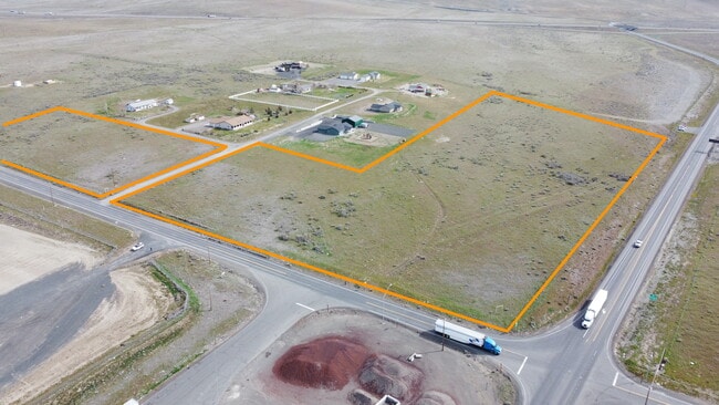
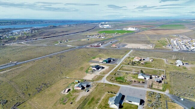
Property Record
Undetermined, Plymouth, WA 99346
NEARBY LISTINGS FOR SALE OR LEASE
-
-
View all Plymouth listings for sale on LoopNet.com
Property Detail
Undetermined
Other Market Areas
Short Plat #2181
Kennewick-Richland, WA
SECTION 5 TOWNSHIP 5 RANGE 28 QUARTER NW; LOT 1, SHORT PLAT NUMBER 2181, ACCORDING TO THE SURVEY THEREOF RECORDED UNDER AUDITORS FILE NUMBER 95-10913, RECORDS OF BENTON COUNTY, WASHINGTON; TOGETHER WITH LOT 2, SAID SHORT PLAT NUMBER 2181; EXCEPT THE
105582012181005
Benton
Storebuilding
Washington
2024
1
2024
16.26 AC
000001
Yakima/Kennewick
DEMOGRAPHICS near Undetermined
1 Mile
3 Mile
5 Mile
2024 Total Population
157
2,987
8,031
2029 Population
156
3,003
8,070
Pop Growth 2024-2029
(0.64%)
+ 0.54%
+ 0.49%
Average Age
39
35
37
2024 Total Households
56
997
2,249
HH Growth 2024-2029
0.00%
+ 0.60%
+ 0.53%
Median Household Inc
$74,999
$49,967
$55,637
Avg Household Size
2.70
2.90
3.00
2024 Avg HH Vehicles
3.00
2.00
2.00
Median Home Value
$399,999
$172,856
$198,856
Median Year Built
1989
1987
1989
Nearby Places
Map Layers
Map Styles
 Street
 Aerial
- Restaurants
- Banks
- Shops
- Fitness
- Groceries
PUBLIC TRANSPORTATION
AIRPORT
Tri-Cities
DRIVE
WALK
Distance
Tri-Cities
36 min
28.5 mi
Freight Ports
Port of Vancouver
DRIVE
WALK
Distance
Port of Vancouver
227 min
190.2 mi
SALE & LEASE HISTORY
LISTING DATE
SALE/LEASE

Mar 29, 2022
For Sale
Nearby Properties
Address
Land Use
TOTAL SIZE
Lot Size
Zoning
Address
Land Use
TOTAL SIZE
Lot Size
Zoning
52,790 SF
372.70 AC
RURAL LAND
Address
Land Use
TOTAL SIZE
Lot Size
Zoning
2,320 SF
22.19 AC
Address
Land Use
TOTAL SIZE
Lot Size
Zoning
10 SF
18.69 AC
CS
Address
Land Use
TOTAL SIZE
Lot Size
Zoning
66,173 SF
14.44 AC
Address
Land Use
TOTAL SIZE
Lot Size
Zoning
4,770 SF
104.91 AC
Address
Land Use
TOTAL SIZE
Lot Size
Zoning
400 SF
20 AC
Address
Land Use
TOTAL SIZE
Lot Size
Zoning
Address
Land Use
TOTAL SIZE
Lot Size
Zoning
20,850 SF
0.43 AC
DC
Address
Land Use
TOTAL SIZE
Lot Size
Zoning
17,981 SF
3.69 AC
GC
Address
Land Use
TOTAL SIZE
Lot Size
Zoning
8,031 SF
628.65 AC
G.M.A. AGR
Address
Land Use
TOTAL SIZE
Lot Size
Zoning
46,984 SF
2.42 AC
R2
Address
Land Use
TOTAL SIZE
Lot Size
Zoning
1,680 SF
640 AC
G.M.A. AGR
Address
Land Use
TOTAL SIZE
Lot Size
Zoning
16,958 SF
0.74 AC
C-3
Address
Land Use
TOTAL SIZE
Lot Size
Zoning
4,255 SF
1.94 AC
M-1
Address
Land Use
TOTAL SIZE
Lot Size
Zoning
6,848 SF
636.02 AC
Address
Land Use
TOTAL SIZE
Lot Size
Zoning
760 SF
146.63 AC
Address
Land Use
TOTAL SIZE
Lot Size
Zoning
5,616 SF
20.03 AC
Address
Land Use
TOTAL SIZE
Lot Size
Zoning
16,192 SF
0.76 AC
C-3
Address
Land Use
TOTAL SIZE
Lot Size
Zoning
16,320 SF
4.87 AC
M-1
Address
Land Use
TOTAL SIZE
Lot Size
Zoning
9,200 SF
0.26 AC
C-3
Address
Land Use
TOTAL SIZE
Lot Size
Zoning
20,736 SF
0.80 AC
C-3
Address
Land Use
TOTAL SIZE
Lot Size
Zoning
6,728 SF
1 AC
M-1
Address
Land Use
TOTAL SIZE
Lot Size
Zoning
7,636 SF
0.66 AC
C-3
Address
Land Use
TOTAL SIZE
Lot Size
Zoning
5,300 SF
0.30 AC
R2
Address
Land Use
TOTAL SIZE
Lot Size
Zoning
10 SF
20.88 AC
M-1
Address
Land Use
TOTAL SIZE
Lot Size
Zoning
Address
Land Use
TOTAL SIZE
Lot Size
Zoning
12,400 SF
0.98 AC
C-3
Address
Land Use
TOTAL SIZE
Lot Size
Zoning
2,938 SF
0.40 AC
C-3
Address
Land Use
TOTAL SIZE
Lot Size
Zoning
5,508 SF
2.75 AC
R-1A
The World's #1 Commercial Real Estate Marketplace
Connect with us
© 2026 CoStar Group
The information above has been obtained from sources believed reliable. While we do not doubt its accuracy we have not verified it and make no guarantee, warranty or representation about it. It is your responsibility to independently confirm its accuracy and completeness. Any projections, opinions, assumptions, or estimates used are for example only and do not represent the current or future performance of the property. The value of this transaction to you depends on tax and other factors which should be evaluated by your tax, financial, and legal advisors. You and your advisors should conduct a careful, independent investigation of the property to determine to your satisfaction the suitability of the property for your needs.