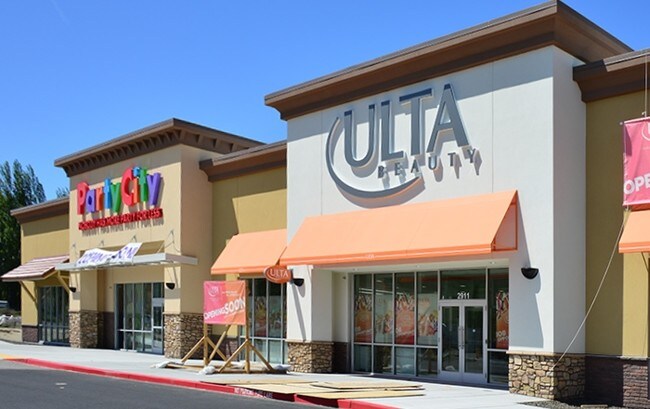
Property Record
Undetermined, Richland, WA 99352

NEARBY LISTINGS FOR SALE OR LEASE
Property Detail
Undetermined
Other Market Areas
Short Plat #3538
Kennewick-Richland, WA
THAT PORTION OF THE FOLLOWING LEGAL DESCRIPTION IN SECTION 16 AND TAX CODE AREA R5: LOT 3, SHORT PLAT NO. 3538, ACCORDING TO THE PLAT THEREOF RECORDED IN VOLUME 1 OF SHORT PLATS, PAGE 3538, RECORDS OF BENTON COUNTY, WASHINGTON; TOGETHER WITH THAT POR
121981013538011
Benton
Storebuilding
Washington
2024
3
2024
1.75 AC
010600
Yakima/Kennewick
21,804 SF
DEMOGRAPHICS near Undetermined
1 Mile
3 Mile
5 Mile
2024 Total Population
5,634
46,053
101,295
2029 Population
6,022
49,476
109,076
Pop Growth 2024-2029
+ 6.89%
+ 7.43%
+ 7.68%
Average Age
38
38
39
2024 Total Households
2,198
17,033
38,351
HH Growth 2024-2029
+ 6.60%
+ 7.43%
+ 7.65%
Median Household Inc
$127,552
$101,375
$98,866
Avg Household Size
2.50
2.70
2.60
2024 Avg HH Vehicles
2.00
2.00
2.00
Median Home Value
$432,007
$377,642
$377,482
Median Year Built
2003
1992
1994
Nearby Places
Map Layers
Map Styles
 Street
 Aerial
- Restaurants
- Banks
- Shops
- Fitness
- Groceries
PUBLIC TRANSPORTATION
AIRPORT
Tri-Cities
DRIVE
WALK
Distance
Tri-Cities
18 min
11.5 mi
SALE & LEASE HISTORY
LISTING DATE
SALE/LEASE

Jun 08, 2017
For Sale
Nearby Properties
Address
Land Use
TOTAL SIZE
Lot Size
Zoning
Address
Land Use
TOTAL SIZE
Lot Size
Zoning
562,186 SF
7.61 AC
Address
Land Use
TOTAL SIZE
Lot Size
Zoning
183,204 SF
14.94 AC
Address
Land Use
TOTAL SIZE
Lot Size
Zoning
143,592 SF
6.86 AC
RICHLAND -
Address
Land Use
TOTAL SIZE
Lot Size
Zoning
428,225 SF
12.60 AC
Address
Land Use
TOTAL SIZE
Lot Size
Zoning
351,217 SF
60.86 AC
Address
Land Use
TOTAL SIZE
Lot Size
Zoning
236,556 SF
11.34 AC
Address
Land Use
TOTAL SIZE
Lot Size
Zoning
185,302 SF
9.13 AC
Address
Land Use
TOTAL SIZE
Lot Size
Zoning
220,970 SF
1.28 AC
Address
Land Use
TOTAL SIZE
Lot Size
Zoning
82,226 SF
40 AC
G.M.A. AGR
Address
Land Use
TOTAL SIZE
Lot Size
Zoning
216,270 SF
22.32 AC
Address
Land Use
TOTAL SIZE
Lot Size
Zoning
113,052 SF
3.32 AC
Address
Land Use
TOTAL SIZE
Lot Size
Zoning
81,497 SF
16.69 AC
Address
Land Use
TOTAL SIZE
Lot Size
Zoning
69,488 SF
1.69 AC
Address
Land Use
TOTAL SIZE
Lot Size
Zoning
170,307 SF
14.15 AC
Address
Land Use
TOTAL SIZE
Lot Size
Zoning
109,517 SF
4.67 AC
Address
Land Use
TOTAL SIZE
Lot Size
Zoning
102,146 SF
40 AC
Address
Land Use
TOTAL SIZE
Lot Size
Zoning
126,251 SF
7 AC
Address
Land Use
TOTAL SIZE
Lot Size
Zoning
116,318 SF
2.74 AC
Address
Land Use
TOTAL SIZE
Lot Size
Zoning
74,089 SF
12.33 AC
Address
Land Use
TOTAL SIZE
Lot Size
Zoning
76,249 SF
13 AC
Address
Land Use
TOTAL SIZE
Lot Size
Zoning
39,875 SF
1.80 AC
Address
Land Use
TOTAL SIZE
Lot Size
Zoning
61,068 SF
0.78 AC
Address
Land Use
TOTAL SIZE
Lot Size
Zoning
127,195 SF
9.16 AC
Address
Land Use
TOTAL SIZE
Lot Size
Zoning
74,352 SF
13.55 AC
RICHLAND -
Address
Land Use
TOTAL SIZE
Lot Size
Zoning
99,409 SF
9.08 AC
Address
Land Use
TOTAL SIZE
Lot Size
Zoning
66,380 SF
2.98 AC
Address
Land Use
TOTAL SIZE
Lot Size
Zoning
87,117 SF
3.94 AC
Address
Land Use
TOTAL SIZE
Lot Size
Zoning
106,478 SF
2.37 AC
Address
Land Use
TOTAL SIZE
Lot Size
Zoning
79,887 SF
21.87 AC
Address
Land Use
TOTAL SIZE
Lot Size
Zoning
74,028 SF
6.02 AC
The World's #1 Commercial Real Estate Marketplace
Connect with us
© 2026 CoStar Group
The information above has been obtained from sources believed reliable. While we do not doubt its accuracy we have not verified it and make no guarantee, warranty or representation about it. It is your responsibility to independently confirm its accuracy and completeness. Any projections, opinions, assumptions, or estimates used are for example only and do not represent the current or future performance of the property. The value of this transaction to you depends on tax and other factors which should be evaluated by your tax, financial, and legal advisors. You and your advisors should conduct a careful, independent investigation of the property to determine to your satisfaction the suitability of the property for your needs.