Property Record
Undetermined, Richland, WA 99352
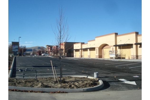

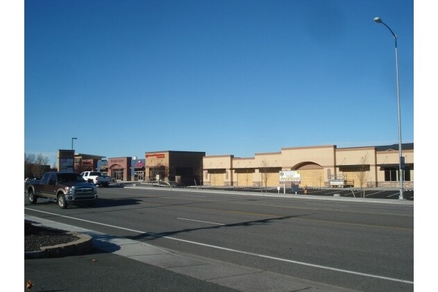
Property Detail
Undetermined
Kennewick-Richland, WA
SHORT PLAT #788 LOT 2: R/W CONT 7/21/81 : ESMT 2/21/80: (TCO 78)
126984010788002
BENTON
Transportationcommunicationsgeneral
Washington
RICHLAND -
2
2025
1 AC
2025
Yakima/Kennewick
0108033010
Other Market Areas
4,721 SF
NEARBY LISTINGS FOR SALE OR LEASE
DEMOGRAPHICS near Undetermined
1 mile
3 mile
5 mile
2025 Total Population
11,786
48,082
127,413
2030 Population
12,245
50,370
133,533
Pop Growth 2025-2030
+ 3.89%
+ 4.76%
+ 4.80%
Average Age
42
40
38
2025 Total Households
4,790
18,950
47,357
HH Growth 2025-2030
+ 3.88%
+ 4.68%
+ 4.76%
Median Household Inc
$91,414
$94,645
$90,990
Avg Household Size
2.50
2.50
2.70
2025 Avg HH Vehicles
2.00
2.00
2.00
Median Home Value
$473,073
$483,841
$460,232
Median Year Built
1999
2000
1997
Nearby Places
Map Layers
Map Styles
 Street
 Aerial
Layers
 Traffic
 Biking
Places
Listings with unknown addresses are not visible on the map
- Restaurants
- Banks
- Shops
- Fitness
- Groceries
PUBLIC TRANSPORTATION
AIRPORT
Tri-Cities
Drive
Walk
Distance
Tri-Cities
17 min
11.1 mi
Freight Ports
Port of Tacoma
Drive
Walk
Distance
Port of Tacoma
264 min
229.8 mi
SALE & LEASE HISTORY
LISTING DATE
SALE/LEASE

Aug 07, 2017
For Lease
Nearby Properties
Address
Land Use
TOTAL SIZE
Lot Size
Zoning
Address
Land Use
TOTAL SIZE
Lot Size
Zoning
614,021 SF
45.64 AC
Address
Land Use
TOTAL SIZE
Lot Size
Zoning
477,838 SF
25.15 AC
KENNEWICK
Address
Land Use
TOTAL SIZE
Lot Size
Zoning
340,554 SF
16.21 AC
RICHLAND -
Address
Land Use
TOTAL SIZE
Lot Size
Zoning
185,307 SF
9.13 AC
Address
Land Use
TOTAL SIZE
Lot Size
Zoning
183,204 SF
14.94 AC
Address
Land Use
TOTAL SIZE
Lot Size
Zoning
248,623 SF
12 AC
Address
Land Use
TOTAL SIZE
Lot Size
Zoning
223,214 SF
17.06 AC
Address
Land Use
TOTAL SIZE
Lot Size
Zoning
179,139 SF
11.79 AC
Address
Land Use
TOTAL SIZE
Lot Size
Zoning
181,666 SF
12.29 AC
35
Address
Land Use
TOTAL SIZE
Lot Size
Zoning
168,652 SF
10.43 AC
KENNEWICK
Address
Land Use
TOTAL SIZE
Lot Size
Zoning
4,415 SF
22.32 AC
Address
Land Use
TOTAL SIZE
Lot Size
Zoning
206,208 SF
10.01 AC
KENNEWICK
Address
Land Use
TOTAL SIZE
Lot Size
Zoning
82,470 SF
14.49 AC
Address
Land Use
TOTAL SIZE
Lot Size
Zoning
127,840 SF
3.69 AC
Address
Land Use
TOTAL SIZE
Lot Size
Zoning
200,734 SF
12.38 AC
Address
Land Use
TOTAL SIZE
Lot Size
Zoning
126,589 SF
4.05 AC
Address
Land Use
TOTAL SIZE
Lot Size
Zoning
80,622 SF
26.90 AC
Address
Land Use
TOTAL SIZE
Lot Size
Zoning
144,723 SF
6.88 AC
Address
Land Use
TOTAL SIZE
Lot Size
Zoning
157,320 SF
3.80 AC
53
Address
Land Use
TOTAL SIZE
Lot Size
Zoning
118,412 SF
9.91 AC
KENNEWICK
Address
Land Use
TOTAL SIZE
Lot Size
Zoning
176,669 SF
Address
Land Use
TOTAL SIZE
Lot Size
Zoning
48,706 SF
25.70 AC
Address
Land Use
TOTAL SIZE
Lot Size
Zoning
93,851 SF
1.05 AC
Address
Land Use
TOTAL SIZE
Lot Size
Zoning
112 SF
14.15 AC
Address
Land Use
TOTAL SIZE
Lot Size
Zoning
86,104 SF
3.26 AC
Address
Land Use
TOTAL SIZE
Lot Size
Zoning
78,836 SF
13.64 AC
Address
Land Use
TOTAL SIZE
Lot Size
Zoning
105,026 SF
8.63 AC
KENNEWICK
Address
Land Use
TOTAL SIZE
Lot Size
Zoning
102,155 SF
12.48 AC
Address
Land Use
TOTAL SIZE
Lot Size
Zoning
74,556 SF
1.22 AC
Address
Land Use
TOTAL SIZE
Lot Size
Zoning
76,028 SF
1.83 AC
The World's #1 Commercial Real Estate Marketplace
Connect with us
© 2026 CoStar Group
The information above has been obtained from sources believed reliable. While we do not doubt its accuracy we have not verified it and make no guarantee, warranty or representation about it. It is your responsibility to independently confirm its accuracy and completeness. Any projections, opinions, assumptions, or estimates used are for example only and do not represent the current or future performance of the property. The value of this transaction to you depends on tax and other factors which should be evaluated by your tax, financial, and legal advisors. You and your advisors should conduct a careful, independent investigation of the property to determine to your satisfaction the suitability of the property for your needs.