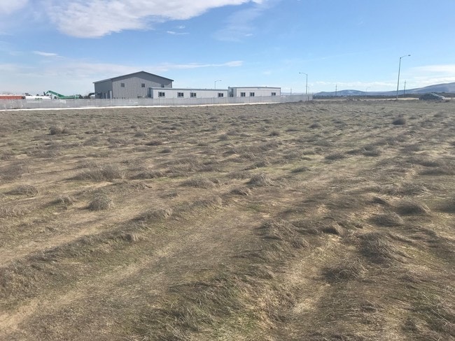
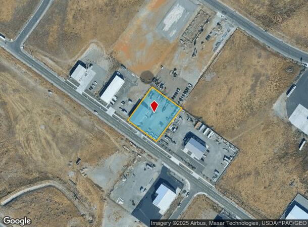
Property Record
Undetermined, Richland, WA 99354
NEARBY LISTINGS FOR SALE OR LEASE
Property Detail
Undetermined
Kennewick-Richland, WA
Side Plat No 2056
128081000002011
A PORTION OF BINDING SITE PLAN 2056 ACCORDING TO THE SURVEY THEREOF RECORDED IN VOLUME 1 OF SURVEYS PAGE 2056 UNDER AUDITORS FILE NUMBER 1995-018807 RECORDS OF BENTON COUNTY WASHINGTON SITUATED IN THE NORTHEAST QUARTER OF SECTION 28 TOWNSHIP 10 NO
Commercialnec
Benton
2024
Washington
2024
1 AC
010201
Yakima/Kennewick
1,234 SF
Other Market Areas
DEMOGRAPHICS near Undetermined
1 Mile
3 Mile
5 Mile
2024 Total Population
2,133
27,440
59,423
2029 Population
2,295
29,480
63,895
Pop Growth 2024-2029
+ 7.59%
+ 7.43%
+ 7.53%
Average Age
46
40
39
2024 Total Households
898
11,109
22,868
HH Growth 2024-2029
+ 7.57%
+ 7.44%
+ 7.50%
Median Household Inc
$153,421
$79,669
$90,395
Avg Household Size
2.40
2.40
2.60
2024 Avg HH Vehicles
2.00
2.00
2.00
Median Home Value
$401,762
$335,754
$353,855
Median Year Built
2011
1973
1978
Nearby Places
Map Layers
Map Styles
 Street
 Aerial
- Restaurants
- Banks
- Shops
- Fitness
- Groceries
PUBLIC TRANSPORTATION
AIRPORT
Tri-Cities
DRIVE
WALK
Distance
Tri-Cities
23 min
15.6 mi
Freight Ports
Port of Tacoma
DRIVE
WALK
Distance
Port of Tacoma
258 min
211.8 mi
SALE & LEASE HISTORY
LISTING DATE
SALE/LEASE

Jun 06, 2019
For Sale
Nearby Properties
Address
Land Use
TOTAL SIZE
Lot Size
Zoning
Address
Land Use
TOTAL SIZE
Lot Size
Zoning
650,794 SF
55.19 AC
Address
Land Use
TOTAL SIZE
Lot Size
Zoning
351,518 SF
16.01 AC
Address
Land Use
TOTAL SIZE
Lot Size
Zoning
14,514 SF
160 AC
Address
Land Use
TOTAL SIZE
Lot Size
Zoning
5,948 SF
25 AC
Address
Land Use
TOTAL SIZE
Lot Size
Zoning
305,328 SF
83.37 AC
Address
Land Use
TOTAL SIZE
Lot Size
Zoning
12,866 SF
44.02 AC
Address
Land Use
TOTAL SIZE
Lot Size
Zoning
245,782 SF
10 AC
RICHLAND -
Address
Land Use
TOTAL SIZE
Lot Size
Zoning
148,367 SF
1 AC
Address
Land Use
TOTAL SIZE
Lot Size
Zoning
306,563 SF
14.60 AC
Address
Land Use
TOTAL SIZE
Lot Size
Zoning
277,559 SF
30 AC
Address
Land Use
TOTAL SIZE
Lot Size
Zoning
201,040 SF
4.24 AC
Address
Land Use
TOTAL SIZE
Lot Size
Zoning
719,130 SF
75 AC
RICHLAND -
Address
Land Use
TOTAL SIZE
Lot Size
Zoning
47,160 SF
14.28 AC
Address
Land Use
TOTAL SIZE
Lot Size
Zoning
280,136 SF
Address
Land Use
TOTAL SIZE
Lot Size
Zoning
106,500 SF
3.83 AC
Address
Land Use
TOTAL SIZE
Lot Size
Zoning
90,520 SF
4.32 AC
RICHLAND -
Address
Land Use
TOTAL SIZE
Lot Size
Zoning
94,714 SF
5.22 AC
Address
Land Use
TOTAL SIZE
Lot Size
Zoning
100,872 SF
1 AC
Address
Land Use
TOTAL SIZE
Lot Size
Zoning
100,872 SF
1 AC
Address
Land Use
TOTAL SIZE
Lot Size
Zoning
233,709 SF
39.16 AC
Address
Land Use
TOTAL SIZE
Lot Size
Zoning
69,697 SF
16.83 AC
Address
Land Use
TOTAL SIZE
Lot Size
Zoning
280.55 AC
Address
Land Use
TOTAL SIZE
Lot Size
Zoning
150,522 SF
Address
Land Use
TOTAL SIZE
Lot Size
Zoning
93,484 SF
61.65 AC
Address
Land Use
TOTAL SIZE
Lot Size
Zoning
96,486 SF
13.24 AC
Address
Land Use
TOTAL SIZE
Lot Size
Zoning
99,320 SF
5.37 AC
Address
Land Use
TOTAL SIZE
Lot Size
Zoning
31,531 SF
5.07 AC
Address
Land Use
TOTAL SIZE
Lot Size
Zoning
208,285 SF
5.24 AC
Address
Land Use
TOTAL SIZE
Lot Size
Zoning
80,597 SF
6.37 AC
Address
Land Use
TOTAL SIZE
Lot Size
Zoning
136,013 SF
7.09 AC
The World's #1 Commercial Real Estate Marketplace
Connect with us
© 2025 CoStar Group
The information above has been obtained from sources believed reliable. While we do not doubt its accuracy we have not verified it and make no guarantee, warranty or representation about it. It is your responsibility to independently confirm its accuracy and completeness. Any projections, opinions, assumptions, or estimates used are for example only and do not represent the current or future performance of the property. The value of this transaction to you depends on tax and other factors which should be evaluated by your tax, financial, and legal advisors. You and your advisors should conduct a careful, independent investigation of the property to determine to your satisfaction the suitability of the property for your needs.