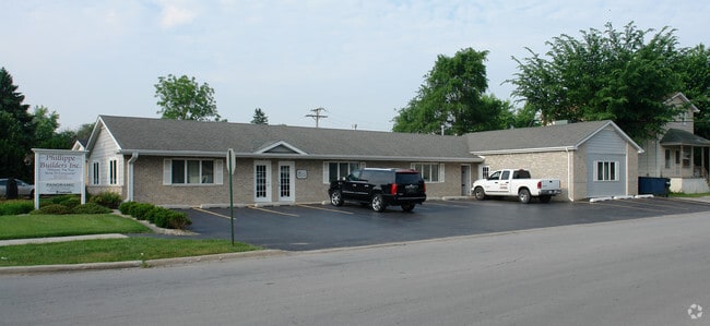
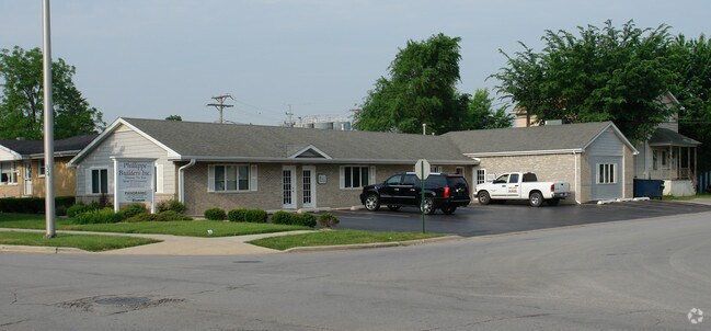
Property Record
Union Ave, Steger, IL 60475
NEARBY LISTINGS FOR SALE OR LEASE
Property Detail
Union Ave
Chicago-Naperville-Elgin, IL-IN
Columbia Heights
23-15-05-216-014
LOT 8 BLOCK 17 IN COLUMBIA HEIGHTS, SUB OF PRT OF THE E1/2 OF THE NE1/4 OF SEC 5, T34N-R14E.
Residentialacreage
Will
X
Illinois
17197C0359G
8
2024
0.35 AC
2024
Far South
829600
Chicago
DEMOGRAPHICS near Union Ave
1 Mile
3 Mile
5 Mile
2024 Total Population
10,480
55,114
118,424
2029 Population
10,431
54,936
117,234
Pop Growth 2024-2029
(0.47%)
(0.32%)
(1.00%)
Average Age
39
39
40
2024 Total Households
4,169
21,009
43,734
HH Growth 2024-2029
(0.67%)
(0.69%)
(1.30%)
Median Household Inc
$53,345
$54,063
$58,275
Avg Household Size
2.40
2.50
2.60
2024 Avg HH Vehicles
2.00
2.00
2.00
Median Home Value
$114,668
$112,099
$129,673
Median Year Built
1964
1963
1967
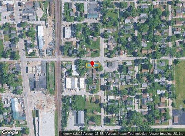
Nearby Places
Map Layers
Map Styles
 Street
 Aerial
- Restaurants
- Banks
- Shops
- Fitness
- Groceries
PUBLIC TRANSPORTATION
COMMUTER RAIL
Richton Park Station (Metra Electric Line - Northeast Illinois Regional Commuter Railroad (Metra))
DRIVE
WALK
Distance
Richton Park Station (Metra Electric Line - Northeast Illinois Regional Commuter Railroad (Metra))
12 min
4.9 mi
Matteson Station (Metra Electric Line - Northeast Illinois Regional Commuter Railroad (Metra))
DRIVE
WALK
Distance
Matteson Station (Metra Electric Line - Northeast Illinois Regional Commuter Railroad (Metra))
12 min
5.3 mi
AIRPORT
Chicago Midway International
DRIVE
WALK
Distance
Chicago Midway International
45 min
26.0 mi
Nearby Properties
Address
Land Use
TOTAL SIZE
Lot Size
Zoning
Address
Land Use
TOTAL SIZE
Lot Size
Zoning
49,866 SF
5.57 AC
Address
Land Use
TOTAL SIZE
Lot Size
Zoning
16.19 AC
Address
Land Use
TOTAL SIZE
Lot Size
Zoning
87,105 SF
7.74 AC
Address
Land Use
TOTAL SIZE
Lot Size
Zoning
15.23 AC
Address
Land Use
TOTAL SIZE
Lot Size
Zoning
2,845,012 SF
133.73 AC
Address
Land Use
TOTAL SIZE
Lot Size
Zoning
304,256 SF
21.50 AC
Address
Land Use
TOTAL SIZE
Lot Size
Zoning
31.08 AC
Address
Land Use
TOTAL SIZE
Lot Size
Zoning
64,295 SF
2.23 AC
Address
Land Use
TOTAL SIZE
Lot Size
Zoning
26.61 AC
Address
Land Use
TOTAL SIZE
Lot Size
Zoning
90,908 SF
1.78 AC
Address
Land Use
TOTAL SIZE
Lot Size
Zoning
268,051 SF
40.82 AC
Address
Land Use
TOTAL SIZE
Lot Size
Zoning
628 SF
4.91 AC
Address
Land Use
TOTAL SIZE
Lot Size
Zoning
3.93 AC
Address
Land Use
TOTAL SIZE
Lot Size
Zoning
37,309 SF
1.50 AC
Address
Land Use
TOTAL SIZE
Lot Size
Zoning
24,508 SF
1.13 AC
Address
Land Use
TOTAL SIZE
Lot Size
Zoning
562,369 SF
50 AC
Address
Land Use
TOTAL SIZE
Lot Size
Zoning
Address
Land Use
TOTAL SIZE
Lot Size
Zoning
Address
Land Use
TOTAL SIZE
Lot Size
Zoning
6,350 SF
1.16 AC
Address
Land Use
TOTAL SIZE
Lot Size
Zoning
Address
Land Use
TOTAL SIZE
Lot Size
Zoning
284,100 SF
12.60 AC
Address
Land Use
TOTAL SIZE
Lot Size
Zoning
85,231 SF
14.72 AC
Address
Land Use
TOTAL SIZE
Lot Size
Zoning
15.64 AC
Address
Land Use
TOTAL SIZE
Lot Size
Zoning
Address
Land Use
TOTAL SIZE
Lot Size
Zoning
Address
Land Use
TOTAL SIZE
Lot Size
Zoning
0.74 AC
Address
Land Use
TOTAL SIZE
Lot Size
Zoning
10.91 AC
Address
Land Use
TOTAL SIZE
Lot Size
Zoning
61,660 SF
7.95 AC
Address
Land Use
TOTAL SIZE
Lot Size
Zoning
Address
Land Use
TOTAL SIZE
Lot Size
Zoning
105,001 SF
5.77 AC
The World's #1 Commercial Real Estate Marketplace
Connect with us
© 2026 CoStar Group
The information above has been obtained from sources believed reliable. While we do not doubt its accuracy we have not verified it and make no guarantee, warranty or representation about it. It is your responsibility to independently confirm its accuracy and completeness. Any projections, opinions, assumptions, or estimates used are for example only and do not represent the current or future performance of the property. The value of this transaction to you depends on tax and other factors which should be evaluated by your tax, financial, and legal advisors. You and your advisors should conduct a careful, independent investigation of the property to determine to your satisfaction the suitability of the property for your needs.