Property Record
Union New Hope Rd, Gastonia, NC 28056

Save to a Folder
{{folder.Name}}
{{folder.ListingIds.length}} Properties
{{folder.ListingIds.length}} Property
Create a New Folder
Property Detail
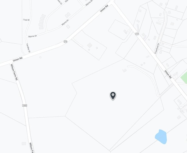
Union New Hope Rd
Charlotte-Concord-Gastonia, NC-SC
15 101 004 02 000
306164
GASTON
Vacantlandnec
North Carolina
B and X Area of moderate flood hazard, usually the area between the limits of the 100-year and 500-year floods.
66.87 AC
2025
Gaston County
2025
Charlotte
033306
NEARBY LISTINGS FOR SALE OR LEASE
-
-
View all Gastonia listings for sale on LoopNet.com
DEMOGRAPHICS near Union New Hope Rd
1 mile
3 mile
5 mile
2025 Total Population
1,384
16,639
61,010
2030 Population
1,530
17,690
64,509
Pop Growth 2025-2030
+ 10.55%
+ 6.32%
+ 5.74%
Average Age
42
41
41
2025 Total Households
537
6,158
23,872
HH Growth 2025-2030
+ 10.80%
+ 6.54%
+ 5.89%
Median Household Inc
$96,341
$110,720
$98,355
Avg Household Size
2.60
2.60
2.50
2025 Avg HH Vehicles
2.00
2.00
2.00
Median Home Value
$338,095
$404,945
$397,821
Median Year Built
1998
1997
1996
Nearby Places
Map Layers
Map Styles
 Street
 Aerial
Layers
 Traffic
 Biking
Places
Listings with unknown addresses are not visible on the map
- Restaurants
- Banks
- Shops
- Fitness
- Groceries
PUBLIC TRANSPORTATION
COMMUTER RAIL
Gastonia Amtrak Station (Crescent - Amtrak)
Drive
Walk
Distance
Gastonia Amtrak Station (Crescent - Amtrak)
14 min
9.1 mi
AIRPORT
Charlotte/Douglas International
Drive
Walk
Distance
Charlotte/Douglas International
32 min
14.9 mi
Concord-Padgett Regional
Drive
Walk
Distance
Concord-Padgett Regional
47 min
32.6 mi
Freight Ports
North Charleston Terminal
Drive
Walk
Distance
North Charleston Terminal
230 min
196.0 mi
Nearby Properties
Address
Land Use
TOTAL SIZE
Lot Size
Zoning
Address
Land Use
TOTAL SIZE
Lot Size
Zoning
203,152 SF
67.60 AC
PUB01
Address
Land Use
TOTAL SIZE
Lot Size
Zoning
1,170 SF
320.29 AC
OFF01
Address
Land Use
TOTAL SIZE
Lot Size
Zoning
5,604 SF
56.06 AC
PUB01
Address
Land Use
TOTAL SIZE
Lot Size
Zoning
15,000 SF
34.49 AC
PUB01
Address
Land Use
TOTAL SIZE
Lot Size
Zoning
35,143 SF
7.95 AC
SP02
Address
Land Use
TOTAL SIZE
Lot Size
Zoning
2,715 SF
11.65 AC
Address
Land Use
TOTAL SIZE
Lot Size
Zoning
7,560 SF
189.75 AC
STOR5
Address
Land Use
TOTAL SIZE
Lot Size
Zoning
20,290 SF
3.12 AC
Address
Land Use
TOTAL SIZE
Lot Size
Zoning
2,015 SF
13.38 AC
R1
Address
Land Use
TOTAL SIZE
Lot Size
Zoning
96,260 SF
8.50 AC
INDS1
Address
Land Use
TOTAL SIZE
Lot Size
Zoning
4,738 SF
21.75 AC
R1
Address
Land Use
TOTAL SIZE
Lot Size
Zoning
209.86 AC
R1
Address
Land Use
TOTAL SIZE
Lot Size
Zoning
5,400 SF
4.88 AC
STOR4
Address
Land Use
TOTAL SIZE
Lot Size
Zoning
216.70 AC
R1
Address
Land Use
TOTAL SIZE
Lot Size
Zoning
119.85 AC
Address
Land Use
TOTAL SIZE
Lot Size
Zoning
144.18 AC
R1
Address
Land Use
TOTAL SIZE
Lot Size
Zoning
0.95 AC
Address
Land Use
TOTAL SIZE
Lot Size
Zoning
195.93 AC
R1
Address
Land Use
TOTAL SIZE
Lot Size
Zoning
8,748 SF
6.31 AC
CHUR2
Address
Land Use
TOTAL SIZE
Lot Size
Zoning
4,816 SF
7.20 AC
SP02
Address
Land Use
TOTAL SIZE
Lot Size
Zoning
19,000 SF
6.58 AC
OFF10
Address
Land Use
TOTAL SIZE
Lot Size
Zoning
113.90 AC
R1
Address
Land Use
TOTAL SIZE
Lot Size
Zoning
9,170 SF
2 AC
Address
Land Use
TOTAL SIZE
Lot Size
Zoning
5,871 SF
0.54 AC
Address
Land Use
TOTAL SIZE
Lot Size
Zoning
142.99 AC
Address
Land Use
TOTAL SIZE
Lot Size
Zoning
6,000 SF
11.16 AC
R1
Address
Land Use
TOTAL SIZE
Lot Size
Zoning
2,343 SF
3.18 AC
R1
Address
Land Use
TOTAL SIZE
Lot Size
Zoning
100.59 AC
R1
Address
Land Use
TOTAL SIZE
Lot Size
Zoning
2,280 SF
23.67 AC
R1
Address
Land Use
TOTAL SIZE
Lot Size
Zoning
16,748 SF
1.61 AC
STOR5
The World's #1 Commercial Real Estate Marketplace
Connect with us
© 2026 CoStar Group
The information above has been obtained from sources believed reliable. While we do not doubt its accuracy we have not verified it and make no guarantee, warranty or representation about it. It is your responsibility to independently confirm its accuracy and completeness. Any projections, opinions, assumptions, or estimates used are for example only and do not represent the current or future performance of the property. The value of this transaction to you depends on tax and other factors which should be evaluated by your tax, financial, and legal advisors. You and your advisors should conduct a careful, independent investigation of the property to determine to your satisfaction the suitability of the property for your needs.