Property Record
Union Rd, Clayton, OH 45315


Property Detail
Union Rd
Dayton, OH
5-4-4
H33-02104-0025
MONTGOMERY
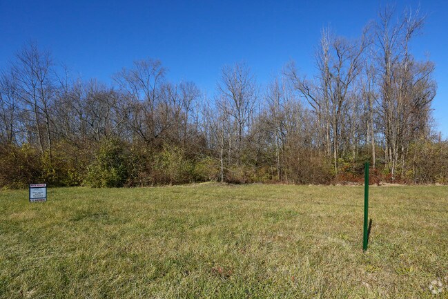
Recreationalacreage
Ohio
B and X Area of moderate flood hazard, usually the area between the limits of the 100-year and 500-year floods.
25
2024
1.57 AC
2025
North Dayton
120101
Cincinnati/Dayton
NEARBY LISTINGS FOR SALE OR LEASE
DEMOGRAPHICS near Union Rd
1 mile
3 mile
5 mile
2025 Total Population
2,700
30,836
76,670
2030 Population
2,708
30,723
76,855
Pop Growth 2025-2030
+ 0.30%
(0.37%)
+ 0.24%
Average Age
41
42
42
2025 Total Households
1,241
13,175
33,237
HH Growth 2025-2030
+ 0.40%
(0.27%)
+ 0.30%
Median Household Inc
$48,539
$64,638
$58,290
Avg Household Size
2.10
2.30
2.20
2025 Avg HH Vehicles
1.00
2.00
2.00
Median Home Value
$151,041
$163,681
$154,785
Median Year Built
1974
1968
1964
Nearby Places
Map Layers
Map Styles
 Street
 Aerial
Layers
 Traffic
 Biking
Places
Listings with unknown addresses are not visible on the map
- Restaurants
- Banks
- Shops
- Fitness
- Groceries
PUBLIC TRANSPORTATION
AIRPORT
James M Cox Dayton International
Drive
Walk
Distance
James M Cox Dayton International
18 min
9.6 mi
Freight Ports
Port of Toledo
Drive
Walk
Distance
Port of Toledo
182 min
156.4 mi
SALE & LEASE HISTORY
LISTING DATE
SALE/LEASE

Dec 18, 2017
For Sale
Nearby Properties
Address
Land Use
TOTAL SIZE
Lot Size
Zoning
Address
Land Use
TOTAL SIZE
Lot Size
Zoning
586,025 SF
194.14 AC
Address
Land Use
TOTAL SIZE
Lot Size
Zoning
1,545,368 SF
162.29 AC
Address
Land Use
TOTAL SIZE
Lot Size
Zoning
146.18 AC
Address
Land Use
TOTAL SIZE
Lot Size
Zoning
Address
Land Use
TOTAL SIZE
Lot Size
Zoning
558,933 SF
19.55 AC
Address
Land Use
TOTAL SIZE
Lot Size
Zoning
200,000 SF
47.69 AC
Address
Land Use
TOTAL SIZE
Lot Size
Zoning
390,656 SF
47.47 AC
Address
Land Use
TOTAL SIZE
Lot Size
Zoning
220,000 SF
16.34 AC
Address
Land Use
TOTAL SIZE
Lot Size
Zoning
196,976 SF
20.24 AC
Address
Land Use
TOTAL SIZE
Lot Size
Zoning
92,782 SF
12.44 AC
Address
Land Use
TOTAL SIZE
Lot Size
Zoning
10.06 AC
Address
Land Use
TOTAL SIZE
Lot Size
Zoning
12.89 AC
Address
Land Use
TOTAL SIZE
Lot Size
Zoning
13 AC
Address
Land Use
TOTAL SIZE
Lot Size
Zoning
9.86 AC
Address
Land Use
TOTAL SIZE
Lot Size
Zoning
9.36 AC
Address
Land Use
TOTAL SIZE
Lot Size
Zoning
8.82 AC
Address
Land Use
TOTAL SIZE
Lot Size
Zoning
107,800 SF
30.73 AC
Address
Land Use
TOTAL SIZE
Lot Size
Zoning
2,520 SF
11.66 AC
Address
Land Use
TOTAL SIZE
Lot Size
Zoning
88,642 SF
11.85 AC
Address
Land Use
TOTAL SIZE
Lot Size
Zoning
23,776 SF
12.39 AC
Address
Land Use
TOTAL SIZE
Lot Size
Zoning
9.11 AC
Address
Land Use
TOTAL SIZE
Lot Size
Zoning
36,350 SF
12.26 AC
Address
Land Use
TOTAL SIZE
Lot Size
Zoning
Address
Land Use
TOTAL SIZE
Lot Size
Zoning
56,102 SF
7.77 AC
Address
Land Use
TOTAL SIZE
Lot Size
Zoning
18,750 SF
2.87 AC
Address
Land Use
TOTAL SIZE
Lot Size
Zoning
17.66 AC
Address
Land Use
TOTAL SIZE
Lot Size
Zoning
23,837 SF
6.20 AC
Address
Land Use
TOTAL SIZE
Lot Size
Zoning
12,753 SF
13.78 AC
Address
Land Use
TOTAL SIZE
Lot Size
Zoning
Address
Land Use
TOTAL SIZE
Lot Size
Zoning
66,150 SF
8.53 AC
The World's #1 Commercial Real Estate Marketplace
Connect with us
© 2026 CoStar Group
The information above has been obtained from sources believed reliable. While we do not doubt its accuracy we have not verified it and make no guarantee, warranty or representation about it. It is your responsibility to independently confirm its accuracy and completeness. Any projections, opinions, assumptions, or estimates used are for example only and do not represent the current or future performance of the property. The value of this transaction to you depends on tax and other factors which should be evaluated by your tax, financial, and legal advisors. You and your advisors should conduct a careful, independent investigation of the property to determine to your satisfaction the suitability of the property for your needs.