Property Record
University, Grosse Pointe, MI 48230

Current Lease Availabilities
NEARBY LISTINGS FOR SALE OR LEASE
Property Detail
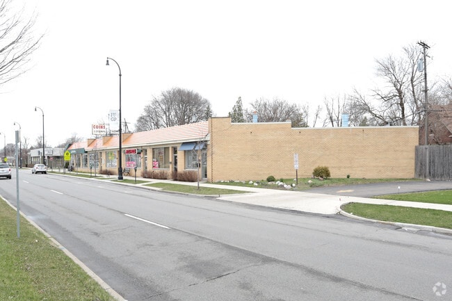
University
Detroit-Warren-Dearborn, MI
Grosse Pointe Colony
37-001-06-0143-000
CYUU92A LOT 92 EXC THE NWLY PT THEREOF MEAS 36.56FT ON THE WLY LINE AND 35.20FT ON THE ELY LINE OF SAID LOT ASSESSORS CITY OF
Commercialacreage
Wayne
X
Michigan
26163C0143F
92
2025
0.17 AC
2025
The Pointes/Harper Woods
550500
Detroit
DEMOGRAPHICS near University
1 mile
3 mile
5 mile
2024 Total Population
16,947
109,122
232,364
2029 Population
16,365
107,441
231,372
Pop Growth 2024-2029
(3.43%)
(1.54%)
(0.43%)
Average Age
41
39
39
2024 Total Households
6,586
41,220
89,825
HH Growth 2024-2029
(3.43%)
(1.60%)
(0.58%)
Median Household Inc
$91,358
$56,435
$50,957
Avg Household Size
2.50
2.60
2.50
2024 Avg HH Vehicles
2.00
2.00
1.00
Median Home Value
$281,935
$190,830
$143,913
Median Year Built
1947
1949
1951
Nearby Places
Map Layers
Map Styles
 Street
 Aerial
Transit
 Traffic
 Biking
Places
Listings with unknown addresses are not visible on the map
- Restaurants
- Banks
- Shops
- Fitness
- Groceries
PUBLIC TRANSPORTATION
COMMUTER RAIL
Detroit (Wolverine - Amtrak)
Drive
Walk
Distance
Detroit (Wolverine - Amtrak)
18 min
10.0 mi
AIRPORT
Windsor International
Drive
Walk
Distance
Windsor International
44 min
21.4 mi
Detroit Metro Wayne County
Drive
Walk
Distance
Detroit Metro Wayne County
47 min
30.9 mi
Freight Ports
Port of Toledo
Drive
Walk
Distance
Port of Toledo
93 min
71.7 mi
Nearby Properties
Address
Land Use
TOTAL SIZE
Lot Size
Zoning
Address
Land Use
TOTAL SIZE
Lot Size
Zoning
211,065 SF
8.84 AC
C.F
Address
Land Use
TOTAL SIZE
Lot Size
Zoning
575,081 SF
8.53 AC
R6
Address
Land Use
TOTAL SIZE
Lot Size
Zoning
101,733 SF
1.10 AC
C-2
Address
Land Use
TOTAL SIZE
Lot Size
Zoning
49,437 SF
0.47 AC
Address
Land Use
TOTAL SIZE
Lot Size
Zoning
93,296 SF
1.05 AC
C-2
Address
Land Use
TOTAL SIZE
Lot Size
Zoning
62,195 SF
1.50 AC
Address
Land Use
TOTAL SIZE
Lot Size
Zoning
17,558 SF
3.15 AC
Address
Land Use
TOTAL SIZE
Lot Size
Zoning
41,000 SF
C-1
Address
Land Use
TOTAL SIZE
Lot Size
Zoning
12,676 SF
1.93 AC
Address
Land Use
TOTAL SIZE
Lot Size
Zoning
18,885 SF
7.37 AC
Address
Land Use
TOTAL SIZE
Lot Size
Zoning
89,897 SF
2.23 AC
Address
Land Use
TOTAL SIZE
Lot Size
Zoning
20,223 SF
2.87 AC
Address
Land Use
TOTAL SIZE
Lot Size
Zoning
15,975 SF
1.82 AC
Address
Land Use
TOTAL SIZE
Lot Size
Zoning
7,787 SF
1.12 AC
Address
Land Use
TOTAL SIZE
Lot Size
Zoning
9,683 SF
1.91 AC
Address
Land Use
TOTAL SIZE
Lot Size
Zoning
14,246 SF
1.44 AC
Address
Land Use
TOTAL SIZE
Lot Size
Zoning
12,800 SF
1.46 AC
Address
Land Use
TOTAL SIZE
Lot Size
Zoning
7,830 SF
2.06 AC
Address
Land Use
TOTAL SIZE
Lot Size
Zoning
14,732 SF
2.48 AC
Address
Land Use
TOTAL SIZE
Lot Size
Zoning
13,006 SF
3.46 AC
Address
Land Use
TOTAL SIZE
Lot Size
Zoning
28,055 SF
0.44 AC
Address
Land Use
TOTAL SIZE
Lot Size
Zoning
10,350 SF
0.57 AC
Address
Land Use
TOTAL SIZE
Lot Size
Zoning
6,600 SF
2.07 AC
Address
Land Use
TOTAL SIZE
Lot Size
Zoning
42,113 SF
0.54 AC
Address
Land Use
TOTAL SIZE
Lot Size
Zoning
102,205 SF
214.30 AC
Address
Land Use
TOTAL SIZE
Lot Size
Zoning
20,625 SF
0.48 AC
C-2
Address
Land Use
TOTAL SIZE
Lot Size
Zoning
10,402 SF
1.84 AC
Address
Land Use
TOTAL SIZE
Lot Size
Zoning
6,806 SF
1.84 AC
Address
Land Use
TOTAL SIZE
Lot Size
Zoning
8,866 SF
10.49 AC
Address
Land Use
TOTAL SIZE
Lot Size
Zoning
8,511 SF
6.23 AC
The World's #1 Commercial Real Estate Marketplace
Connect with us
© 2026 CoStar Group
The information above has been obtained from sources believed reliable. While we do not doubt its accuracy we have not verified it and make no guarantee, warranty or representation about it. It is your responsibility to independently confirm its accuracy and completeness. Any projections, opinions, assumptions, or estimates used are for example only and do not represent the current or future performance of the property. The value of this transaction to you depends on tax and other factors which should be evaluated by your tax, financial, and legal advisors. You and your advisors should conduct a careful, independent investigation of the property to determine to your satisfaction the suitability of the property for your needs.