Property Record
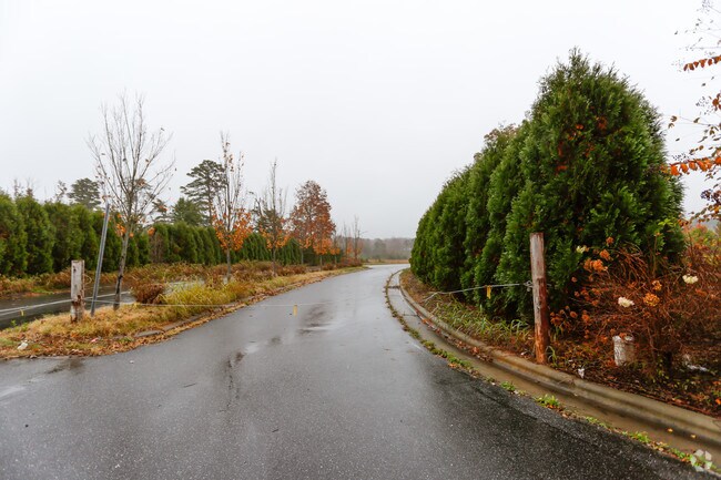
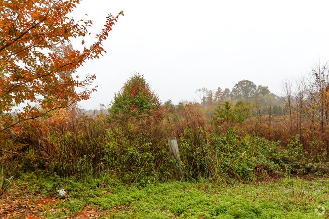
Unix Dr, Morganton, NC 28655

Property Detail
Unix Dr
9500
UNIX DR MORGANTON, NC 28655
Vacantlandnec
BURKE
INDUSTRIAL
North Carolina
B and X Area of moderate flood hazard, usually the area between the limits of the 100-year and 500-year floods.
41.24 AC
2025
Burke County
2025
Charlotte
021400
Hickory-Lenoir-Morganton, NC
NEARBY LISTINGS FOR SALE OR LEASE
-
-
View all Morganton listings for sale on LoopNet.com
DEMOGRAPHICS near Unix Dr
1 mile
3 mile
5 mile
2025 Total Population
1,231
7,367
17,031
2030 Population
1,251
7,478
17,400
Pop Growth 2025-2030
+ 1.62%
+ 1.51%
+ 2.17%
Average Age
46
45
44
2025 Total Households
499
2,941
6,870
HH Growth 2025-2030
+ 1.60%
+ 1.53%
+ 2.24%
Median Household Inc
$52,805
$50,850
$53,906
Avg Household Size
2.40
2.40
2.40
2025 Avg HH Vehicles
2.00
2.00
2.00
Median Home Value
$153,225
$174,635
$207,148
Median Year Built
1988
1983
1985
Nearby Places
Map Layers
Map Styles
 Street
 Aerial
Transit
 Traffic
 Biking
Places
Listings with unknown addresses are not visible on the map
- Restaurants
- Banks
- Shops
- Fitness
- Groceries
SALE & LEASE HISTORY
LISTING DATE
SALE/LEASE

Apr 28, 2025
For Sale
Apr 08, 2019
For Sale
Nearby Properties
Address
Land Use
TOTAL SIZE
Lot Size
Zoning
Address
Land Use
TOTAL SIZE
Lot Size
Zoning
73,872 SF
LOW INTENS
Address
Land Use
TOTAL SIZE
Lot Size
Zoning
510,924 SF
138.59 AC
EXCLUSIVE
Address
Land Use
TOTAL SIZE
Lot Size
Zoning
241,540 SF
36.93 AC
EXCLUSIVE
Address
Land Use
TOTAL SIZE
Lot Size
Zoning
165,508 SF
40.83 AC
EXCLUSIVE
Address
Land Use
TOTAL SIZE
Lot Size
Zoning
31.48 AC
INDUSTRIAL
Address
Land Use
TOTAL SIZE
Lot Size
Zoning
229,703 SF
48.54 AC
EXCLUSIVE
Address
Land Use
TOTAL SIZE
Lot Size
Zoning
13,500 SF
RESIDENTIA
Address
Land Use
TOTAL SIZE
Lot Size
Zoning
17,752 SF
LOW DENSIT
Address
Land Use
TOTAL SIZE
Lot Size
Zoning
58,166 SF
47.63 AC
RURAL MIXE
Address
Land Use
TOTAL SIZE
Lot Size
Zoning
8,765 SF
12.62 AC
EXCLUSIVE
Address
Land Use
TOTAL SIZE
Lot Size
Zoning
108,850 SF
10.19 AC
EXCLUSIVE
Address
Land Use
TOTAL SIZE
Lot Size
Zoning
6,770 SF
LOW DENSIT
Address
Land Use
TOTAL SIZE
Lot Size
Zoning
16,424 SF
11.95 AC
OFFICE INS
Address
Land Use
TOTAL SIZE
Lot Size
Zoning
550.76 AC
INDUSTRIAL
Address
Land Use
TOTAL SIZE
Lot Size
Zoning
8,301 SF
RESIDENTIA
Address
Land Use
TOTAL SIZE
Lot Size
Zoning
9,100 SF
0.55 AC
GENERAL BU
Address
Land Use
TOTAL SIZE
Lot Size
Zoning
36,000 SF
4.05 AC
INDUSTRIAL
Address
Land Use
TOTAL SIZE
Lot Size
Zoning
10,620 SF
0.92 AC
GENERAL BU
Address
Land Use
TOTAL SIZE
Lot Size
Zoning
11,118 SF
0.91 AC
LOW DENSIT
Address
Land Use
TOTAL SIZE
Lot Size
Zoning
5,120 SF
RURAL MIXE
Address
Land Use
TOTAL SIZE
Lot Size
Zoning
EST LOT CO
Address
Land Use
TOTAL SIZE
Lot Size
Zoning
15,699 SF
OFFICE INS
Address
Land Use
TOTAL SIZE
Lot Size
Zoning
15,330 SF
LOW DENSIT
Address
Land Use
TOTAL SIZE
Lot Size
Zoning
6,426 SF
MEDIUM DEN
Address
Land Use
TOTAL SIZE
Lot Size
Zoning
6,612 SF
PLANNED RE
Address
Land Use
TOTAL SIZE
Lot Size
Zoning
3,044 SF
OFFICE INS
Address
Land Use
TOTAL SIZE
Lot Size
Zoning
10,250 SF
RESIDENTIA
Address
Land Use
TOTAL SIZE
Lot Size
Zoning
2,352 SF
1.22 AC
HIGH DENSI
Address
Land Use
TOTAL SIZE
Lot Size
Zoning
12,160 SF
6.30 AC
INDUSTRIAL
Address
Land Use
TOTAL SIZE
Lot Size
Zoning
4,760 SF
3.38 AC
MANUFACTUR
The World's #1 Commercial Real Estate Marketplace
Connect with us
© 2026 CoStar Group
The information above has been obtained from sources believed reliable. While we do not doubt its accuracy we have not verified it and make no guarantee, warranty or representation about it. It is your responsibility to independently confirm its accuracy and completeness. Any projections, opinions, assumptions, or estimates used are for example only and do not represent the current or future performance of the property. The value of this transaction to you depends on tax and other factors which should be evaluated by your tax, financial, and legal advisors. You and your advisors should conduct a careful, independent investigation of the property to determine to your satisfaction the suitability of the property for your needs.