Property Record
Unknown, Lacey, WA 98503

Property Detail
Unknown
Olympia-Lacey-Tumwater, WA
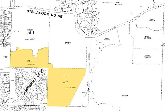
SECTION 18 TOWNSHIP 18 RANGE 1E QUARTER NE SW SURVEY LT PTN 2 DOCUMENT 3685473 REMAINDER PTN FOR FUTURE DEVELOPMENT STEILACOOM RIDGE DIV 1 4513275
21818220300
THURSTON
Vacantlandnec
Washington
RR1/5
2
AE The base floodplain where base flood elevations are provided. AE Zones are now used on new format FIRMs instead of A1-A30 Zones.
32.76 AC
2024
Outlying Thurston County
2025
Olympia
011410
NEARBY LISTINGS FOR SALE OR LEASE
DEMOGRAPHICS near Unknown
1 mile
3 mile
5 mile
2025 Total Population
7,740
42,469
99,522
2030 Population
7,935
43,480
101,302
Pop Growth 2025-2030
+ 2.52%
+ 2.38%
+ 1.79%
Average Age
39
39
40
2025 Total Households
2,826
15,876
37,982
HH Growth 2025-2030
+ 2.65%
+ 2.43%
+ 1.89%
Median Household Inc
$106,086
$95,513
$95,245
Avg Household Size
2.60
2.60
2.50
2025 Avg HH Vehicles
2.00
2.00
2.00
Median Home Value
$450,215
$488,991
$492,534
Median Year Built
1991
1992
1991
Nearby Places
Map Layers
Map Styles
 Street
 Aerial
Transit
 Traffic
 Biking
Places
Listings with unknown addresses are not visible on the map
- Restaurants
- Banks
- Shops
- Fitness
- Groceries
PUBLIC TRANSPORTATION
COMMUTER RAIL
Olympia-Lacey Amtrak Station (Amtrak Cascades - Amtrak, Coast Starlight - Amtrak)
Drive
Walk
Distance
Olympia-Lacey Amtrak Station (Amtrak Cascades - Amtrak, Coast Starlight - Amtrak)
17 min
8.0 mi
Freight Ports
Port of Tacoma
Drive
Walk
Distance
Port of Tacoma
36 min
24.7 mi
Nearby Properties
Address
Land Use
TOTAL SIZE
Lot Size
Zoning
Address
Land Use
TOTAL SIZE
Lot Size
Zoning
1,002,702 SF
42.16 AC
LI
Address
Land Use
TOTAL SIZE
Lot Size
Zoning
720,931 SF
39.25 AC
LI
Address
Land Use
TOTAL SIZE
Lot Size
Zoning
755,671 SF
43.66 AC
LI
Address
Land Use
TOTAL SIZE
Lot Size
Zoning
214,214 SF
12.06 AC
MHDC
Address
Land Use
TOTAL SIZE
Lot Size
Zoning
203,998 SF
9.60 AC
HD
Address
Land Use
TOTAL SIZE
Lot Size
Zoning
209,986 SF
11.21 AC
MHDC
Address
Land Use
TOTAL SIZE
Lot Size
Zoning
208,708 SF
8.46 AC
CO
Address
Land Use
TOTAL SIZE
Lot Size
Zoning
160,106 SF
39.73 AC
OSI-S
Address
Land Use
TOTAL SIZE
Lot Size
Zoning
44,465 SF
127.68 AC
LI
Address
Land Use
TOTAL SIZE
Lot Size
Zoning
194,020 SF
9.49 AC
MHDC
Address
Land Use
TOTAL SIZE
Lot Size
Zoning
315,693 SF
14.65 AC
LI
Address
Land Use
TOTAL SIZE
Lot Size
Zoning
7,656 SF
67.06 AC
OSI-P
Address
Land Use
TOTAL SIZE
Lot Size
Zoning
159,103 SF
8.44 AC
HD
Address
Land Use
TOTAL SIZE
Lot Size
Zoning
64.18 AC
HPBDBC
Address
Land Use
TOTAL SIZE
Lot Size
Zoning
158,221 SF
9.28 AC
HD
Address
Land Use
TOTAL SIZE
Lot Size
Zoning
275,448 SF
29.23 AC
LI
Address
Land Use
TOTAL SIZE
Lot Size
Zoning
164,498 SF
8.80 AC
MHDC
Address
Land Use
TOTAL SIZE
Lot Size
Zoning
318,880 SF
18.13 AC
LI
Address
Land Use
TOTAL SIZE
Lot Size
Zoning
213,391 SF
9.91 AC
MHDC
Address
Land Use
TOTAL SIZE
Lot Size
Zoning
218,920 SF
21.75 AC
GC
Address
Land Use
TOTAL SIZE
Lot Size
Zoning
128,982 SF
6.53 AC
V(U)C
Address
Land Use
TOTAL SIZE
Lot Size
Zoning
117,234 SF
6.65 AC
V(U)C
Address
Land Use
TOTAL SIZE
Lot Size
Zoning
162,254 SF
15.36 AC
GC
Address
Land Use
TOTAL SIZE
Lot Size
Zoning
200,916 SF
12.24 AC
LI-C
Address
Land Use
TOTAL SIZE
Lot Size
Zoning
53.54 AC
HPBD-C
Address
Land Use
TOTAL SIZE
Lot Size
Zoning
193,698 SF
27.48 AC
HPBDBC
Address
Land Use
TOTAL SIZE
Lot Size
Zoning
166,825 SF
13.34 AC
LI
Address
Land Use
TOTAL SIZE
Lot Size
Zoning
197,910 SF
10.43 AC
LI
Address
Land Use
TOTAL SIZE
Lot Size
Zoning
174,440 SF
11.99 AC
LI
Address
Land Use
TOTAL SIZE
Lot Size
Zoning
93,393 SF
6.79 AC
MHDC
The World's #1 Commercial Real Estate Marketplace
Connect with us
© 2026 CoStar Group
The information above has been obtained from sources believed reliable. While we do not doubt its accuracy we have not verified it and make no guarantee, warranty or representation about it. It is your responsibility to independently confirm its accuracy and completeness. Any projections, opinions, assumptions, or estimates used are for example only and do not represent the current or future performance of the property. The value of this transaction to you depends on tax and other factors which should be evaluated by your tax, financial, and legal advisors. You and your advisors should conduct a careful, independent investigation of the property to determine to your satisfaction the suitability of the property for your needs.