Property Record
Unknown, Raymore, MO 64083

Property Detail
Unknown
Kansas City, MO-KS
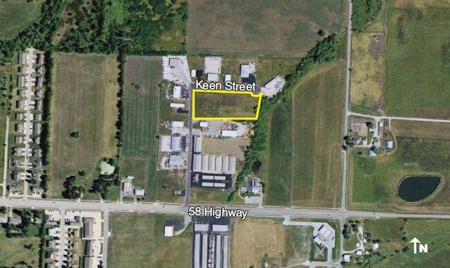
RAYMORE DEV PARK EAST LOT 2 ,
2240117
CASS
Agriculturalland
Missouri
A Areas with a 1% annual chance of flooding and a 26% chance of flooding over the life of a 30-year mortgage.
2
2024
1.08 AC
2025
Cass County
060309
Kansas City
NEARBY LISTINGS FOR SALE OR LEASE
DEMOGRAPHICS near Unknown
1 mile
3 mile
5 mile
2025 Total Population
4,538
28,361
64,389
2030 Population
4,793
29,742
67,227
Pop Growth 2025-2030
+ 5.62%
+ 4.87%
+ 4.41%
Average Age
40
41
40
2025 Total Households
1,759
10,430
23,807
HH Growth 2025-2030
+ 5.80%
+ 5.00%
+ 4.62%
Median Household Inc
$68,968
$98,108
$95,462
Avg Household Size
2.50
2.70
2.70
2025 Avg HH Vehicles
2.00
2.00
2.00
Median Home Value
$223,794
$332,015
$337,122
Median Year Built
1991
2000
2000
Nearby Places
Map Layers
Map Styles
 Street
 Aerial
Transit
 Traffic
 Biking
Places
Listings with unknown addresses are not visible on the map
- Restaurants
- Banks
- Shops
- Fitness
- Groceries
PUBLIC TRANSPORTATION
AIRPORT
Kansas City International
Drive
Walk
Distance
Kansas City International
63 min
45.3 mi
Nearby Properties
Address
Land Use
TOTAL SIZE
Lot Size
Zoning
Address
Land Use
TOTAL SIZE
Lot Size
Zoning
4,954 SF
23.93 AC
Address
Land Use
TOTAL SIZE
Lot Size
Zoning
15.22 AC
Address
Land Use
TOTAL SIZE
Lot Size
Zoning
3.31 AC
Address
Land Use
TOTAL SIZE
Lot Size
Zoning
2.23 AC
Address
Land Use
TOTAL SIZE
Lot Size
Zoning
50,121 SF
2.98 AC
Address
Land Use
TOTAL SIZE
Lot Size
Zoning
80,456 SF
8.23 AC
Address
Land Use
TOTAL SIZE
Lot Size
Zoning
2.18 AC
Address
Land Use
TOTAL SIZE
Lot Size
Zoning
181,400 SF
12.23 AC
Address
Land Use
TOTAL SIZE
Lot Size
Zoning
1.94 AC
Address
Land Use
TOTAL SIZE
Lot Size
Zoning
1.76 AC
Address
Land Use
TOTAL SIZE
Lot Size
Zoning
5.46 AC
Address
Land Use
TOTAL SIZE
Lot Size
Zoning
594,769 SF
18.43 AC
Address
Land Use
TOTAL SIZE
Lot Size
Zoning
25,484 SF
2.13 AC
Address
Land Use
TOTAL SIZE
Lot Size
Zoning
611,460 SF
23.70 AC
Address
Land Use
TOTAL SIZE
Lot Size
Zoning
137,544 SF
11.36 AC
Address
Land Use
TOTAL SIZE
Lot Size
Zoning
137,824 SF
13.62 AC
Address
Land Use
TOTAL SIZE
Lot Size
Zoning
Address
Land Use
TOTAL SIZE
Lot Size
Zoning
19,714 SF
8.40 AC
Address
Land Use
TOTAL SIZE
Lot Size
Zoning
Address
Land Use
TOTAL SIZE
Lot Size
Zoning
20,980 SF
3.06 AC
Address
Land Use
TOTAL SIZE
Lot Size
Zoning
14,466 SF
1.44 AC
Address
Land Use
TOTAL SIZE
Lot Size
Zoning
8,800 SF
1.26 AC
Address
Land Use
TOTAL SIZE
Lot Size
Zoning
103,066 SF
4.86 AC
Address
Land Use
TOTAL SIZE
Lot Size
Zoning
15,336 SF
3.06 AC
Address
Land Use
TOTAL SIZE
Lot Size
Zoning
116,250 SF
6.71 AC
Address
Land Use
TOTAL SIZE
Lot Size
Zoning
218,689 SF
10.37 AC
Address
Land Use
TOTAL SIZE
Lot Size
Zoning
18,946 SF
3.90 AC
Address
Land Use
TOTAL SIZE
Lot Size
Zoning
11,304 SF
3.50 AC
Address
Land Use
TOTAL SIZE
Lot Size
Zoning
9,030 SF
3.30 AC
Address
Land Use
TOTAL SIZE
Lot Size
Zoning
40,827 SF
3 AC
The World's #1 Commercial Real Estate Marketplace
Connect with us
© 2026 CoStar Group
The information above has been obtained from sources believed reliable. While we do not doubt its accuracy we have not verified it and make no guarantee, warranty or representation about it. It is your responsibility to independently confirm its accuracy and completeness. Any projections, opinions, assumptions, or estimates used are for example only and do not represent the current or future performance of the property. The value of this transaction to you depends on tax and other factors which should be evaluated by your tax, financial, and legal advisors. You and your advisors should conduct a careful, independent investigation of the property to determine to your satisfaction the suitability of the property for your needs.