Property Record
Unknown Rd, Vacaville, CA 95687
Property Detail
Unknown Rd
Vallejo, CA
BK-BG 00-00
0166-040-100
SOLANO
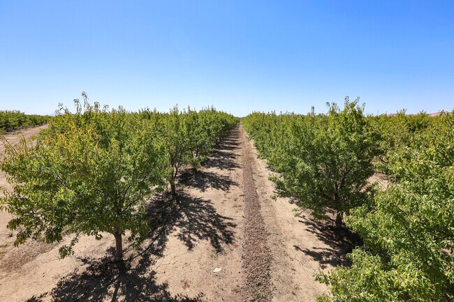
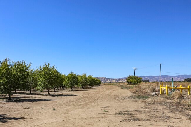
Orchard
California
B and X Area of moderate flood hazard, usually the area between the limits of the 100-year and 500-year floods.
59.73 AC
2024
Outer Solano County
2025
North Bay/Santa Rosa
2535001180
NEARBY LISTINGS FOR SALE OR LEASE
DEMOGRAPHICS near Unknown Rd
1 mile
3 mile
5 mile
2025 Total Population
10
24,369
83,635
2030 Population
10
25,158
85,248
Pop Growth 2025-2030
0.00%
+ 3.24%
+ 1.93%
Average Age
30
37
40
2025 Total Households
3
7,691
27,340
HH Growth 2025-2030
0.00%
+ 3.20%
+ 2.04%
Median Household Inc
$199,999
$141,279
$111,667
Avg Household Size
3.00
3.10
2.70
2025 Avg HH Vehicles
3.00
3.00
2.00
Median Home Value
$750,000
$730,139
$696,207
Median Year Built
2005
1996
1988
Nearby Places
Map Layers
Map Styles
 Street
 Aerial
Transit
 Traffic
 Biking
Places
Listings with unknown addresses are not visible on the map
- Restaurants
- Banks
- Shops
- Fitness
- Groceries
PUBLIC TRANSPORTATION
COMMUTER RAIL
Fairfield-Vacaville Amtrak Station (Capitol Corridor - Amtrak)
Drive
Walk
Distance
Fairfield-Vacaville Amtrak Station (Capitol Corridor - Amtrak)
9 min
3.9 mi
Freight Ports
Port of Richmond
Drive
Walk
Distance
Port of Richmond
64 min
45.6 mi
SALE & LEASE HISTORY
LISTING DATE
SALE/LEASE

Nov 16, 2022
For Lease
Nearby Properties
Address
Land Use
TOTAL SIZE
Lot Size
Zoning
Address
Land Use
TOTAL SIZE
Lot Size
Zoning
Address
Land Use
TOTAL SIZE
Lot Size
Zoning
299.34 AC
Address
Land Use
TOTAL SIZE
Lot Size
Zoning
313.44 AC
Address
Land Use
TOTAL SIZE
Lot Size
Zoning
302.37 AC
Address
Land Use
TOTAL SIZE
Lot Size
Zoning
76,504 SF
4.03 AC
Address
Land Use
TOTAL SIZE
Lot Size
Zoning
42,350 SF
3.57 AC
Address
Land Use
TOTAL SIZE
Lot Size
Zoning
6.18 AC
Address
Land Use
TOTAL SIZE
Lot Size
Zoning
45,350 SF
9.88 AC
Address
Land Use
TOTAL SIZE
Lot Size
Zoning
9.91 AC
Address
Land Use
TOTAL SIZE
Lot Size
Zoning
152.90 AC
Address
Land Use
TOTAL SIZE
Lot Size
Zoning
153.18 AC
Address
Land Use
TOTAL SIZE
Lot Size
Zoning
133.34 AC
Address
Land Use
TOTAL SIZE
Lot Size
Zoning
137 AC
Address
Land Use
TOTAL SIZE
Lot Size
Zoning
3,915 SF
0.64 AC
Address
Land Use
TOTAL SIZE
Lot Size
Zoning
153.94 AC
Address
Land Use
TOTAL SIZE
Lot Size
Zoning
1.37 AC
Address
Land Use
TOTAL SIZE
Lot Size
Zoning
5.59 AC
Address
Land Use
TOTAL SIZE
Lot Size
Zoning
8.59 AC
Address
Land Use
TOTAL SIZE
Lot Size
Zoning
18.93 AC
A-20
Address
Land Use
TOTAL SIZE
Lot Size
Zoning
152.77 AC
Address
Land Use
TOTAL SIZE
Lot Size
Zoning
20,976 SF
4.03 AC
Address
Land Use
TOTAL SIZE
Lot Size
Zoning
10,698 SF
5 AC
Address
Land Use
TOTAL SIZE
Lot Size
Zoning
19,008 SF
1.82 AC
Address
Land Use
TOTAL SIZE
Lot Size
Zoning
5.72 AC
Address
Land Use
TOTAL SIZE
Lot Size
Zoning
181.20 AC
Address
Land Use
TOTAL SIZE
Lot Size
Zoning
3,987 SF
0.51 AC
Address
Land Use
TOTAL SIZE
Lot Size
Zoning
5.15 AC
Address
Land Use
TOTAL SIZE
Lot Size
Zoning
291.44 AC
A-80
Address
Land Use
TOTAL SIZE
Lot Size
Zoning
3.76 AC
The World's #1 Commercial Real Estate Marketplace
Connect with us
© 2026 CoStar Group
The information above has been obtained from sources believed reliable. While we do not doubt its accuracy we have not verified it and make no guarantee, warranty or representation about it. It is your responsibility to independently confirm its accuracy and completeness. Any projections, opinions, assumptions, or estimates used are for example only and do not represent the current or future performance of the property. The value of this transaction to you depends on tax and other factors which should be evaluated by your tax, financial, and legal advisors. You and your advisors should conduct a careful, independent investigation of the property to determine to your satisfaction the suitability of the property for your needs.