Property Record
Upper Wooten Rd, Chattahoochee Hills, GA 30268
NEARBY LISTINGS FOR SALE OR LEASE
Property Detail
Upper Wooten Rd
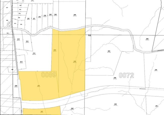
08-1800-0089-044-5
AN SPLIT FROM # 20 & 5-6
Residentialacreage
Fulton
X
Georgia
13045C0310E
167.62 AC
2024
North Clayton/Airport
2025
Atlanta
010402
Atlanta-Sandy Springs-Roswell, GA
DEMOGRAPHICS near Upper Wooten Rd
1 Mile
3 Mile
5 Mile
2024 Total Population
105
841
6,173
2029 Population
109
891
6,716
Pop Growth 2024-2029
+ 3.81%
+ 5.95%
+ 8.80%
Average Age
49
48
44
2024 Total Households
43
348
2,364
HH Growth 2024-2029
+ 2.33%
+ 6.03%
+ 8.76%
Median Household Inc
$63,750
$80,921
$89,981
Avg Household Size
2.50
2.40
2.60
2024 Avg HH Vehicles
2.00
2.00
2.00
Median Home Value
$383,333
$539,130
$371,264
Median Year Built
1973
1983
1995
Nearby Places
Map Layers
Map Styles
 Street
 Aerial
- Restaurants
- Banks
- Shops
- Fitness
- Groceries
PUBLIC TRANSPORTATION
AIRPORT
Hartsfield - Jackson Atlanta International
DRIVE
WALK
Distance
Hartsfield - Jackson Atlanta International
39 min
25.3 mi
Freight Ports
Georgia Ports - Savannah
DRIVE
WALK
Distance
Georgia Ports - Savannah
301 min
262.6 mi
Nearby Properties
Address
Land Use
TOTAL SIZE
Lot Size
Zoning
Address
Land Use
TOTAL SIZE
Lot Size
Zoning
552.49 AC
AG1
Address
Land Use
TOTAL SIZE
Lot Size
Zoning
679.93 AC
AG1
Address
Land Use
TOTAL SIZE
Lot Size
Zoning
773.32 AC
RL
Address
Land Use
TOTAL SIZE
Lot Size
Zoning
307.43 AC
AG1
Address
Land Use
TOTAL SIZE
Lot Size
Zoning
562.30 AC
AG1
Address
Land Use
TOTAL SIZE
Lot Size
Zoning
222.65 AC
AG1
Address
Land Use
TOTAL SIZE
Lot Size
Zoning
236.78 AC
AG1
Address
Land Use
TOTAL SIZE
Lot Size
Zoning
3,424 SF
67.86 AC
AG1
Address
Land Use
TOTAL SIZE
Lot Size
Zoning
132.02 AC
AG1
Address
Land Use
TOTAL SIZE
Lot Size
Zoning
40.85 AC
HMLDR
Address
Land Use
TOTAL SIZE
Lot Size
Zoning
127.30 AC
AG1
Address
Land Use
TOTAL SIZE
Lot Size
Zoning
168.05 AC
AG1
Address
Land Use
TOTAL SIZE
Lot Size
Zoning
124.30 AC
AG1
Address
Land Use
TOTAL SIZE
Lot Size
Zoning
936 SF
159.60 AC
AG1
Address
Land Use
TOTAL SIZE
Lot Size
Zoning
337.08 AC
AG1
Address
Land Use
TOTAL SIZE
Lot Size
Zoning
52.54 AC
AG1
Address
Land Use
TOTAL SIZE
Lot Size
Zoning
1,997 SF
72.70 AC
RL
Address
Land Use
TOTAL SIZE
Lot Size
Zoning
81.93 AC
AG1
Address
Land Use
TOTAL SIZE
Lot Size
Zoning
8 AC
HMMU
Address
Land Use
TOTAL SIZE
Lot Size
Zoning
165.90 AC
AG1
Address
Land Use
TOTAL SIZE
Lot Size
Zoning
268.50 AC
AG1
Address
Land Use
TOTAL SIZE
Lot Size
Zoning
171.65 AC
AG1
Address
Land Use
TOTAL SIZE
Lot Size
Zoning
185.22 AC
AG1
Address
Land Use
TOTAL SIZE
Lot Size
Zoning
206.11 AC
AG1
Address
Land Use
TOTAL SIZE
Lot Size
Zoning
224.40 AC
AG1
Address
Land Use
TOTAL SIZE
Lot Size
Zoning
180 AC
AG1
Address
Land Use
TOTAL SIZE
Lot Size
Zoning
7,148 SF
7.26 AC
Address
Land Use
TOTAL SIZE
Lot Size
Zoning
1,794 SF
6.10 AC
AG1
Address
Land Use
TOTAL SIZE
Lot Size
Zoning
154.53 AC
AG1
Address
Land Use
TOTAL SIZE
Lot Size
Zoning
151.95 AC
AG1
The World's #1 Commercial Real Estate Marketplace
Connect with us
© 2026 CoStar Group
The information above has been obtained from sources believed reliable. While we do not doubt its accuracy we have not verified it and make no guarantee, warranty or representation about it. It is your responsibility to independently confirm its accuracy and completeness. Any projections, opinions, assumptions, or estimates used are for example only and do not represent the current or future performance of the property. The value of this transaction to you depends on tax and other factors which should be evaluated by your tax, financial, and legal advisors. You and your advisors should conduct a careful, independent investigation of the property to determine to your satisfaction the suitability of the property for your needs.