Property Record
Air Tool Dr, Southern Pines, NC 28387


NEARBY LISTINGS FOR SALE OR LEASE
-
-
View all Southern Pines listings for sale on LoopNet.com
Property Detail
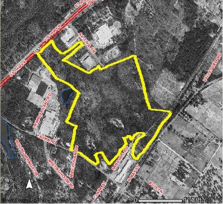
Air Tool Dr
Pinehurst-Southern Pines, NC
Green Space
8582-00-84-4732
KNOLLWOOD LAND
Commercialacreage
Moore
X
North Carolina
3710858200J
103.32 AC
2024
North Carolina Southeast Area
2024
Other Market Areas
DEMOGRAPHICS near Air Tool Dr
1 Mile
3 Mile
5 Mile
2024 Total Population
1,455
16,211
41,445
2029 Population
1,667
18,730
47,899
Pop Growth 2024-2029
+ 14.57%
+ 15.54%
+ 15.57%
Average Age
44
44
44
2024 Total Households
752
7,869
18,558
HH Growth 2024-2029
+ 14.76%
+ 15.77%
+ 15.89%
Median Household Inc
$65,147
$64,954
$72,726
Avg Household Size
1.90
2.00
2.20
2024 Avg HH Vehicles
2.00
2.00
2.00
Median Home Value
$318,359
$345,611
$363,947
Median Year Built
1979
1992
1996
Nearby Places
Map Layers
Map Styles
 Street
 Aerial
- Restaurants
- Banks
- Shops
- Fitness
- Groceries
PUBLIC TRANSPORTATION
COMMUTER RAIL
Southern Pines Amtrak Station (Silver Star - Amtrak)
DRIVE
WALK
Distance
Southern Pines Amtrak Station (Silver Star - Amtrak)
5 min
2.1 mi
Freight Ports
Port of Wilmington
DRIVE
WALK
Distance
Port of Wilmington
173 min
136.7 mi
SALE & LEASE HISTORY
LISTING DATE
SALE/LEASE

Mar 31, 2017
For Sale
Apr 20, 2017
For Sale
Apr 04, 2018
For Sale
Apr 04, 2017
For Sale
Nearby Properties
Address
Land Use
TOTAL SIZE
Lot Size
Zoning
Address
Land Use
TOTAL SIZE
Lot Size
Zoning
30,190 SF
181.04 AC
PPC
Address
Land Use
TOTAL SIZE
Lot Size
Zoning
18.49 AC
Address
Land Use
TOTAL SIZE
Lot Size
Zoning
39.86 AC
Address
Land Use
TOTAL SIZE
Lot Size
Zoning
Address
Land Use
TOTAL SIZE
Lot Size
Zoning
44.59 AC
MULTI
Address
Land Use
TOTAL SIZE
Lot Size
Zoning
12.78 AC
Address
Land Use
TOTAL SIZE
Lot Size
Zoning
Address
Land Use
TOTAL SIZE
Lot Size
Zoning
39,490 SF
5.16 AC
GBCD
Address
Land Use
TOTAL SIZE
Lot Size
Zoning
Address
Land Use
TOTAL SIZE
Lot Size
Zoning
2,420.50 AC
MULTI
Address
Land Use
TOTAL SIZE
Lot Size
Zoning
Address
Land Use
TOTAL SIZE
Lot Size
Zoning
11.17 AC
Address
Land Use
TOTAL SIZE
Lot Size
Zoning
7.62 AC
Address
Land Use
TOTAL SIZE
Lot Size
Zoning
98,272 SF
25 AC
I
Address
Land Use
TOTAL SIZE
Lot Size
Zoning
53,926 SF
21.69 AC
GB
Address
Land Use
TOTAL SIZE
Lot Size
Zoning
Address
Land Use
TOTAL SIZE
Lot Size
Zoning
1,034 SF
12.10 AC
RM1
Address
Land Use
TOTAL SIZE
Lot Size
Zoning
Address
Land Use
TOTAL SIZE
Lot Size
Zoning
Address
Land Use
TOTAL SIZE
Lot Size
Zoning
10,281 SF
0.52 AC
RM1
Address
Land Use
TOTAL SIZE
Lot Size
Zoning
5,962 SF
1.52 AC
RM1
Address
Land Use
TOTAL SIZE
Lot Size
Zoning
13,200 SF
2 AC
I
Address
Land Use
TOTAL SIZE
Lot Size
Zoning
572 SF
117 AC
MULTI
Address
Land Use
TOTAL SIZE
Lot Size
Zoning
4,128 SF
5.92 AC
RM1
Address
Land Use
TOTAL SIZE
Lot Size
Zoning
3,807 SF
5 AC
PPC
Address
Land Use
TOTAL SIZE
Lot Size
Zoning
25,872 SF
4.40 AC
PPC
Address
Land Use
TOTAL SIZE
Lot Size
Zoning
44,856 SF
6.36 AC
GB
Address
Land Use
TOTAL SIZE
Lot Size
Zoning
17.78 AC
Address
Land Use
TOTAL SIZE
Lot Size
Zoning
13,475 SF
6.03 AC
Address
Land Use
TOTAL SIZE
Lot Size
Zoning
13.18 AC
The World's #1 Commercial Real Estate Marketplace
Connect with us
© 2025 CoStar Group
The information above has been obtained from sources believed reliable. While we do not doubt its accuracy we have not verified it and make no guarantee, warranty or representation about it. It is your responsibility to independently confirm its accuracy and completeness. Any projections, opinions, assumptions, or estimates used are for example only and do not represent the current or future performance of the property. The value of this transaction to you depends on tax and other factors which should be evaluated by your tax, financial, and legal advisors. You and your advisors should conduct a careful, independent investigation of the property to determine to your satisfaction the suitability of the property for your needs.