Property Record
Us 1, Oak Hill, FL 32759
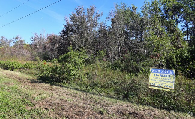


Property Detail
Us 1
Deltona-Daytona Beach-Ormond Beach, FL
LOTS 148 TO 153 INC EXC ROAD PABLO SUB PER OR 4336 PG 2974 PER OR 8811 PG 2232
9537-02-00-1480
VOLUSIA
Recreationalacreage
Florida
01A2
148-1
A Areas with a 1% annual chance of flooding and a 26% chance of flooding over the life of a 30-year mortgage.
40.40 AC
2025
SE Volusia County
2026
Deltona/Daytona Beach
083003
NEARBY LISTINGS FOR SALE OR LEASE
DEMOGRAPHICS near Us 1
1 mile
3 mile
5 mile
2025 Total Population
234
2,415
4,992
2030 Population
256
2,659
5,505
Pop Growth 2025-2030
+ 9.40%
+ 10.10%
+ 10.28%
Average Age
47
50
52
2025 Total Households
97
1,061
2,271
HH Growth 2025-2030
+ 9.28%
+ 10.18%
+ 10.30%
Median Household Inc
$72,499
$68,653
$69,843
Avg Household Size
2.40
2.30
2.20
2025 Avg HH Vehicles
2.00
2.00
2.00
Median Home Value
$352,272
$359,715
$338,902
Median Year Built
1991
1994
1995
Nearby Places
Map Layers
Map Styles
 Street
 Aerial
Layers
 Traffic
 Biking
Places
Listings with unknown addresses are not visible on the map
- Restaurants
- Banks
- Shops
- Fitness
- Groceries
PUBLIC TRANSPORTATION
AIRPORT
Daytona Beach International
Drive
Walk
Distance
Daytona Beach International
46 min
33.0 mi
Orlando Sanford International
Drive
Walk
Distance
Orlando Sanford International
59 min
34.9 mi
Freight Ports
Port Canaveral
Drive
Walk
Distance
Port Canaveral
54 min
45.2 mi
SALE & LEASE HISTORY
LISTING DATE
SALE/LEASE

Nov 28, 2017
For Sale
Jan 24, 2025
For Sale
Nearby Properties
Address
Land Use
TOTAL SIZE
Lot Size
Zoning
Address
Land Use
TOTAL SIZE
Lot Size
Zoning
76,446 SF
10.09 AC
11R1
Address
Land Use
TOTAL SIZE
Lot Size
Zoning
24,071 SF
0.63 AC
11R1
Address
Land Use
TOTAL SIZE
Lot Size
Zoning
31,352 SF
10 AC
01A3
Address
Land Use
TOTAL SIZE
Lot Size
Zoning
4,808 SF
5.75 AC
01B4
Address
Land Use
TOTAL SIZE
Lot Size
Zoning
11,161 SF
1.40 AC
11R3
Address
Land Use
TOTAL SIZE
Lot Size
Zoning
1,436 SF
3.44 AC
Address
Land Use
TOTAL SIZE
Lot Size
Zoning
9,100 SF
1.56 AC
11B3
Address
Land Use
TOTAL SIZE
Lot Size
Zoning
15,240 SF
14.25 AC
MH5
Address
Land Use
TOTAL SIZE
Lot Size
Zoning
3,633 SF
3.81 AC
Address
Land Use
TOTAL SIZE
Lot Size
Zoning
11,607 SF
1.41 AC
Address
Land Use
TOTAL SIZE
Lot Size
Zoning
45,060 SF
2.63 AC
Address
Land Use
TOTAL SIZE
Lot Size
Zoning
4,361 SF
4.63 AC
R3W
Address
Land Use
TOTAL SIZE
Lot Size
Zoning
2,245 SF
2.53 AC
Address
Land Use
TOTAL SIZE
Lot Size
Zoning
640 AC
CW
Address
Land Use
TOTAL SIZE
Lot Size
Zoning
640 AC
CW
Address
Land Use
TOTAL SIZE
Lot Size
Zoning
640 AC
CW
Address
Land Use
TOTAL SIZE
Lot Size
Zoning
636 AC
CW
Address
Land Use
TOTAL SIZE
Lot Size
Zoning
6,330 SF
1.43 AC
11B4
Address
Land Use
TOTAL SIZE
Lot Size
Zoning
2,212 SF
1.97 AC
11B7
Address
Land Use
TOTAL SIZE
Lot Size
Zoning
5,677 SF
1.70 AC
Address
Land Use
TOTAL SIZE
Lot Size
Zoning
5,124 SF
1.40 AC
11B3
Address
Land Use
TOTAL SIZE
Lot Size
Zoning
2,060 SF
15 AC
RC
Address
Land Use
TOTAL SIZE
Lot Size
Zoning
4,350 SF
1.59 AC
RCW
Address
Land Use
TOTAL SIZE
Lot Size
Zoning
483 SF
1.63 AC
Address
Land Use
TOTAL SIZE
Lot Size
Zoning
1,110 SF
0.23 AC
MH5W
Address
Land Use
TOTAL SIZE
Lot Size
Zoning
2,889 SF
7.54 AC
Address
Land Use
TOTAL SIZE
Lot Size
Zoning
14,344 SF
2.13 AC
11B4
Address
Land Use
TOTAL SIZE
Lot Size
Zoning
39 AC
A1
Address
Land Use
TOTAL SIZE
Lot Size
Zoning
33.50 AC
Address
Land Use
TOTAL SIZE
Lot Size
Zoning
3,626 SF
10 AC
A1
The World's #1 Commercial Real Estate Marketplace
Connect with us
© 2026 CoStar Group
The information above has been obtained from sources believed reliable. While we do not doubt its accuracy we have not verified it and make no guarantee, warranty or representation about it. It is your responsibility to independently confirm its accuracy and completeness. Any projections, opinions, assumptions, or estimates used are for example only and do not represent the current or future performance of the property. The value of this transaction to you depends on tax and other factors which should be evaluated by your tax, financial, and legal advisors. You and your advisors should conduct a careful, independent investigation of the property to determine to your satisfaction the suitability of the property for your needs.