Property Record
N Us Highway 281, San Antonio, TX 78261
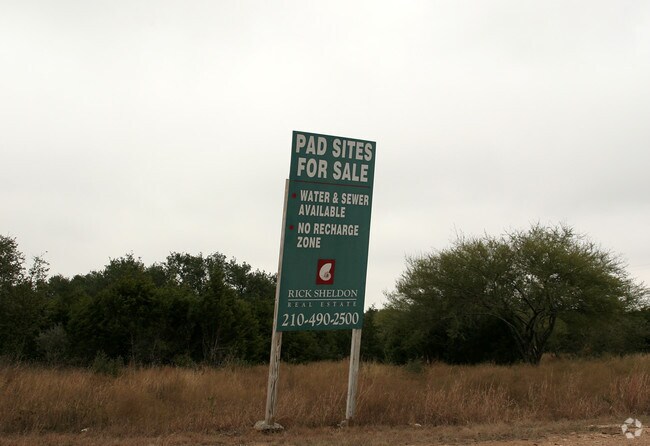

Property Detail
N Us Highway 281
San Antonio-New Braunfels, TX
CB 4864 P-22 ABS 266 (FORMERLY P-8A) 2022- RMS PER SPLIT PER DEED 20190058282 EXE 10-11-2018. ASGIS02-18-2022.2013- RMS SPLIT PER DEED 15336/618 EXE 02-06-12
04864-000-0220
BEXAR
Privatepreserveopenspacevacantlandforestlandconservation
Texas
B and X Area of moderate flood hazard, usually the area between the limits of the 100-year and 500-year floods.
22
2024
19.32 AC
2025
Far North Central
121912
San Antonio
NEARBY LISTINGS FOR SALE OR LEASE
DEMOGRAPHICS near N Us Highway 281
1 mile
3 mile
5 mile
2025 Total Population
3,132
47,010
106,225
2030 Population
3,266
50,537
113,714
Pop Growth 2025-2030
+ 4.28%
+ 7.50%
+ 7.05%
Average Age
39
38
38
2025 Total Households
1,028
15,491
36,022
HH Growth 2025-2030
+ 4.38%
+ 7.74%
+ 7.25%
Median Household Inc
$119,918
$134,014
$131,572
Avg Household Size
3.10
3.00
2.90
2025 Avg HH Vehicles
2.00
2.00
2.00
Median Home Value
$398,406
$462,151
$465,280
Median Year Built
2007
2009
2007
Nearby Places
Map Layers
Map Styles
 Street
 Aerial
Layers
 Traffic
 Biking
Places
Listings with unknown addresses are not visible on the map
- Restaurants
- Banks
- Shops
- Fitness
- Groceries
PUBLIC TRANSPORTATION
AIRPORT
San Antonio International
Drive
Walk
Distance
San Antonio International
18 min
14.5 mi
Freight Ports
Calhoun Port
Drive
Walk
Distance
Calhoun Port
196 min
163.2 mi
Nearby Properties
Address
Land Use
TOTAL SIZE
Lot Size
Zoning
Address
Land Use
TOTAL SIZE
Lot Size
Zoning
116,135 SF
17.35 AC
Address
Land Use
TOTAL SIZE
Lot Size
Zoning
283,877 SF
22.15 AC
Address
Land Use
TOTAL SIZE
Lot Size
Zoning
310,384 SF
14.25 AC
Address
Land Use
TOTAL SIZE
Lot Size
Zoning
123,938 SF
27.21 AC
Address
Land Use
TOTAL SIZE
Lot Size
Zoning
296,413 SF
15 AC
Address
Land Use
TOTAL SIZE
Lot Size
Zoning
137,704 SF
26.31 AC
Address
Land Use
TOTAL SIZE
Lot Size
Zoning
128,042 SF
5.35 AC
Address
Land Use
TOTAL SIZE
Lot Size
Zoning
Address
Land Use
TOTAL SIZE
Lot Size
Zoning
85,133 SF
4.65 AC
Address
Land Use
TOTAL SIZE
Lot Size
Zoning
35,888 SF
6.06 AC
Address
Land Use
TOTAL SIZE
Lot Size
Zoning
54,150 SF
3.47 AC
Address
Land Use
TOTAL SIZE
Lot Size
Zoning
28,128 SF
10.66 AC
Address
Land Use
TOTAL SIZE
Lot Size
Zoning
28.60 AC
Address
Land Use
TOTAL SIZE
Lot Size
Zoning
42,321 SF
13.85 AC
Address
Land Use
TOTAL SIZE
Lot Size
Zoning
25.20 AC
Address
Land Use
TOTAL SIZE
Lot Size
Zoning
Address
Land Use
TOTAL SIZE
Lot Size
Zoning
22.75 AC
Address
Land Use
TOTAL SIZE
Lot Size
Zoning
76,879 SF
3.85 AC
Address
Land Use
TOTAL SIZE
Lot Size
Zoning
15.28 AC
Address
Land Use
TOTAL SIZE
Lot Size
Zoning
20.13 AC
Address
Land Use
TOTAL SIZE
Lot Size
Zoning
19,952 SF
3.32 AC
Address
Land Use
TOTAL SIZE
Lot Size
Zoning
74,320 SF
4.55 AC
Address
Land Use
TOTAL SIZE
Lot Size
Zoning
12,004 SF
3.37 AC
Address
Land Use
TOTAL SIZE
Lot Size
Zoning
76,120 SF
3.90 AC
Address
Land Use
TOTAL SIZE
Lot Size
Zoning
20.95 AC
Address
Land Use
TOTAL SIZE
Lot Size
Zoning
5,508 SF
3.50 AC
Address
Land Use
TOTAL SIZE
Lot Size
Zoning
Address
Land Use
TOTAL SIZE
Lot Size
Zoning
183.24 AC
Address
Land Use
TOTAL SIZE
Lot Size
Zoning
5,400 SF
3.24 AC
The World's #1 Commercial Real Estate Marketplace
Connect with us
© 2026 CoStar Group
The information above has been obtained from sources believed reliable. While we do not doubt its accuracy we have not verified it and make no guarantee, warranty or representation about it. It is your responsibility to independently confirm its accuracy and completeness. Any projections, opinions, assumptions, or estimates used are for example only and do not represent the current or future performance of the property. The value of this transaction to you depends on tax and other factors which should be evaluated by your tax, financial, and legal advisors. You and your advisors should conduct a careful, independent investigation of the property to determine to your satisfaction the suitability of the property for your needs.