Property Record
Us 301 N, Parrish, FL 34219


Property Detail
Us 301 N
3904-1010-9
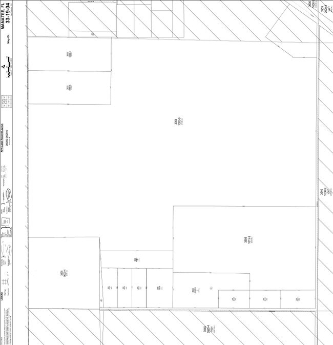
FROM THE NE COR OF SEC 4, TWN 33S, RNG 19E, RUN S 89 DEG47MIN 31 SEC W, ALG THE N LN OF SD SEC 4, A DIST OF 1332.62FT [DELETE TO THE POB]; TH S 00 DEG 51 MIN 34 SEC
Pasture
MANATEE
PD-MU
Florida
A Areas with a 1% annual chance of flooding and a 26% chance of flooding over the life of a 30-year mortgage.
15.73 AC
2023
Manatee
2025
Tampa/St Petersburg
001913
North Port-Bradenton-Sarasota, FL
1,264 SF
NEARBY LISTINGS FOR SALE OR LEASE
DEMOGRAPHICS near Us 301 N
1 mile
3 mile
5 mile
2025 Total Population
590
5,932
38,597
2030 Population
754
7,167
44,783
Pop Growth 2025-2030
+ 27.80%
+ 20.82%
+ 16.03%
Average Age
36
38
44
2025 Total Households
149
1,729
13,761
HH Growth 2025-2030
+ 28.19%
+ 19.32%
+ 14.58%
Median Household Inc
$163,158
$111,718
$84,770
Avg Household Size
3.30
3.00
2.60
2025 Avg HH Vehicles
3.00
3.00
2.00
Median Home Value
$684,210
$547,941
$363,923
Median Year Built
2011
2010
2010
Nearby Places
Map Layers
Map Styles
 Street
 Aerial
Layers
 Traffic
 Biking
Places
Listings with unknown addresses are not visible on the map
- Restaurants
- Banks
- Shops
- Fitness
- Groceries
PUBLIC TRANSPORTATION
AIRPORT
Sarasota/Bradenton International
Drive
Walk
Distance
Sarasota/Bradenton International
42 min
25.8 mi
Tampa International
Drive
Walk
Distance
Tampa International
57 min
38.9 mi
St Pete-Clearwater International
Drive
Walk
Distance
St Pete-Clearwater International
60 min
42.3 mi
Freight Ports
Port Manatee
Drive
Walk
Distance
Port Manatee
22 min
13.4 mi
Nearby Properties
Address
Land Use
TOTAL SIZE
Lot Size
Zoning
Address
Land Use
TOTAL SIZE
Lot Size
Zoning
204.10 AC
PD
Address
Land Use
TOTAL SIZE
Lot Size
Zoning
139.83 AC
PD
Address
Land Use
TOTAL SIZE
Lot Size
Zoning
1,861 SF
61.85 AC
PD
Address
Land Use
TOTAL SIZE
Lot Size
Zoning
146.22 AC
PD
Address
Land Use
TOTAL SIZE
Lot Size
Zoning
102.37 AC
PD
Address
Land Use
TOTAL SIZE
Lot Size
Zoning
3.11 AC
Address
Land Use
TOTAL SIZE
Lot Size
Zoning
Address
Land Use
TOTAL SIZE
Lot Size
Zoning
154.48 AC
AR
Address
Land Use
TOTAL SIZE
Lot Size
Zoning
30.70 AC
Address
Land Use
TOTAL SIZE
Lot Size
Zoning
145.29 AC
PD
Address
Land Use
TOTAL SIZE
Lot Size
Zoning
113.80 AC
Address
Land Use
TOTAL SIZE
Lot Size
Zoning
Address
Land Use
TOTAL SIZE
Lot Size
Zoning
30,720 SF
13.43 AC
AS-1
Address
Land Use
TOTAL SIZE
Lot Size
Zoning
71,726 SF
11.06 AC
AS-1
Address
Land Use
TOTAL SIZE
Lot Size
Zoning
58.47 AC
Address
Land Use
TOTAL SIZE
Lot Size
Zoning
Address
Land Use
TOTAL SIZE
Lot Size
Zoning
78.38 AC
Address
Land Use
TOTAL SIZE
Lot Size
Zoning
7,684 SF
17.06 AC
PD
Address
Land Use
TOTAL SIZE
Lot Size
Zoning
41.59 AC
Address
Land Use
TOTAL SIZE
Lot Size
Zoning
52,125 SF
358.64 AC
A GENERAL
Address
Land Use
TOTAL SIZE
Lot Size
Zoning
Address
Land Use
TOTAL SIZE
Lot Size
Zoning
37.37 AC
Address
Land Use
TOTAL SIZE
Lot Size
Zoning
5,289 SF
1.26 AC
PD
Address
Land Use
TOTAL SIZE
Lot Size
Zoning
2.11 AC
PD-MU
Address
Land Use
TOTAL SIZE
Lot Size
Zoning
34.21 AC
PD
Address
Land Use
TOTAL SIZE
Lot Size
Zoning
14.98 AC
AS-1
Address
Land Use
TOTAL SIZE
Lot Size
Zoning
3,504 SF
6.33 AC
A GENERAL
Address
Land Use
TOTAL SIZE
Lot Size
Zoning
1,806 SF
40.85 AC
AS-1
Address
Land Use
TOTAL SIZE
Lot Size
Zoning
69.54 AC
AR
Address
Land Use
TOTAL SIZE
Lot Size
Zoning
21.81 AC
The World's #1 Commercial Real Estate Marketplace
Connect with us
© 2026 CoStar Group
The information above has been obtained from sources believed reliable. While we do not doubt its accuracy we have not verified it and make no guarantee, warranty or representation about it. It is your responsibility to independently confirm its accuracy and completeness. Any projections, opinions, assumptions, or estimates used are for example only and do not represent the current or future performance of the property. The value of this transaction to you depends on tax and other factors which should be evaluated by your tax, financial, and legal advisors. You and your advisors should conduct a careful, independent investigation of the property to determine to your satisfaction the suitability of the property for your needs.