Property Record
Us 64 E, , NC

Property Detail
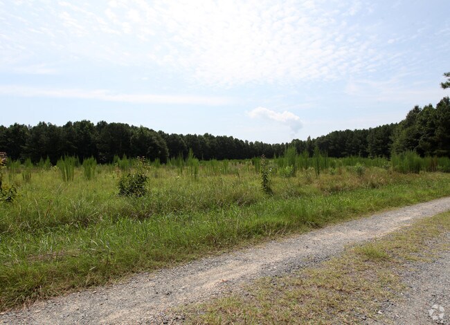
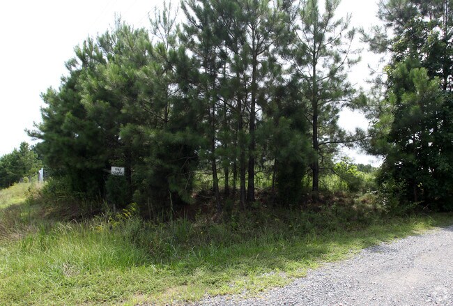
Us 64 E
Durham-Chapel Hill, NC
Q5-8A-2 AC 36.34 BK 2004 PG 20
80653
CHATHAM
Vacantlandnec
North Carolina
R-1
36.34 AC
B and X Area of moderate flood hazard, usually the area between the limits of the 100-year and 500-year floods.
Chatham County
2025
Raleigh/Durham
2025
NEARBY LISTINGS FOR SALE OR LEASE
DEMOGRAPHICS near Us 64 E
1 mile
3 mile
5 mile
2025 Total Population
277
2,370
29,564
2030 Population
303
2,648
32,911
Pop Growth 2025-2030
+ 9.39%
+ 11.73%
+ 11.32%
Average Age
47
41
38
2025 Total Households
113
875
10,089
HH Growth 2025-2030
+ 9.73%
+ 11.89%
+ 11.63%
Median Household Inc
$113,425
$132,500
$163,251
Avg Household Size
2.30
2.70
2.90
2025 Avg HH Vehicles
3.00
2.00
2.00
Median Home Value
$685,897
$717,268
$728,398
Median Year Built
1993
2007
2010
Nearby Places
Map Layers
Map Styles
 Street
 Aerial
Transit
 Traffic
 Biking
Places
Listings with unknown addresses are not visible on the map
- Restaurants
- Banks
- Shops
- Fitness
- Groceries
PUBLIC TRANSPORTATION
AIRPORT
Raleigh-Durham International
Drive
Walk
Distance
Raleigh-Durham International
28 min
19.8 mi
Freight Ports
Port of Wilmington
Drive
Walk
Distance
Port of Wilmington
177 min
152.3 mi
SALE & LEASE HISTORY
LISTING DATE
SALE/LEASE

Sep 24, 2016
For Sale
Oct 19, 2018
For Sale
Nearby Properties
Address
Land Use
TOTAL SIZE
Lot Size
Zoning
Address
Land Use
TOTAL SIZE
Lot Size
Zoning
855.90 AC
R-80W
Address
Land Use
TOTAL SIZE
Lot Size
Zoning
174,645 SF
23.23 AC
LI-CZ
Address
Land Use
TOTAL SIZE
Lot Size
Zoning
189,429 SF
26.61 AC
PUD-C
Address
Land Use
TOTAL SIZE
Lot Size
Zoning
22,534 SF
20.01 AC
CD-RB
Address
Land Use
TOTAL SIZE
Lot Size
Zoning
39,040 SF
42.75 AC
CD-IL
Address
Land Use
TOTAL SIZE
Lot Size
Zoning
83.23 AC
M-1
Address
Land Use
TOTAL SIZE
Lot Size
Zoning
28,089 SF
16.40 AC
R-80W
Address
Land Use
TOTAL SIZE
Lot Size
Zoning
2,331 SF
56.57 AC
R-80W
Address
Land Use
TOTAL SIZE
Lot Size
Zoning
16,840 SF
25.72 AC
CD-RB
Address
Land Use
TOTAL SIZE
Lot Size
Zoning
16.42 AC
LI-CZ
Address
Land Use
TOTAL SIZE
Lot Size
Zoning
30.18 AC
R-80W
Address
Land Use
TOTAL SIZE
Lot Size
Zoning
2,343 SF
39.42 AC
RR
Address
Land Use
TOTAL SIZE
Lot Size
Zoning
40.60 AC
R-80W
Address
Land Use
TOTAL SIZE
Lot Size
Zoning
1,350 SF
38.11 AC
MH-NC
Address
Land Use
TOTAL SIZE
Lot Size
Zoning
12,000 SF
15.34 AC
CU-B-1
Address
Land Use
TOTAL SIZE
Lot Size
Zoning
2,000 SF
14.19 AC
M-1
Address
Land Use
TOTAL SIZE
Lot Size
Zoning
12,000 SF
2.04 AC
CD-CB
Address
Land Use
TOTAL SIZE
Lot Size
Zoning
33.66 AC
R-1
Address
Land Use
TOTAL SIZE
Lot Size
Zoning
35,960 SF
5.35 AC
CU-B-1
Address
Land Use
TOTAL SIZE
Lot Size
Zoning
5,784 SF
1.44 AC
B-1
Address
Land Use
TOTAL SIZE
Lot Size
Zoning
1,152 SF
20.71 AC
R-80W
Address
Land Use
TOTAL SIZE
Lot Size
Zoning
5,542 SF
3.02 AC
R-80W
Address
Land Use
TOTAL SIZE
Lot Size
Zoning
7,650 SF
6.76 AC
CD-CB
Address
Land Use
TOTAL SIZE
Lot Size
Zoning
2,738 SF
24.56 AC
R-1
Address
Land Use
TOTAL SIZE
Lot Size
Zoning
11.72 AC
M-1
Address
Land Use
TOTAL SIZE
Lot Size
Zoning
11 AC
R-80W
Address
Land Use
TOTAL SIZE
Lot Size
Zoning
13,767 SF
0.24 AC
CU-IND-L
Address
Land Use
TOTAL SIZE
Lot Size
Zoning
10.83 AC
M-1
Address
Land Use
TOTAL SIZE
Lot Size
Zoning
2,078 SF
13.88 AC
R-1
Address
Land Use
TOTAL SIZE
Lot Size
Zoning
1,624 SF
13.70 AC
R-1
The World's #1 Commercial Real Estate Marketplace
Connect with us
© 2026 CoStar Group
The information above has been obtained from sources believed reliable. While we do not doubt its accuracy we have not verified it and make no guarantee, warranty or representation about it. It is your responsibility to independently confirm its accuracy and completeness. Any projections, opinions, assumptions, or estimates used are for example only and do not represent the current or future performance of the property. The value of this transaction to you depends on tax and other factors which should be evaluated by your tax, financial, and legal advisors. You and your advisors should conduct a careful, independent investigation of the property to determine to your satisfaction the suitability of the property for your needs.