Property Record
Us Highway 1, Hilliard, FL 32046
NEARBY LISTINGS FOR SALE OR LEASE
Property Detail
Us Highway 1
Jacksonville, FL
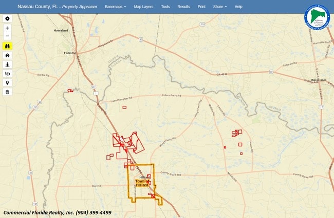
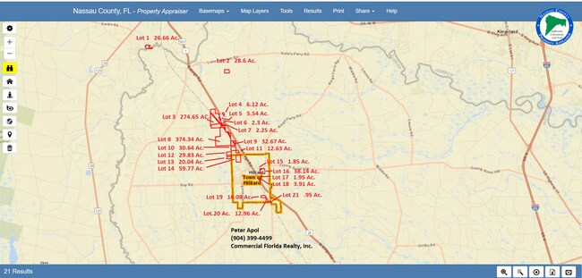
GOVT LOTS 1 & 2 OF SEC 4-4N-23E LEASED BY JEFFERSON SMURFIT
31-4N-24-0000-0001-0000
Nassau
Timberlandforesttreesagricultural
Florida
A
1
12089C0130F
365.57 AC
2025
Nassau County
2025
Jacksonville (Florida)
050403
DEMOGRAPHICS near Us Highway 1
1 Mile
3 Mile
5 Mile
2024 Total Population
154
1,577
5,086
2029 Population
182
1,873
6,079
Pop Growth 2024-2029
+ 18.18%
+ 18.77%
+ 19.52%
Average Age
42
41
40
2024 Total Households
56
577
1,864
HH Growth 2024-2029
+ 19.64%
+ 19.93%
+ 20.65%
Median Household Inc
$77,500
$75,833
$69,197
Avg Household Size
2.70
2.70
2.70
2024 Avg HH Vehicles
2.00
2.00
2.00
Median Home Value
$311,111
$294,614
$263,822
Median Year Built
1992
1992
1991
Nearby Places
Map Layers
Map Styles
 Street
 Aerial
- Restaurants
- Banks
- Shops
- Fitness
- Groceries
PUBLIC TRANSPORTATION
AIRPORT
Jacksonville International
DRIVE
WALK
Distance
Jacksonville International
51 min
28.9 mi
Freight Ports
Jacksonville Port
DRIVE
WALK
Distance
Jacksonville Port
60 min
35.8 mi
SALE & LEASE HISTORY
LISTING DATE
SALE/LEASE

May 07, 2019
For Sale
Nearby Properties
Address
Land Use
TOTAL SIZE
Lot Size
Zoning
Address
Land Use
TOTAL SIZE
Lot Size
Zoning
126,358 SF
23.72 AC
R-2
Address
Land Use
TOTAL SIZE
Lot Size
Zoning
97,842 SF
37.75 AC
R-2
Address
Land Use
TOTAL SIZE
Lot Size
Zoning
116,334 SF
18 AC
A-1
Address
Land Use
TOTAL SIZE
Lot Size
Zoning
42,825 SF
4 AC
OR
Address
Land Use
TOTAL SIZE
Lot Size
Zoning
147.27 AC
PUD
Address
Land Use
TOTAL SIZE
Lot Size
Zoning
23,621 SF
35.49 AC
OR
Address
Land Use
TOTAL SIZE
Lot Size
Zoning
40,782 SF
5.09 AC
C-1 - HILL
Address
Land Use
TOTAL SIZE
Lot Size
Zoning
25,583 SF
3.02 AC
R-2
Address
Land Use
TOTAL SIZE
Lot Size
Zoning
9,844 SF
6.50 AC
A-1
Address
Land Use
TOTAL SIZE
Lot Size
Zoning
11,556 SF
1.30 AC
R-3
Address
Land Use
TOTAL SIZE
Lot Size
Zoning
12,432 SF
6.11 AC
R-3
Address
Land Use
TOTAL SIZE
Lot Size
Zoning
9,730 SF
79.13 AC
OR
Address
Land Use
TOTAL SIZE
Lot Size
Zoning
7,101 SF
1.01 AC
R-2
Address
Land Use
TOTAL SIZE
Lot Size
Zoning
10,324 SF
1.20 AC
R-2
Address
Land Use
TOTAL SIZE
Lot Size
Zoning
9,100 SF
1.11 AC
C-1 - HILL
Address
Land Use
TOTAL SIZE
Lot Size
Zoning
8,397 SF
1.15 AC
R-3
Address
Land Use
TOTAL SIZE
Lot Size
Zoning
16,064 SF
2.04 AC
C-1 - HILL
Address
Land Use
TOTAL SIZE
Lot Size
Zoning
27,087 SF
4.05 AC
R-3
Address
Land Use
TOTAL SIZE
Lot Size
Zoning
14,189 SF
92.20 AC
OR
Address
Land Use
TOTAL SIZE
Lot Size
Zoning
7,157 SF
1.82 AC
R-3
Address
Land Use
TOTAL SIZE
Lot Size
Zoning
12,802 SF
0.86 AC
R-3
Address
Land Use
TOTAL SIZE
Lot Size
Zoning
7,172 SF
5.80 AC
OR
Address
Land Use
TOTAL SIZE
Lot Size
Zoning
8,613 SF
1.71 AC
R-2
Address
Land Use
TOTAL SIZE
Lot Size
Zoning
4,139 SF
4.42 AC
CI
Address
Land Use
TOTAL SIZE
Lot Size
Zoning
6,393 SF
2.17 AC
C-1 - HILL
Address
Land Use
TOTAL SIZE
Lot Size
Zoning
7,128 SF
1.06 AC
C-1 - HILL
Address
Land Use
TOTAL SIZE
Lot Size
Zoning
11,354 SF
2.47 AC
CI
Address
Land Use
TOTAL SIZE
Lot Size
Zoning
17,120 SF
3.09 AC
C-1 - HILL
Address
Land Use
TOTAL SIZE
Lot Size
Zoning
12,118 SF
1.45 AC
C-1 - HILL
Address
Land Use
TOTAL SIZE
Lot Size
Zoning
3,536 SF
52.82 AC
OR
The World's #1 Commercial Real Estate Marketplace
Connect with us
© 2026 CoStar Group
The information above has been obtained from sources believed reliable. While we do not doubt its accuracy we have not verified it and make no guarantee, warranty or representation about it. It is your responsibility to independently confirm its accuracy and completeness. Any projections, opinions, assumptions, or estimates used are for example only and do not represent the current or future performance of the property. The value of this transaction to you depends on tax and other factors which should be evaluated by your tax, financial, and legal advisors. You and your advisors should conduct a careful, independent investigation of the property to determine to your satisfaction the suitability of the property for your needs.