Property Record
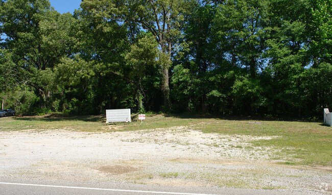
Us Highway 11, Springville, AL 35146

NEARBY LISTINGS FOR SALE OR LEASE
-
-
View all Springville listings for sale on LoopNet.com
Property Detail
Us Highway 11
13-09-29-0-002-008.000
BEG INT N ROW US HWY 11 & E LN SE4 TH SWLY 372 ALG ROW, N 165 E 385 S 82 TO POB 1.2 ACC 29-14-2
Storebuilding
St Clair
X
Alabama
01009C0500F
1.42 AC
2024
St Clair County
2024
Birmingham
040503
Birmingham-Hoover, AL
795 SF
DEMOGRAPHICS near Us Highway 11
1 Mile
3 Mile
5 Mile
2024 Total Population
700
5,618
10,984
2029 Population
744
5,989
11,746
Pop Growth 2024-2029
+ 6.29%
+ 6.60%
+ 6.94%
Average Age
42
42
41
2024 Total Households
264
2,089
4,016
HH Growth 2024-2029
+ 6.06%
+ 6.41%
+ 6.72%
Median Household Inc
$93,181
$84,180
$75,234
Avg Household Size
2.60
2.70
2.70
2024 Avg HH Vehicles
2.00
2.00
2.00
Median Home Value
$309,884
$294,371
$255,454
Median Year Built
2000
1999
1999
Nearby Places
Map Layers
Map Styles
 Street
 Aerial
- Restaurants
- Banks
- Shops
- Fitness
- Groceries
PUBLIC TRANSPORTATION
AIRPORT
Birmingham-Shuttlesworth International
DRIVE
WALK
Distance
Birmingham-Shuttlesworth International
33 min
28.2 mi
SALE & LEASE HISTORY
LISTING DATE
SALE/LEASE

Sep 24, 2016
For Sale
Nearby Properties
Address
Land Use
TOTAL SIZE
Lot Size
Zoning
Address
Land Use
TOTAL SIZE
Lot Size
Zoning
91,680 SF
8.60 AC
Address
Land Use
TOTAL SIZE
Lot Size
Zoning
Address
Land Use
TOTAL SIZE
Lot Size
Zoning
4,650 SF
4.17 AC
Address
Land Use
TOTAL SIZE
Lot Size
Zoning
7,538 SF
1.25 AC
Address
Land Use
TOTAL SIZE
Lot Size
Zoning
16,996 SF
3.10 AC
Address
Land Use
TOTAL SIZE
Lot Size
Zoning
2,760 SF
7.50 AC
Address
Land Use
TOTAL SIZE
Lot Size
Zoning
5,190 SF
9.60 AC
Address
Land Use
TOTAL SIZE
Lot Size
Zoning
6,988 SF
1 AC
Address
Land Use
TOTAL SIZE
Lot Size
Zoning
3,453 SF
1.12 AC
Address
Land Use
TOTAL SIZE
Lot Size
Zoning
12,600 SF
0.36 AC
Address
Land Use
TOTAL SIZE
Lot Size
Zoning
1,136 SF
8.40 AC
Address
Land Use
TOTAL SIZE
Lot Size
Zoning
5,395 SF
1.66 AC
Address
Land Use
TOTAL SIZE
Lot Size
Zoning
33,136 SF
3 AC
Address
Land Use
TOTAL SIZE
Lot Size
Zoning
11.13 AC
Address
Land Use
TOTAL SIZE
Lot Size
Zoning
2,942 SF
0.89 AC
Address
Land Use
TOTAL SIZE
Lot Size
Zoning
3,911 SF
1.10 AC
Address
Land Use
TOTAL SIZE
Lot Size
Zoning
5,628 SF
1.30 AC
Address
Land Use
TOTAL SIZE
Lot Size
Zoning
7,083 SF
0.96 AC
Address
Land Use
TOTAL SIZE
Lot Size
Zoning
4,872 SF
1.03 AC
Address
Land Use
TOTAL SIZE
Lot Size
Zoning
3,111 SF
0.88 AC
Address
Land Use
TOTAL SIZE
Lot Size
Zoning
4,266 SF
95 AC
Address
Land Use
TOTAL SIZE
Lot Size
Zoning
3,329 SF
0.70 AC
Address
Land Use
TOTAL SIZE
Lot Size
Zoning
3,902 SF
2.58 AC
Address
Land Use
TOTAL SIZE
Lot Size
Zoning
4,751 SF
0.71 AC
The World's #1 Commercial Real Estate Marketplace
Connect with us
© 2026 CoStar Group
The information above has been obtained from sources believed reliable. While we do not doubt its accuracy we have not verified it and make no guarantee, warranty or representation about it. It is your responsibility to independently confirm its accuracy and completeness. Any projections, opinions, assumptions, or estimates used are for example only and do not represent the current or future performance of the property. The value of this transaction to you depends on tax and other factors which should be evaluated by your tax, financial, and legal advisors. You and your advisors should conduct a careful, independent investigation of the property to determine to your satisfaction the suitability of the property for your needs.