Property Record
Us Highway 17 N, Wauchula, FL 33873

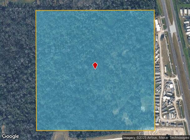
This Property Is For Sale
NEARBY LISTINGS FOR SALE OR LEASE
-
-
View all Wauchula listings for sale on LoopNet.com
Property Detail
Us Highway 17 N
2133-25-0000-03120-0000
40 AC SW/4 OF SW/4 21 33S 25E 150P205 297P558 201025003556/3922-BCC-ROD 201825007772(LEGL ERROR) 202225005591-AFF /5592 202425000715-LD/0716/0717
Commercialacreage
Hardee
AE
Florida
12049C0179D
40 AC
2025
Florida Central South Area
2025
Other Market Areas
970301
Wauchula, FL
DEMOGRAPHICS near Us Highway 17 N
1 Mile
3 Mile
5 Mile
2024 Total Population
2,287
8,063
16,701
2029 Population
2,378
8,381
17,362
Pop Growth 2024-2029
+ 3.98%
+ 3.94%
+ 3.96%
Average Age
37
38
37
2024 Total Households
788
2,762
5,547
HH Growth 2024-2029
+ 4.19%
+ 4.09%
+ 4.06%
Median Household Inc
$42,500
$45,904
$39,640
Avg Household Size
2.90
2.90
2.90
2024 Avg HH Vehicles
2.00
2.00
2.00
Median Home Value
$240,571
$152,624
$123,269
Median Year Built
1979
1978
1979
Nearby Places
Map Layers
Map Styles
 Street
 Aerial
- Restaurants
- Banks
- Shops
- Fitness
- Groceries
Nearby Properties
Address
Land Use
TOTAL SIZE
Lot Size
Zoning
Address
Land Use
TOTAL SIZE
Lot Size
Zoning
60.50 AC
F-R
Address
Land Use
TOTAL SIZE
Lot Size
Zoning
47,399 SF
55.51 AC
C-2
Address
Land Use
TOTAL SIZE
Lot Size
Zoning
107,610 SF
14.32 AC
C-1
Address
Land Use
TOTAL SIZE
Lot Size
Zoning
122,608 SF
10.32 AC
R-3
Address
Land Use
TOTAL SIZE
Lot Size
Zoning
45,018 SF
17.48 AC
P-SP
Address
Land Use
TOTAL SIZE
Lot Size
Zoning
1,260 SF
39.68 AC
P-I
Address
Land Use
TOTAL SIZE
Lot Size
Zoning
13.28 AC
F-R
Address
Land Use
TOTAL SIZE
Lot Size
Zoning
31,216 SF
5.16 AC
C-2
Address
Land Use
TOTAL SIZE
Lot Size
Zoning
1,224 SF
47.28 AC
A-1
Address
Land Use
TOTAL SIZE
Lot Size
Zoning
581.63 AC
A-1
Address
Land Use
TOTAL SIZE
Lot Size
Zoning
2,708 SF
225.32 AC
A-1
Address
Land Use
TOTAL SIZE
Lot Size
Zoning
80,858 SF
8.63 AC
C/IBC
Address
Land Use
TOTAL SIZE
Lot Size
Zoning
35,140 SF
2.02 AC
P-SP
Address
Land Use
TOTAL SIZE
Lot Size
Zoning
68,254 SF
11 AC
R-3
Address
Land Use
TOTAL SIZE
Lot Size
Zoning
41,794 SF
4.07 AC
C/IBC
Address
Land Use
TOTAL SIZE
Lot Size
Zoning
38,275 SF
18.72 AC
C-2
Address
Land Use
TOTAL SIZE
Lot Size
Zoning
27,168 SF
3.62 AC
C-1
Address
Land Use
TOTAL SIZE
Lot Size
Zoning
29,145 SF
0.80 AC
HC-1
Address
Land Use
TOTAL SIZE
Lot Size
Zoning
36,053 SF
15.50 AC
C-2
Address
Land Use
TOTAL SIZE
Lot Size
Zoning
62.17 AC
A-1
Address
Land Use
TOTAL SIZE
Lot Size
Zoning
7,680 SF
181.93 AC
A-1
Address
Land Use
TOTAL SIZE
Lot Size
Zoning
173.72 AC
A-1
Address
Land Use
TOTAL SIZE
Lot Size
Zoning
181.06 AC
A-1
Address
Land Use
TOTAL SIZE
Lot Size
Zoning
1,864 SF
487.82 AC
A-1
Address
Land Use
TOTAL SIZE
Lot Size
Zoning
5,004 SF
162.50 AC
A-1
Address
Land Use
TOTAL SIZE
Lot Size
Zoning
5,495 SF
269.87 AC
A-1
Address
Land Use
TOTAL SIZE
Lot Size
Zoning
196.63 AC
A-1
Address
Land Use
TOTAL SIZE
Lot Size
Zoning
28,174 SF
5.05 AC
C-2
Address
Land Use
TOTAL SIZE
Lot Size
Zoning
23,747 SF
7.28 AC
R-3
Address
Land Use
TOTAL SIZE
Lot Size
Zoning
12,170 SF
1.11 AC
P-SP
The World's #1 Commercial Real Estate Marketplace
Connect with us
© 2025 CoStar Group
The information above has been obtained from sources believed reliable. While we do not doubt its accuracy we have not verified it and make no guarantee, warranty or representation about it. It is your responsibility to independently confirm its accuracy and completeness. Any projections, opinions, assumptions, or estimates used are for example only and do not represent the current or future performance of the property. The value of this transaction to you depends on tax and other factors which should be evaluated by your tax, financial, and legal advisors. You and your advisors should conduct a careful, independent investigation of the property to determine to your satisfaction the suitability of the property for your needs.