Property Record
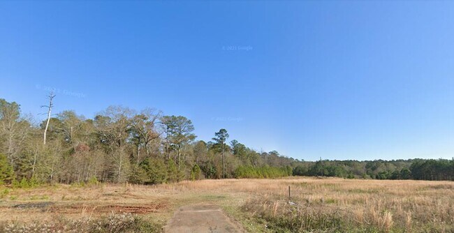
Us Highway 280 E, Americus, GA 31709
Property Detail
Us Highway 280 E
64A-15
6.35 ACRES LL 172 & 189 27TH LD
Commercialacreage
SUMTER
007
Georgia
B and X Area of moderate flood hazard, usually the area between the limits of the 100-year and 500-year floods.
6.35 AC
2025
Georgia South Area
2025
Other Market Areas
950700
Americus, GA
NEARBY LISTINGS FOR SALE OR LEASE
DEMOGRAPHICS near Us Highway 280 E
1 mile
3 mile
5 mile
2025 Total Population
3,368
16,600
20,620
2030 Population
3,244
16,326
20,302
Pop Growth 2025-2030
(3.68%)
(1.65%)
(1.54%)
Average Age
34
37
38
2025 Total Households
1,235
6,450
7,951
HH Growth 2025-2030
(4.29%)
(1.77%)
(1.66%)
Median Household Inc
$39,670
$40,903
$41,700
Avg Household Size
2.30
2.40
2.40
2025 Avg HH Vehicles
1.00
2.00
2.00
Median Home Value
$182,533
$131,777
$140,536
Median Year Built
1981
1976
1977
Nearby Places
Map Layers
Map Styles
 Street
 Aerial
Transit
 Traffic
 Biking
Places
Listings with unknown addresses are not visible on the map
- Restaurants
- Banks
- Shops
- Fitness
- Groceries
SALE & LEASE HISTORY
LISTING DATE
SALE/LEASE

Dec 01, 2023
For Sale
Nearby Properties
Address
Land Use
TOTAL SIZE
Lot Size
Zoning
Address
Land Use
TOTAL SIZE
Lot Size
Zoning
1,326 SF
155 AC
001
Address
Land Use
TOTAL SIZE
Lot Size
Zoning
99,811 SF
5.31 AC
001
Address
Land Use
TOTAL SIZE
Lot Size
Zoning
169,501 SF
21.47 AC
002
Address
Land Use
TOTAL SIZE
Lot Size
Zoning
236.60 AC
001
Address
Land Use
TOTAL SIZE
Lot Size
Zoning
103,790 SF
14.52 AC
C-1
Address
Land Use
TOTAL SIZE
Lot Size
Zoning
38,456 SF
35 AC
007
Address
Land Use
TOTAL SIZE
Lot Size
Zoning
76,704 SF
14.50 AC
002
Address
Land Use
TOTAL SIZE
Lot Size
Zoning
8.28 AC
001
Address
Land Use
TOTAL SIZE
Lot Size
Zoning
32,000 SF
33 AC
007
Address
Land Use
TOTAL SIZE
Lot Size
Zoning
66,303 SF
8.10 AC
002
Address
Land Use
TOTAL SIZE
Lot Size
Zoning
89,888 SF
27.14 AC
007
Address
Land Use
TOTAL SIZE
Lot Size
Zoning
42.75 AC
007
Address
Land Use
TOTAL SIZE
Lot Size
Zoning
13,552 SF
12 AC
Address
Land Use
TOTAL SIZE
Lot Size
Zoning
56,142 SF
1.45 AC
002
Address
Land Use
TOTAL SIZE
Lot Size
Zoning
52,000 SF
1.43 AC
001
Address
Land Use
TOTAL SIZE
Lot Size
Zoning
38,624 SF
3.76 AC
001
Address
Land Use
TOTAL SIZE
Lot Size
Zoning
12,000 SF
12.50 AC
002
Address
Land Use
TOTAL SIZE
Lot Size
Zoning
48,216 SF
9.30 AC
001
Address
Land Use
TOTAL SIZE
Lot Size
Zoning
8,218 SF
12.01 AC
002
Address
Land Use
TOTAL SIZE
Lot Size
Zoning
51.90 AC
001
Address
Land Use
TOTAL SIZE
Lot Size
Zoning
1,152 SF
116.27 AC
003
Address
Land Use
TOTAL SIZE
Lot Size
Zoning
3,086 SF
8.16 AC
002
Address
Land Use
TOTAL SIZE
Lot Size
Zoning
8,424 SF
5.58 AC
001
Address
Land Use
TOTAL SIZE
Lot Size
Zoning
29.50 AC
001
Address
Land Use
TOTAL SIZE
Lot Size
Zoning
9,420 SF
9.92 AC
001
Address
Land Use
TOTAL SIZE
Lot Size
Zoning
57,600 SF
2.40 AC
001
Address
Land Use
TOTAL SIZE
Lot Size
Zoning
29,184 SF
5 AC
001
Address
Land Use
TOTAL SIZE
Lot Size
Zoning
31,605 SF
3.90 AC
001
Address
Land Use
TOTAL SIZE
Lot Size
Zoning
22,238 SF
2.93 AC
002
The World's #1 Commercial Real Estate Marketplace
Connect with us
© 2026 CoStar Group
The information above has been obtained from sources believed reliable. While we do not doubt its accuracy we have not verified it and make no guarantee, warranty or representation about it. It is your responsibility to independently confirm its accuracy and completeness. Any projections, opinions, assumptions, or estimates used are for example only and do not represent the current or future performance of the property. The value of this transaction to you depends on tax and other factors which should be evaluated by your tax, financial, and legal advisors. You and your advisors should conduct a careful, independent investigation of the property to determine to your satisfaction the suitability of the property for your needs.