Property Record
Briarmeadow Dr Dead End, Hempstead, TX 77445


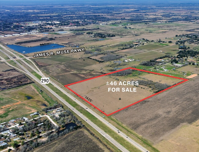
This Property Is For Sale
Property Detail
Briarmeadow Dr Dead End
Houston-Pasadena-The Woodlands, TX
ABS A312400 A-124 GEORGE A DENNETT TRACT 118-4 ACRES 45.023
152137
WALLER
Pasture
Texas
B and X Area of moderate flood hazard, usually the area between the limits of the 100-year and 500-year floods.
45.02 AC
2024
Outlying Waller County
2025
Houston
NEARBY LISTINGS FOR SALE OR LEASE
DEMOGRAPHICS near Briarmeadow Dr Dead End
1 mile
3 mile
5 mile
2025 Total Population
896
6,227
11,111
2030 Population
1,008
6,890
12,211
Pop Growth 2025-2030
+ 12.50%
+ 10.65%
+ 9.90%
Average Age
37
37
38
2025 Total Households
364
2,273
3,992
HH Growth 2025-2030
+ 12.09%
+ 10.56%
+ 9.84%
Median Household Inc
$18,895
$39,898
$47,545
Avg Household Size
2.50
2.70
2.80
2025 Avg HH Vehicles
2.00
2.00
2.00
Median Home Value
$275,999
$233,680
$262,068
Median Year Built
1990
1989
1992
Nearby Places
Map Layers
Map Styles
 Street
 Aerial
Transit
 Traffic
 Biking
Places
Listings with unknown addresses are not visible on the map
- Restaurants
- Banks
- Shops
- Fitness
- Groceries
Nearby Properties
Address
Land Use
TOTAL SIZE
Lot Size
Zoning
Address
Land Use
TOTAL SIZE
Lot Size
Zoning
315.67 AC
Address
Land Use
TOTAL SIZE
Lot Size
Zoning
Address
Land Use
TOTAL SIZE
Lot Size
Zoning
512,325 SF
63.88 AC
Address
Land Use
TOTAL SIZE
Lot Size
Zoning
189,034 SF
9.49 AC
Address
Land Use
TOTAL SIZE
Lot Size
Zoning
218,106 SF
8.72 AC
Address
Land Use
TOTAL SIZE
Lot Size
Zoning
239,994 SF
71.50 AC
Address
Land Use
TOTAL SIZE
Lot Size
Zoning
767 SF
26.68 AC
Address
Land Use
TOTAL SIZE
Lot Size
Zoning
257,734 SF
18.32 AC
Address
Land Use
TOTAL SIZE
Lot Size
Zoning
436.70 AC
Address
Land Use
TOTAL SIZE
Lot Size
Zoning
162,668 SF
39.99 AC
Address
Land Use
TOTAL SIZE
Lot Size
Zoning
140,211 SF
4.53 AC
Address
Land Use
TOTAL SIZE
Lot Size
Zoning
123,444 SF
23.37 AC
Address
Land Use
TOTAL SIZE
Lot Size
Zoning
114,480 SF
49.86 AC
Address
Land Use
TOTAL SIZE
Lot Size
Zoning
84,596 SF
4.17 AC
Address
Land Use
TOTAL SIZE
Lot Size
Zoning
62,388 SF
16.54 AC
Address
Land Use
TOTAL SIZE
Lot Size
Zoning
121,600 SF
10.06 AC
Address
Land Use
TOTAL SIZE
Lot Size
Zoning
123,852 SF
7.80 AC
Address
Land Use
TOTAL SIZE
Lot Size
Zoning
96,437 SF
12.86 AC
Address
Land Use
TOTAL SIZE
Lot Size
Zoning
97,294 SF
14.51 AC
Address
Land Use
TOTAL SIZE
Lot Size
Zoning
62,526 SF
3.10 AC
Address
Land Use
TOTAL SIZE
Lot Size
Zoning
24,572 SF
67 AC
Address
Land Use
TOTAL SIZE
Lot Size
Zoning
146,248 SF
14.62 AC
Address
Land Use
TOTAL SIZE
Lot Size
Zoning
8,167 SF
19.47 AC
Address
Land Use
TOTAL SIZE
Lot Size
Zoning
76,920 SF
16 AC
Address
Land Use
TOTAL SIZE
Lot Size
Zoning
66,520 SF
10.15 AC
Address
Land Use
TOTAL SIZE
Lot Size
Zoning
30,748 SF
17.20 AC
Address
Land Use
TOTAL SIZE
Lot Size
Zoning
83,411 SF
9.10 AC
Address
Land Use
TOTAL SIZE
Lot Size
Zoning
94,709 SF
20.91 AC
Address
Land Use
TOTAL SIZE
Lot Size
Zoning
57,880 SF
5.23 AC
Address
Land Use
TOTAL SIZE
Lot Size
Zoning
80,364 SF
25 AC
The World's #1 Commercial Real Estate Marketplace
Connect with us
© 2026 CoStar Group
The information above has been obtained from sources believed reliable. While we do not doubt its accuracy we have not verified it and make no guarantee, warranty or representation about it. It is your responsibility to independently confirm its accuracy and completeness. Any projections, opinions, assumptions, or estimates used are for example only and do not represent the current or future performance of the property. The value of this transaction to you depends on tax and other factors which should be evaluated by your tax, financial, and legal advisors. You and your advisors should conduct a careful, independent investigation of the property to determine to your satisfaction the suitability of the property for your needs.