Property Record
Us Highway 421 N, Dunn, NC 28334


Save to a Folder
{{folder.Name}}
{{folder.ListingIds.length}} Properties
{{folder.ListingIds.length}} Property
Create a New Folder
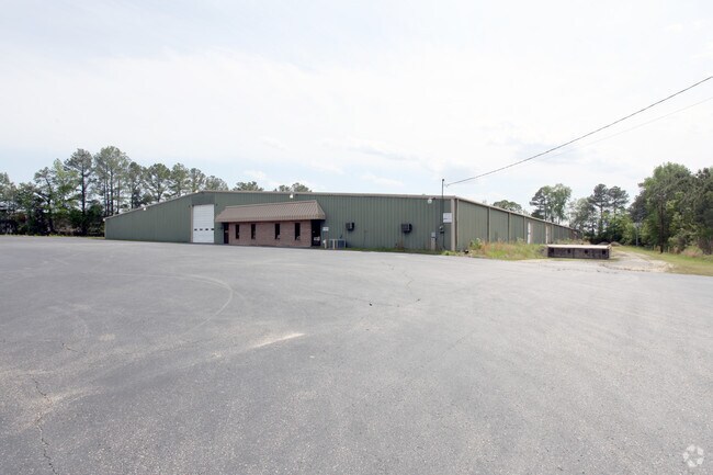
Property Detail
Us Highway 421 N
14083104004
SAMPSON
Commercialnec
North Carolina
B and X Area of moderate flood hazard, usually the area between the limits of the 100-year and 500-year floods.
4.10 AC
2025
North Carolina Southeast Area
2025
Other Market Areas
070100
NEARBY LISTINGS FOR SALE OR LEASE
DEMOGRAPHICS near Us Highway 421 N
1 mile
3 mile
5 mile
2025 Total Population
233
5,094
17,583
2030 Population
242
5,484
18,941
Pop Growth 2025-2030
+ 3.86%
+ 7.66%
+ 7.72%
Average Age
41
41
42
2025 Total Households
91
2,067
7,263
HH Growth 2025-2030
+ 3.30%
+ 7.69%
+ 7.75%
Median Household Inc
$55,000
$47,687
$48,883
Avg Household Size
2.50
2.40
2.40
2025 Avg HH Vehicles
2.00
2.00
2.00
Median Home Value
$301,562
$193,952
$228,371
Median Year Built
1991
1977
1979
Nearby Places
Map Layers
Map Styles
 Street
 Aerial
Layers
 Traffic
 Biking
Places
Listings with unknown addresses are not visible on the map
- Restaurants
- Banks
- Shops
- Fitness
- Groceries
PUBLIC TRANSPORTATION
AIRPORT
Fayetteville Regional/Grannis Field
Drive
Walk
Distance
Fayetteville Regional/Grannis Field
40 min
30.5 mi
SALE & LEASE HISTORY
LISTING DATE
SALE/LEASE

Jan 20, 2017
For Sale
Nearby Properties
Address
Land Use
TOTAL SIZE
Lot Size
Zoning
Address
Land Use
TOTAL SIZE
Lot Size
Zoning
1,444,066 SF
116.27 AC
I100
Address
Land Use
TOTAL SIZE
Lot Size
Zoning
1,336,065 SF
115.65 AC
IND
Address
Land Use
TOTAL SIZE
Lot Size
Zoning
2,410 SF
27.20 AC
Address
Land Use
TOTAL SIZE
Lot Size
Zoning
50,165 SF
3.65 AC
C3
Address
Land Use
TOTAL SIZE
Lot Size
Zoning
67,844 SF
2.64 AC
C3
Address
Land Use
TOTAL SIZE
Lot Size
Zoning
44,726 SF
34.92 AC
I10
Address
Land Use
TOTAL SIZE
Lot Size
Zoning
26,334 SF
3.45 AC
C3
Address
Land Use
TOTAL SIZE
Lot Size
Zoning
8,133 SF
9.44 AC
C3
Address
Land Use
TOTAL SIZE
Lot Size
Zoning
30,959 SF
2.14 AC
C3
Address
Land Use
TOTAL SIZE
Lot Size
Zoning
Address
Land Use
TOTAL SIZE
Lot Size
Zoning
37,716 SF
3.70 AC
C3
Address
Land Use
TOTAL SIZE
Lot Size
Zoning
43,785 SF
2.94 AC
Address
Land Use
TOTAL SIZE
Lot Size
Zoning
5,362 SF
1.24 AC
C2
Address
Land Use
TOTAL SIZE
Lot Size
Zoning
17,555 SF
12.85 AC
R10
Address
Land Use
TOTAL SIZE
Lot Size
Zoning
138.54 AC
I100
Address
Land Use
TOTAL SIZE
Lot Size
Zoning
1,755 SF
2 AC
Address
Land Use
TOTAL SIZE
Lot Size
Zoning
13,955 SF
2 AC
COMM
Address
Land Use
TOTAL SIZE
Lot Size
Zoning
47,250 SF
6.53 AC
I100
Address
Land Use
TOTAL SIZE
Lot Size
Zoning
10,062 SF
3.69 AC
C3
Address
Land Use
TOTAL SIZE
Lot Size
Zoning
21,950 SF
1.08 AC
C3
Address
Land Use
TOTAL SIZE
Lot Size
Zoning
22,500 SF
19.22 AC
IND
Address
Land Use
TOTAL SIZE
Lot Size
Zoning
21,240 SF
0.97 AC
C1
Address
Land Use
TOTAL SIZE
Lot Size
Zoning
16,353 SF
7.22 AC
COMM
Address
Land Use
TOTAL SIZE
Lot Size
Zoning
21,408 SF
5.98 AC
C3
Address
Land Use
TOTAL SIZE
Lot Size
Zoning
15,705 SF
4.56 AC
C3
Address
Land Use
TOTAL SIZE
Lot Size
Zoning
0.96 AC
Address
Land Use
TOTAL SIZE
Lot Size
Zoning
11,908 SF
1.50 AC
C3
Address
Land Use
TOTAL SIZE
Lot Size
Zoning
13,341 SF
2 AC
C3
Address
Land Use
TOTAL SIZE
Lot Size
Zoning
35,148 SF
9.20 AC
IND
Address
Land Use
TOTAL SIZE
Lot Size
Zoning
17,040 SF
12.70 AC
C3
The World's #1 Commercial Real Estate Marketplace
Connect with us
© 2026 CoStar Group
The information above has been obtained from sources believed reliable. While we do not doubt its accuracy we have not verified it and make no guarantee, warranty or representation about it. It is your responsibility to independently confirm its accuracy and completeness. Any projections, opinions, assumptions, or estimates used are for example only and do not represent the current or future performance of the property. The value of this transaction to you depends on tax and other factors which should be evaluated by your tax, financial, and legal advisors. You and your advisors should conduct a careful, independent investigation of the property to determine to your satisfaction the suitability of the property for your needs.