Property Record
Us Highway 431, , AL
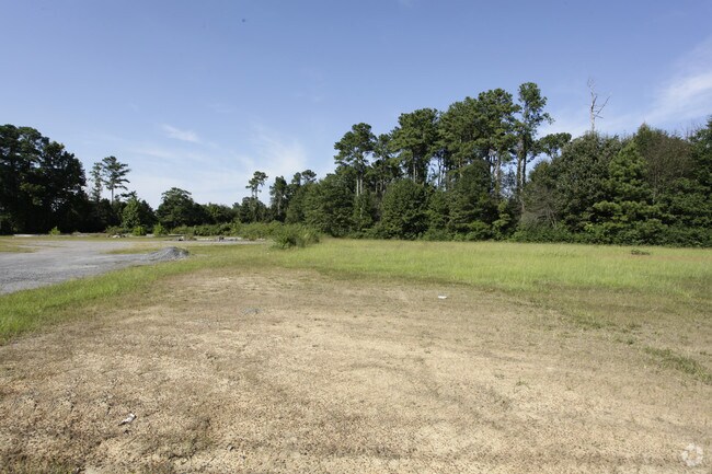
Property Detail
Us Highway 431
Albertville, AL
BEG INT N R/W LN HWY 431 & S LN NE 1/4 NW 1/4 IN SEC 4, T 9, R 4 CONT 1 AC 668-565
190204-2-002-023000
MARSHALL
Commercialacreage
Alabama
B and X Area of moderate flood hazard, usually the area between the limits of the 100-year and 500-year floods.
1.07 AC
2025
Alabama North Area
2024
Other Market Areas
030903
NEARBY LISTINGS FOR SALE OR LEASE
DEMOGRAPHICS near Us Highway 431
1 mile
3 mile
5 mile
2025 Total Population
4,052
20,471
32,853
2030 Population
4,171
21,150
34,017
Pop Growth 2025-2030
+ 2.94%
+ 3.32%
+ 3.54%
Average Age
36
36
36
2025 Total Households
1,411
7,125
11,551
HH Growth 2025-2030
+ 2.69%
+ 3.05%
+ 3.28%
Median Household Inc
$41,747
$55,520
$56,441
Avg Household Size
2.80
2.80
2.70
2025 Avg HH Vehicles
2.00
2.00
2.00
Median Home Value
$146,333
$167,992
$168,481
Median Year Built
1976
1979
1981
Nearby Places
Map Layers
Map Styles
 Street
 Aerial
Transit
 Traffic
 Biking
Places
Listings with unknown addresses are not visible on the map
- Restaurants
- Banks
- Shops
- Fitness
- Groceries
Nearby Properties
Address
Land Use
TOTAL SIZE
Lot Size
Zoning
Address
Land Use
TOTAL SIZE
Lot Size
Zoning
166,010 SF
52 AC
Address
Land Use
TOTAL SIZE
Lot Size
Zoning
219,480 SF
27 AC
Address
Land Use
TOTAL SIZE
Lot Size
Zoning
94,980 SF
13.80 AC
Address
Land Use
TOTAL SIZE
Lot Size
Zoning
125,162 SF
12.24 AC
Address
Land Use
TOTAL SIZE
Lot Size
Zoning
176,389 SF
14 AC
Address
Land Use
TOTAL SIZE
Lot Size
Zoning
84,300 SF
6.20 AC
Address
Land Use
TOTAL SIZE
Lot Size
Zoning
140,800 SF
20.80 AC
Address
Land Use
TOTAL SIZE
Lot Size
Zoning
36,894 SF
4.72 AC
Address
Land Use
TOTAL SIZE
Lot Size
Zoning
136,255 SF
25 AC
Address
Land Use
TOTAL SIZE
Lot Size
Zoning
77,172 SF
1.61 AC
Address
Land Use
TOTAL SIZE
Lot Size
Zoning
33,539 SF
5.96 AC
Address
Land Use
TOTAL SIZE
Lot Size
Zoning
21,144 SF
1.86 AC
Address
Land Use
TOTAL SIZE
Lot Size
Zoning
74,600 SF
2.48 AC
Address
Land Use
TOTAL SIZE
Lot Size
Zoning
4,622 SF
2.01 AC
Address
Land Use
TOTAL SIZE
Lot Size
Zoning
98,833 SF
28.30 AC
Address
Land Use
TOTAL SIZE
Lot Size
Zoning
51,638 SF
20 AC
Address
Land Use
TOTAL SIZE
Lot Size
Zoning
53,752 SF
9.40 AC
Address
Land Use
TOTAL SIZE
Lot Size
Zoning
16,528 SF
11 AC
Address
Land Use
TOTAL SIZE
Lot Size
Zoning
61,248 SF
0.51 AC
Address
Land Use
TOTAL SIZE
Lot Size
Zoning
47,866 SF
15 AC
Address
Land Use
TOTAL SIZE
Lot Size
Zoning
1,988 SF
8.50 AC
Address
Land Use
TOTAL SIZE
Lot Size
Zoning
148,729 SF
14.10 AC
Address
Land Use
TOTAL SIZE
Lot Size
Zoning
29,741 SF
3.07 AC
Address
Land Use
TOTAL SIZE
Lot Size
Zoning
26,320 SF
27 AC
Address
Land Use
TOTAL SIZE
Lot Size
Zoning
96,272 SF
5.70 AC
Address
Land Use
TOTAL SIZE
Lot Size
Zoning
77,270 SF
7.10 AC
Address
Land Use
TOTAL SIZE
Lot Size
Zoning
10,240 SF
3.40 AC
Address
Land Use
TOTAL SIZE
Lot Size
Zoning
27,886 SF
7 AC
Address
Land Use
TOTAL SIZE
Lot Size
Zoning
41,204 SF
8 AC
Address
Land Use
TOTAL SIZE
Lot Size
Zoning
42,097 SF
0.98 AC
The World's #1 Commercial Real Estate Marketplace
Connect with us
© 2026 CoStar Group
The information above has been obtained from sources believed reliable. While we do not doubt its accuracy we have not verified it and make no guarantee, warranty or representation about it. It is your responsibility to independently confirm its accuracy and completeness. Any projections, opinions, assumptions, or estimates used are for example only and do not represent the current or future performance of the property. The value of this transaction to you depends on tax and other factors which should be evaluated by your tax, financial, and legal advisors. You and your advisors should conduct a careful, independent investigation of the property to determine to your satisfaction the suitability of the property for your needs.