Property Record
Us Highway 431, Alexandria, AL 36250

NEARBY LISTINGS FOR SALE OR LEASE
-
-
View all Alexandria listings for sale on LoopNet.com
Property Detail
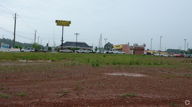
Us Highway 431
13-08-27-0-001-045.000
SEC 27 TSP 14S RNG 07E BEG INT W LINE SEC 27 & N ROW AL HWY 144 TH N 550 E 712 SE 250 SW 195.4 SW 183.6 W 490.2 TO POB
Vacantlandnec
Calhoun
X
Alabama
01015C0145E
4.80 AC
2025
Gadsden/Anniston Area
2025
Other Market Areas
002504
Anniston-Oxford-Jacksonville, AL
DEMOGRAPHICS near Us Highway 431
1 Mile
3 Mile
5 Mile
2024 Total Population
725
5,081
12,713
2029 Population
705
4,920
12,352
Pop Growth 2024-2029
(2.76%)
(3.17%)
(2.84%)
Average Age
41
41
42
2024 Total Households
277
1,952
4,984
HH Growth 2024-2029
(2.89%)
(3.28%)
(2.91%)
Median Household Inc
$78,125
$78,151
$71,401
Avg Household Size
2.50
2.50
2.50
2024 Avg HH Vehicles
3.00
2.00
2.00
Median Home Value
$157,303
$159,366
$147,967
Median Year Built
1987
1985
1981
Nearby Places
Map Layers
Map Styles
 Street
 Aerial
- Restaurants
- Banks
- Shops
- Fitness
- Groceries
Nearby Properties
Address
Land Use
TOTAL SIZE
Lot Size
Zoning
Address
Land Use
TOTAL SIZE
Lot Size
Zoning
2,313 SF
19 AC
Address
Land Use
TOTAL SIZE
Lot Size
Zoning
6,610 SF
23 AC
Address
Land Use
TOTAL SIZE
Lot Size
Zoning
39,064 SF
6 AC
Address
Land Use
TOTAL SIZE
Lot Size
Zoning
3,400 SF
12.28 AC
Address
Land Use
TOTAL SIZE
Lot Size
Zoning
26,956 SF
4.05 AC
Address
Land Use
TOTAL SIZE
Lot Size
Zoning
6,000 SF
35 AC
Address
Land Use
TOTAL SIZE
Lot Size
Zoning
14,708 SF
4.78 AC
Address
Land Use
TOTAL SIZE
Lot Size
Zoning
19,080 SF
3 AC
Address
Land Use
TOTAL SIZE
Lot Size
Zoning
7,724 SF
4.83 AC
Address
Land Use
TOTAL SIZE
Lot Size
Zoning
32,000 SF
16.60 AC
Address
Land Use
TOTAL SIZE
Lot Size
Zoning
11,078 SF
24.05 AC
Address
Land Use
TOTAL SIZE
Lot Size
Zoning
3,857 SF
4.10 AC
Address
Land Use
TOTAL SIZE
Lot Size
Zoning
10,672 SF
2.26 AC
Address
Land Use
TOTAL SIZE
Lot Size
Zoning
3,320 SF
2.60 AC
Address
Land Use
TOTAL SIZE
Lot Size
Zoning
3,752 SF
2.98 AC
Address
Land Use
TOTAL SIZE
Lot Size
Zoning
17,270 SF
2.11 AC
Address
Land Use
TOTAL SIZE
Lot Size
Zoning
3,553 SF
1.17 AC
Address
Land Use
TOTAL SIZE
Lot Size
Zoning
16,492 SF
1.46 AC
Address
Land Use
TOTAL SIZE
Lot Size
Zoning
10,632 SF
3.04 AC
Address
Land Use
TOTAL SIZE
Lot Size
Zoning
17,351 SF
2.49 AC
Address
Land Use
TOTAL SIZE
Lot Size
Zoning
10,500 SF
8.10 AC
Address
Land Use
TOTAL SIZE
Lot Size
Zoning
5,084 SF
2.12 AC
Address
Land Use
TOTAL SIZE
Lot Size
Zoning
3,318 SF
0.93 AC
Address
Land Use
TOTAL SIZE
Lot Size
Zoning
3.20 AC
Address
Land Use
TOTAL SIZE
Lot Size
Zoning
6,068 SF
4.75 AC
Address
Land Use
TOTAL SIZE
Lot Size
Zoning
8,450 SF
2.60 AC
Address
Land Use
TOTAL SIZE
Lot Size
Zoning
16,354 SF
2.20 AC
Address
Land Use
TOTAL SIZE
Lot Size
Zoning
7,060 SF
11 AC
Address
Land Use
TOTAL SIZE
Lot Size
Zoning
9,000 SF
1.24 AC
Address
Land Use
TOTAL SIZE
Lot Size
Zoning
9,900 SF
2.19 AC
The World's #1 Commercial Real Estate Marketplace
Connect with us
© 2026 CoStar Group
The information above has been obtained from sources believed reliable. While we do not doubt its accuracy we have not verified it and make no guarantee, warranty or representation about it. It is your responsibility to independently confirm its accuracy and completeness. Any projections, opinions, assumptions, or estimates used are for example only and do not represent the current or future performance of the property. The value of this transaction to you depends on tax and other factors which should be evaluated by your tax, financial, and legal advisors. You and your advisors should conduct a careful, independent investigation of the property to determine to your satisfaction the suitability of the property for your needs.