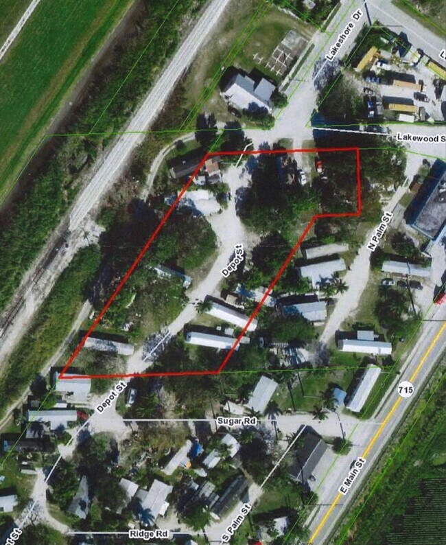
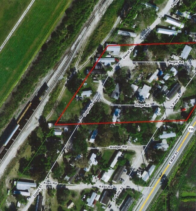
Property Record
Us Highway 441, Pahokee, FL 33476

NEARBY LISTINGS FOR SALE OR LEASE
Property Detail
Us Highway 441
West Palm Beach-Boca Raton-Delray Beach, FL
Acreage & Unrec
48-37-42-04-00-000-1060
4-42-37~ S 185 FT OF NLY 1584.43 FT OF WLY 190.40 FT LYG W OF & ADJ TO MEANDER LI BEING PT OF ST LT 3 AS IN OR3831P184
Vacantlandnec
Palm Beach
AE
Florida
12099C0257F
3
2024
0.78 AC
2025
Palm Bch Cty Outlying
008002
South Florida
DEMOGRAPHICS near Us Highway 441
1 Mile
3 Mile
5 Mile
2024 Total Population
377
5,006
7,736
2029 Population
384
5,168
7,971
Pop Growth 2024-2029
+ 1.86%
+ 3.24%
+ 3.04%
Average Age
38
37
36
2024 Total Households
119
1,511
2,431
HH Growth 2024-2029
+ 0.84%
+ 2.71%
+ 2.43%
Median Household Inc
$14,397
$23,070
$23,010
Avg Household Size
3.00
2.90
2.90
2024 Avg HH Vehicles
2.00
2.00
1.00
Median Home Value
$221,428
$169,374
$140,082
Median Year Built
1969
1970
1972
Nearby Places
Map Layers
Map Styles
 Street
 Aerial
- Restaurants
- Banks
- Shops
- Fitness
- Groceries
SALE & LEASE HISTORY
LISTING DATE
SALE/LEASE

Jun 27, 2021
For Sale
Nearby Properties
Address
Land Use
TOTAL SIZE
Lot Size
Zoning
Address
Land Use
TOTAL SIZE
Lot Size
Zoning
198,172 SF
15.08 AC
PF
Address
Land Use
TOTAL SIZE
Lot Size
Zoning
97,658 SF
19.97 AC
AP
Address
Land Use
TOTAL SIZE
Lot Size
Zoning
164,185 SF
33.70 AC
PF
Address
Land Use
TOTAL SIZE
Lot Size
Zoning
78,217 SF
16.09 AC
PO
Address
Land Use
TOTAL SIZE
Lot Size
Zoning
10,513 SF
33.29 AC
WOR
Address
Land Use
TOTAL SIZE
Lot Size
Zoning
10,972 SF
549.28 AC
AP
Address
Land Use
TOTAL SIZE
Lot Size
Zoning
28,878 SF
2.47 AC
SFMU
Address
Land Use
TOTAL SIZE
Lot Size
Zoning
47,310 SF
7.65 AC
RH
Address
Land Use
TOTAL SIZE
Lot Size
Zoning
49,753 SF
8.67 AC
CORE
Address
Land Use
TOTAL SIZE
Lot Size
Zoning
74,714 SF
10.87 AC
RM
Address
Land Use
TOTAL SIZE
Lot Size
Zoning
12,587 SF
15.02 AC
AG
Address
Land Use
TOTAL SIZE
Lot Size
Zoning
31,532 SF
2.42 AC
PF
Address
Land Use
TOTAL SIZE
Lot Size
Zoning
8,821 SF
2.68 AC
AG
Address
Land Use
TOTAL SIZE
Lot Size
Zoning
72,518 SF
7.06 AC
RH
Address
Land Use
TOTAL SIZE
Lot Size
Zoning
7,690 SF
2.53 AC
PF
Address
Land Use
TOTAL SIZE
Lot Size
Zoning
42,042 SF
5.67 AC
MF12
Address
Land Use
TOTAL SIZE
Lot Size
Zoning
9,173 SF
0.91 AC
CORE
Address
Land Use
TOTAL SIZE
Lot Size
Zoning
19,054 SF
2.86 AC
SFMU
Address
Land Use
TOTAL SIZE
Lot Size
Zoning
21,671 SF
1.85 AC
AP
Address
Land Use
TOTAL SIZE
Lot Size
Zoning
14,940 SF
1.90 AC
CORE
Address
Land Use
TOTAL SIZE
Lot Size
Zoning
5,379 SF
0.98 AC
CORE
Address
Land Use
TOTAL SIZE
Lot Size
Zoning
80,706 SF
551.07 AC
AP
Address
Land Use
TOTAL SIZE
Lot Size
Zoning
18,600 SF
0.52 AC
GC
Address
Land Use
TOTAL SIZE
Lot Size
Zoning
18,380 SF
2.60 AC
NC
Address
Land Use
TOTAL SIZE
Lot Size
Zoning
8,577 SF
0.84 AC
CORE
Address
Land Use
TOTAL SIZE
Lot Size
Zoning
10,652 SF
0.85 AC
LI
Address
Land Use
TOTAL SIZE
Lot Size
Zoning
34,242 SF
2.64 AC
MF18
Address
Land Use
TOTAL SIZE
Lot Size
Zoning
19,168 SF
0.65 AC
CORE
Address
Land Use
TOTAL SIZE
Lot Size
Zoning
13,965 SF
1 AC
SF7
Address
Land Use
TOTAL SIZE
Lot Size
Zoning
10,497 SF
0.99 AC
AG
The World's #1 Commercial Real Estate Marketplace
Connect with us
© 2025 CoStar Group
The information above has been obtained from sources believed reliable. While we do not doubt its accuracy we have not verified it and make no guarantee, warranty or representation about it. It is your responsibility to independently confirm its accuracy and completeness. Any projections, opinions, assumptions, or estimates used are for example only and do not represent the current or future performance of the property. The value of this transaction to you depends on tax and other factors which should be evaluated by your tax, financial, and legal advisors. You and your advisors should conduct a careful, independent investigation of the property to determine to your satisfaction the suitability of the property for your needs.