Property Record
Us Highway 542 W, Winter Haven, FL 33880

Current Lease Availabilities
NEARBY LISTINGS FOR SALE OR LEASE
Property Detail
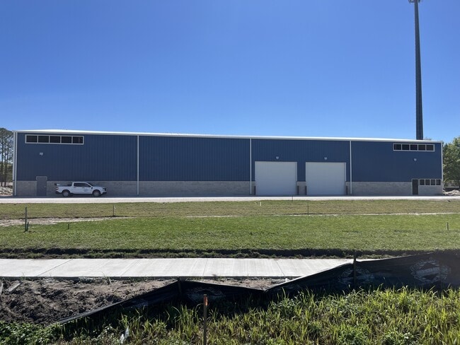
Us Highway 542 W
Lakeland-Winter Haven, FL
Lombardi Joe Inc
25-28-22-000000-043140
W 230 FT OF E 260 FT OF W 660 FT OF SEC LYING S OF SR 542 LESS E 30 FT & LESS S 2310 FT & LESS W 30 FT & LESS ADDNL RD R/W PER OR 13012-1748
Commercialacreage
Polk
X
Florida
12105C0345G
1.24 AC
2024
Polk County
2025
Tampa/St Petersburg
013802
DEMOGRAPHICS near Us Highway 542 W
1 Mile
3 Mile
5 Mile
2024 Total Population
2,046
33,085
91,331
2029 Population
2,881
46,958
130,491
Pop Growth 2024-2029
+ 40.81%
+ 41.93%
+ 42.88%
Average Age
40
39
41
2024 Total Households
760
12,322
36,114
HH Growth 2024-2029
+ 41.32%
+ 42.54%
+ 43.52%
Median Household Inc
$59,791
$50,499
$53,823
Avg Household Size
2.70
2.60
2.50
2024 Avg HH Vehicles
2.00
2.00
2.00
Median Home Value
$197,402
$153,360
$171,868
Median Year Built
1981
1980
1983
Nearby Places
- Restaurants
- Banks
- Shops
- Fitness
- Groceries
PUBLIC TRANSPORTATION
COMMUTER RAIL
Winter Haven (Silver Meteor - Amtrak, Silver Star - Amtrak)
DRIVE
WALK
Distance
Winter Haven (Silver Meteor - Amtrak, Silver Star - Amtrak)
10 min
5.8 mi
Lakeland (Silver Star - Amtrak)
DRIVE
WALK
Distance
Lakeland (Silver Star - Amtrak)
17 min
9.4 mi
Freight Ports
Port of Tampa Bay
DRIVE
WALK
Distance
Port of Tampa Bay
61 min
46.0 mi
Nearby Properties
Address
Land Use
TOTAL SIZE
Lot Size
Zoning
Address
Land Use
TOTAL SIZE
Lot Size
Zoning
942,646 SF
91.30 AC
R3
Address
Land Use
TOTAL SIZE
Lot Size
Zoning
238,721 SF
11.66 AC
GI
Address
Land Use
TOTAL SIZE
Lot Size
Zoning
202,567 SF
189.02 AC
RE1
Address
Land Use
TOTAL SIZE
Lot Size
Zoning
215,942 SF
43.90 AC
Address
Land Use
TOTAL SIZE
Lot Size
Zoning
110,108 SF
10 AC
Address
Land Use
TOTAL SIZE
Lot Size
Zoning
136,724 SF
4.62 AC
GI
Address
Land Use
TOTAL SIZE
Lot Size
Zoning
200,200 SF
10.29 AC
Address
Land Use
TOTAL SIZE
Lot Size
Zoning
503,625 SF
20.61 AC
Address
Land Use
TOTAL SIZE
Lot Size
Zoning
108,360 SF
4.23 AC
GI
Address
Land Use
TOTAL SIZE
Lot Size
Zoning
188,553 SF
29.12 AC
Address
Land Use
TOTAL SIZE
Lot Size
Zoning
178,899 SF
10.09 AC
GI
Address
Land Use
TOTAL SIZE
Lot Size
Zoning
241,319 SF
5.67 AC
Address
Land Use
TOTAL SIZE
Lot Size
Zoning
173,328 SF
37.45 AC
C3
Address
Land Use
TOTAL SIZE
Lot Size
Zoning
84,129 SF
336.67 AC
Address
Land Use
TOTAL SIZE
Lot Size
Zoning
129,567 SF
11.72 AC
C3
Address
Land Use
TOTAL SIZE
Lot Size
Zoning
135,247 SF
22.49 AC
C4
Address
Land Use
TOTAL SIZE
Lot Size
Zoning
91,962 SF
19.46 AC
R4
Address
Land Use
TOTAL SIZE
Lot Size
Zoning
191,975 SF
14.28 AC
HI
Address
Land Use
TOTAL SIZE
Lot Size
Zoning
174,108 SF
4.82 AC
Address
Land Use
TOTAL SIZE
Lot Size
Zoning
126,384 SF
4.67 AC
CH
Address
Land Use
TOTAL SIZE
Lot Size
Zoning
320,765 SF
14.93 AC
GI
Address
Land Use
TOTAL SIZE
Lot Size
Zoning
268,800 SF
9.22 AC
Address
Land Use
TOTAL SIZE
Lot Size
Zoning
243,600 SF
35.47 AC
C4
Address
Land Use
TOTAL SIZE
Lot Size
Zoning
42,668 SF
9.44 AC
R2
Address
Land Use
TOTAL SIZE
Lot Size
Zoning
309,124 SF
31.33 AC
XX
Address
Land Use
TOTAL SIZE
Lot Size
Zoning
231,000 SF
10.10 AC
Address
Land Use
TOTAL SIZE
Lot Size
Zoning
80,280 SF
25.05 AC
Address
Land Use
TOTAL SIZE
Lot Size
Zoning
122,260 SF
4.77 AC
Address
Land Use
TOTAL SIZE
Lot Size
Zoning
90,077 SF
12.41 AC
Address
Land Use
TOTAL SIZE
Lot Size
Zoning
50,869 SF
5.98 AC
C3
The World's #1 Commercial Real Estate Marketplace
Connect with us
© 2025 CoStar Group
The information above has been obtained from sources believed reliable. While we do not doubt its accuracy we have not verified it and make no guarantee, warranty or representation about it. It is your responsibility to independently confirm its accuracy and completeness. Any projections, opinions, assumptions, or estimates used are for example only and do not represent the current or future performance of the property. The value of this transaction to you depends on tax and other factors which should be evaluated by your tax, financial, and legal advisors. You and your advisors should conduct a careful, independent investigation of the property to determine to your satisfaction the suitability of the property for your needs.