Property Record
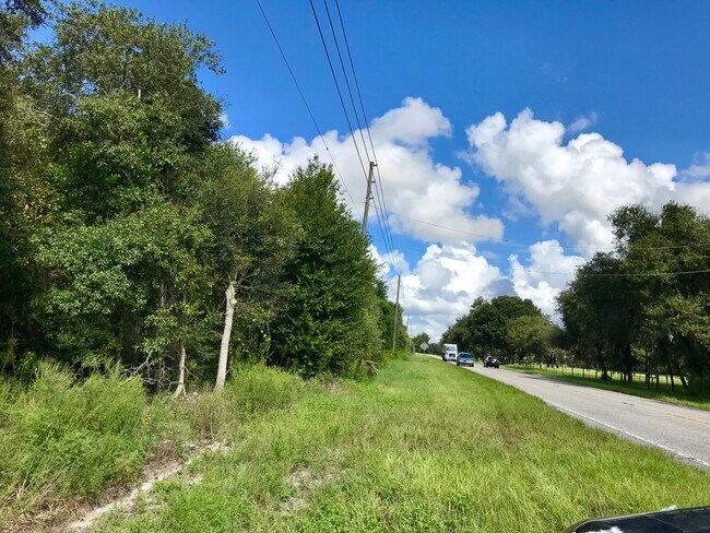
Us Highway 544 E, Haines City, FL 33844

NEARBY LISTINGS FOR SALE OR LEASE
Property Detail
Us Highway 544 E
Lakeland-Winter Haven, FL
Alameda Heights
27-28-02-000000-031030
COMM AT NW COR OF SEC 2 RUN S 40 FT TO S R/W LINE RUN E ALONG S R/W LINE 661.65 FT TO POB CONT E ALONG S R/W LINE 369.64 FT CURVE RIGHT SELY 295.79 FT TO INTERSECTION WITH E BDRY OF NW1/4 OF NW1/4 OF SEC RUN S ALONG SAID E BDRY 1258.81 FT TO PT LYING
Vacantlandnec
Polk
X
Florida
12105C0380G
9
2024
25.24 AC
2025
Polk County
012701
Tampa/St Petersburg
DEMOGRAPHICS near Us Highway 544 E
1 Mile
3 Mile
5 Mile
2024 Total Population
3,719
32,974
78,992
2029 Population
4,516
40,188
96,845
Pop Growth 2024-2029
+ 21.43%
+ 21.88%
+ 22.60%
Average Age
37
41
41
2024 Total Households
1,208
12,050
29,108
HH Growth 2024-2029
+ 21.36%
+ 22.02%
+ 22.55%
Median Household Inc
$55,537
$45,050
$54,218
Avg Household Size
3.00
2.70
2.70
2024 Avg HH Vehicles
2.00
2.00
2.00
Median Home Value
$271,979
$163,875
$202,364
Median Year Built
1995
1990
1996
Nearby Places
Map Layers
Map Styles
 Street
 Aerial
- Restaurants
- Banks
- Shops
- Fitness
- Groceries
PUBLIC TRANSPORTATION
AIRPORT
Orlando International
DRIVE
WALK
Distance
Orlando International
61 min
43.3 mi
Freight Ports
Port of Tampa Bay
DRIVE
WALK
Distance
Port of Tampa Bay
87 min
58.5 mi
SALE & LEASE HISTORY
LISTING DATE
SALE/LEASE

Nov 29, 2020
For Sale
Nearby Properties
Address
Land Use
TOTAL SIZE
Lot Size
Zoning
Address
Land Use
TOTAL SIZE
Lot Size
Zoning
807,937 SF
72.45 AC
Address
Land Use
TOTAL SIZE
Lot Size
Zoning
312,653 SF
51.81 AC
Address
Land Use
TOTAL SIZE
Lot Size
Zoning
190,153 SF
118.87 AC
Address
Land Use
TOTAL SIZE
Lot Size
Zoning
200,070 SF
19.09 AC
Address
Land Use
TOTAL SIZE
Lot Size
Zoning
154,429 SF
51.75 AC
Address
Land Use
TOTAL SIZE
Lot Size
Zoning
200,000 SF
22.75 AC
Address
Land Use
TOTAL SIZE
Lot Size
Zoning
379,597 SF
40.77 AC
OUA
Address
Land Use
TOTAL SIZE
Lot Size
Zoning
103,673 SF
17.12 AC
Address
Land Use
TOTAL SIZE
Lot Size
Zoning
92,502 SF
15.22 AC
Address
Land Use
TOTAL SIZE
Lot Size
Zoning
78,344 SF
17.46 AC
Address
Land Use
TOTAL SIZE
Lot Size
Zoning
160,916 SF
38.59 AC
Address
Land Use
TOTAL SIZE
Lot Size
Zoning
40,156 SF
13.54 AC
R3
Address
Land Use
TOTAL SIZE
Lot Size
Zoning
94,518 SF
43.26 AC
Address
Land Use
TOTAL SIZE
Lot Size
Zoning
100,910 SF
12.49 AC
ILW
Address
Land Use
TOTAL SIZE
Lot Size
Zoning
35,772 SF
14.75 AC
RC
Address
Land Use
TOTAL SIZE
Lot Size
Zoning
37,176 SF
15.29 AC
Address
Land Use
TOTAL SIZE
Lot Size
Zoning
86,942 SF
20 AC
Address
Land Use
TOTAL SIZE
Lot Size
Zoning
21,510 SF
29 AC
RC
Address
Land Use
TOTAL SIZE
Lot Size
Zoning
75,054 SF
5.44 AC
Address
Land Use
TOTAL SIZE
Lot Size
Zoning
34,063 SF
21.84 AC
R1A
Address
Land Use
TOTAL SIZE
Lot Size
Zoning
60,928 SF
8.91 AC
Address
Land Use
TOTAL SIZE
Lot Size
Zoning
26,931 SF
3.10 AC
R2
Address
Land Use
TOTAL SIZE
Lot Size
Zoning
44,332 SF
10.18 AC
ILW
Address
Land Use
TOTAL SIZE
Lot Size
Zoning
23,800 SF
4.77 AC
OUA
Address
Land Use
TOTAL SIZE
Lot Size
Zoning
48,228 SF
1.38 AC
RIO
Address
Land Use
TOTAL SIZE
Lot Size
Zoning
176,355 SF
9.59 AC
IH
Address
Land Use
TOTAL SIZE
Lot Size
Zoning
25,666 SF
5.23 AC
R3
Address
Land Use
TOTAL SIZE
Lot Size
Zoning
39,750 SF
7.01 AC
Address
Land Use
TOTAL SIZE
Lot Size
Zoning
39,870 SF
8.74 AC
Address
Land Use
TOTAL SIZE
Lot Size
Zoning
74,000 SF
16.85 AC
The World's #1 Commercial Real Estate Marketplace
Connect with us
© 2026 CoStar Group
The information above has been obtained from sources believed reliable. While we do not doubt its accuracy we have not verified it and make no guarantee, warranty or representation about it. It is your responsibility to independently confirm its accuracy and completeness. Any projections, opinions, assumptions, or estimates used are for example only and do not represent the current or future performance of the property. The value of this transaction to you depends on tax and other factors which should be evaluated by your tax, financial, and legal advisors. You and your advisors should conduct a careful, independent investigation of the property to determine to your satisfaction the suitability of the property for your needs.