Property Record
W Highway 80, Forney, TX 75126

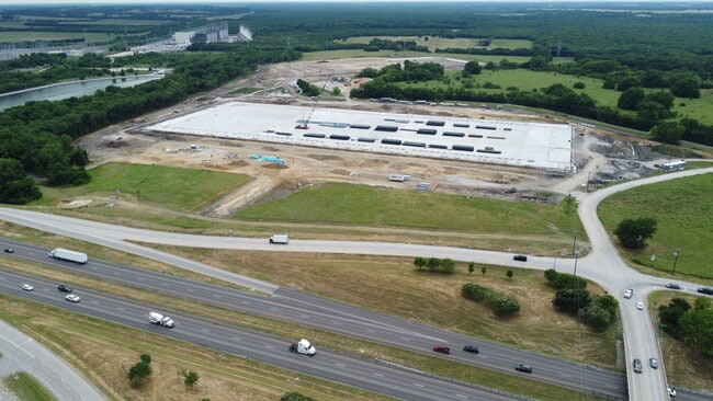
Property Detail
W Highway 80
Dallas-Fort Worth-Arlington, TX
SAMUEL COATS, TRACT 10.00; 185. ACRES
3891
KAUFMAN
Farms
Texas
AE The base floodplain where base flood elevations are provided. AE Zones are now used on new format FIRMs instead of A1-A30 Zones.
185 AC
2024
Mesquite/Forney/Terrell
2025
Dallas/Ft Worth
050214
NEARBY LISTINGS FOR SALE OR LEASE
DEMOGRAPHICS near W Highway 80
1 mile
3 mile
5 mile
2025 Total Population
2,333
39,965
104,714
2030 Population
3,073
51,797
129,119
Pop Growth 2025-2030
+ 31.72%
+ 29.61%
+ 23.31%
Average Age
38
33
34
2025 Total Households
813
12,281
32,228
HH Growth 2025-2030
+ 29.64%
+ 27.29%
+ 21.62%
Median Household Inc
$87,092
$97,335
$106,322
Avg Household Size
2.90
3.10
3.10
2025 Avg HH Vehicles
2.00
2.00
2.00
Median Home Value
$362,068
$352,279
$359,314
Median Year Built
2010
2010
2010
Nearby Places
Map Layers
Map Styles
 Street
 Aerial
Layers
 Traffic
 Biking
Places
Listings with unknown addresses are not visible on the map
- Restaurants
- Banks
- Shops
- Fitness
- Groceries
PUBLIC TRANSPORTATION
AIRPORT
Dallas Love Field
Drive
Walk
Distance
Dallas Love Field
34 min
21.8 mi
Freight Ports
Port of Shreveport
Drive
Walk
Distance
Port of Shreveport
192 min
179.7 mi
SALE & LEASE HISTORY
LISTING DATE
SALE/LEASE

Mar 01, 2021
For Sale
Nearby Properties
Address
Land Use
TOTAL SIZE
Lot Size
Zoning
Address
Land Use
TOTAL SIZE
Lot Size
Zoning
256,600 SF
80.73 AC
Z265
Address
Land Use
TOTAL SIZE
Lot Size
Zoning
877,230 SF
102.36 AC
Z05
Address
Land Use
TOTAL SIZE
Lot Size
Zoning
649,398 SF
42.19 AC
Address
Land Use
TOTAL SIZE
Lot Size
Zoning
592,958 SF
32.34 AC
Address
Land Use
TOTAL SIZE
Lot Size
Zoning
643,200 SF
30.02 AC
Z109
Address
Land Use
TOTAL SIZE
Lot Size
Zoning
0.03 AC
Z63
Address
Land Use
TOTAL SIZE
Lot Size
Zoning
35.49 AC
Address
Land Use
TOTAL SIZE
Lot Size
Zoning
66.34 AC
Address
Land Use
TOTAL SIZE
Lot Size
Zoning
379,619 SF
24.68 AC
Z376
Address
Land Use
TOTAL SIZE
Lot Size
Zoning
333,000 SF
17.04 AC
Address
Land Use
TOTAL SIZE
Lot Size
Zoning
310,900 SF
18.01 AC
Address
Land Use
TOTAL SIZE
Lot Size
Zoning
342,000 SF
26.44 AC
Address
Land Use
TOTAL SIZE
Lot Size
Zoning
328,530 SF
17.37 AC
Z109
Address
Land Use
TOTAL SIZE
Lot Size
Zoning
182,369 SF
12.38 AC
Z117
Address
Land Use
TOTAL SIZE
Lot Size
Zoning
139,030 SF
0.01 AC
Z31
Address
Land Use
TOTAL SIZE
Lot Size
Zoning
37,448 SF
7.02 AC
Z109
Address
Land Use
TOTAL SIZE
Lot Size
Zoning
8,086 SF
91.28 AC
Z117
Address
Land Use
TOTAL SIZE
Lot Size
Zoning
22,878 SF
2.40 AC
Z267
Address
Land Use
TOTAL SIZE
Lot Size
Zoning
16,352 SF
13.70 AC
Z267
Address
Land Use
TOTAL SIZE
Lot Size
Zoning
78.56 AC
Z117
Address
Land Use
TOTAL SIZE
Lot Size
Zoning
75.17 AC
Z267
Address
Land Use
TOTAL SIZE
Lot Size
Zoning
32.47 AC
Z267
Address
Land Use
TOTAL SIZE
Lot Size
Zoning
23,711 SF
2.15 AC
Z267
Address
Land Use
TOTAL SIZE
Lot Size
Zoning
22,173 SF
9.56 AC
Z267
Address
Land Use
TOTAL SIZE
Lot Size
Zoning
18.04 AC
Address
Land Use
TOTAL SIZE
Lot Size
Zoning
12,000 SF
147.17 AC
Address
Land Use
TOTAL SIZE
Lot Size
Zoning
3,000 SF
181.74 AC
Address
Land Use
TOTAL SIZE
Lot Size
Zoning
36.99 AC
Z104
Address
Land Use
TOTAL SIZE
Lot Size
Zoning
109.20 AC
Z05
Address
Land Use
TOTAL SIZE
Lot Size
Zoning
113.40 AC
Z267
The World's #1 Commercial Real Estate Marketplace
Connect with us
© 2026 CoStar Group
The information above has been obtained from sources believed reliable. While we do not doubt its accuracy we have not verified it and make no guarantee, warranty or representation about it. It is your responsibility to independently confirm its accuracy and completeness. Any projections, opinions, assumptions, or estimates used are for example only and do not represent the current or future performance of the property. The value of this transaction to you depends on tax and other factors which should be evaluated by your tax, financial, and legal advisors. You and your advisors should conduct a careful, independent investigation of the property to determine to your satisfaction the suitability of the property for your needs.