Property Record
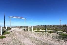
Us Highway 359, Laredo, TX 78043

NEARBY LISTINGS FOR SALE OR LEASE
Property Detail
Us Highway 359
Laredo, TX
Weatherford
304720
WEATHERFORD, BLOCK 1, LOT 1, PHASE 1
Commercialnec
Webb
X
Texas
48479C1385C
1
2024
1.62 AC
2025
Texas South Area
001003
Other Market Areas
DEMOGRAPHICS near Us Highway 359
1 Mile
3 Mile
5 Mile
2024 Total Population
1,266
11,822
70,030
2029 Population
1,274
12,155
70,686
Pop Growth 2024-2029
+ 0.63%
+ 2.82%
+ 0.94%
Average Age
30
29
32
2024 Total Households
304
3,101
19,106
HH Growth 2024-2029
+ 0.66%
+ 2.97%
+ 0.95%
Median Household Inc
$30,568
$77,904
$53,433
Avg Household Size
4.00
3.80
3.60
2024 Avg HH Vehicles
2.00
2.00
2.00
Median Home Value
$120,792
$154,350
$138,413
Median Year Built
1995
2007
1998
Nearby Places
Map Layers
Map Styles
 Street
 Aerial
- Restaurants
- Banks
- Shops
- Fitness
- Groceries
PUBLIC TRANSPORTATION
AIRPORT
Laredo International
DRIVE
WALK
Distance
Laredo International
9 min
5.6 mi
Freight Ports
Port of Corpus Christi
DRIVE
WALK
Distance
Port of Corpus Christi
162 min
142.0 mi
SALE & LEASE HISTORY
LISTING DATE
SALE/LEASE

Aug 26, 2017
For Sale
Nearby Properties
Address
Land Use
TOTAL SIZE
Lot Size
Zoning
Address
Land Use
TOTAL SIZE
Lot Size
Zoning
310,346 SF
87.65 AC
R1A
Address
Land Use
TOTAL SIZE
Lot Size
Zoning
347,773 SF
49.74 AC
R1
Address
Land Use
TOTAL SIZE
Lot Size
Zoning
165,608 SF
28.50 AC
R2
Address
Land Use
TOTAL SIZE
Lot Size
Zoning
380,420 SF
9.18 AC
B3
Address
Land Use
TOTAL SIZE
Lot Size
Zoning
169,339 SF
28 AC
Address
Land Use
TOTAL SIZE
Lot Size
Zoning
108,994 SF
15.39 AC
Address
Land Use
TOTAL SIZE
Lot Size
Zoning
107,824 SF
13.38 AC
R1
Address
Land Use
TOTAL SIZE
Lot Size
Zoning
96,665 SF
12.03 AC
R1A
Address
Land Use
TOTAL SIZE
Lot Size
Zoning
95,769 SF
10 AC
R1
Address
Land Use
TOTAL SIZE
Lot Size
Zoning
79,764 SF
30 AC
R1
Address
Land Use
TOTAL SIZE
Lot Size
Zoning
95,612 SF
10 AC
R1A
Address
Land Use
TOTAL SIZE
Lot Size
Zoning
136,195 SF
9.50 AC
Address
Land Use
TOTAL SIZE
Lot Size
Zoning
90,400 SF
1.77 AC
R3
Address
Land Use
TOTAL SIZE
Lot Size
Zoning
70,843 SF
20 AC
Address
Land Use
TOTAL SIZE
Lot Size
Zoning
81,470 SF
36.89 AC
Address
Land Use
TOTAL SIZE
Lot Size
Zoning
57,690 SF
8.98 AC
B4
Address
Land Use
TOTAL SIZE
Lot Size
Zoning
42,001 SF
6.01 AC
R1
Address
Land Use
TOTAL SIZE
Lot Size
Zoning
221,975 SF
24.16 AC
B3
Address
Land Use
TOTAL SIZE
Lot Size
Zoning
124,154 SF
10.60 AC
B3
Address
Land Use
TOTAL SIZE
Lot Size
Zoning
42.64 AC
B3
Address
Land Use
TOTAL SIZE
Lot Size
Zoning
105,253 SF
16.02 AC
M1
Address
Land Use
TOTAL SIZE
Lot Size
Zoning
70,750 SF
9.42 AC
Address
Land Use
TOTAL SIZE
Lot Size
Zoning
45,862 SF
10.18 AC
Address
Land Use
TOTAL SIZE
Lot Size
Zoning
28,778 SF
10.33 AC
R1
Address
Land Use
TOTAL SIZE
Lot Size
Zoning
67,991 SF
3.74 AC
Address
Land Use
TOTAL SIZE
Lot Size
Zoning
50,754 SF
5.43 AC
B3
Address
Land Use
TOTAL SIZE
Lot Size
Zoning
69,806 SF
8.03 AC
M1
Address
Land Use
TOTAL SIZE
Lot Size
Zoning
84,150 SF
5.78 AC
M1
Address
Land Use
TOTAL SIZE
Lot Size
Zoning
46,493 SF
3.83 AC
B3
Address
Land Use
TOTAL SIZE
Lot Size
Zoning
92,236 SF
5.45 AC
M1
The World's #1 Commercial Real Estate Marketplace
Connect with us
© 2026 CoStar Group
The information above has been obtained from sources believed reliable. While we do not doubt its accuracy we have not verified it and make no guarantee, warranty or representation about it. It is your responsibility to independently confirm its accuracy and completeness. Any projections, opinions, assumptions, or estimates used are for example only and do not represent the current or future performance of the property. The value of this transaction to you depends on tax and other factors which should be evaluated by your tax, financial, and legal advisors. You and your advisors should conduct a careful, independent investigation of the property to determine to your satisfaction the suitability of the property for your needs.