No Photo
Property Record
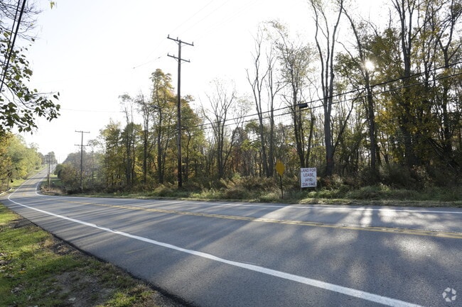
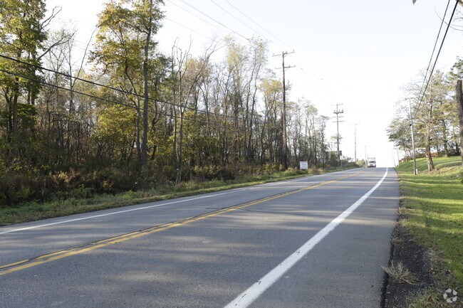
Us Route 30, Imperial, PA 15126
NEARBY LISTINGS FOR SALE OR LEASE
Property Detail
Us Route 30
Pittsburgh, PA
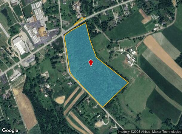
25.11 A LD RTE 30 COR TWP RD
1470-P-00226-0000-00
Allegheny
Vacantlandnec
Pennsylvania
X
226
42125C0055E
25.11 AC
2024
Parkway West Corridor
2025
Pittsburgh
452000
DEMOGRAPHICS near Us Route 30
1 Mile
3 Mile
5 Mile
2024 Total Population
868
3,057
10,063
2029 Population
874
3,051
9,922
Pop Growth 2024-2029
+ 0.69%
(0.20%)
(1.40%)
Average Age
38
41
41
2024 Total Households
326
1,209
3,900
HH Growth 2024-2029
+ 0.61%
(0.25%)
(1.38%)
Median Household Inc
$44,582
$68,515
$88,406
Avg Household Size
2.60
2.50
2.50
2024 Avg HH Vehicles
2.00
2.00
2.00
Median Home Value
$289,473
$247,500
$278,503
Median Year Built
1986
1985
1988
Nearby Places
Map Layers
Map Styles
 Street
 Aerial
- Restaurants
- Banks
- Shops
- Fitness
- Groceries
PUBLIC TRANSPORTATION
AIRPORT
Pittsburgh International
DRIVE
WALK
Distance
Pittsburgh International
18 min
8.3 mi
Freight Ports
Port of Toledo
DRIVE
WALK
Distance
Port of Toledo
254 min
222.6 mi
SALE & LEASE HISTORY
LISTING DATE
SALE/LEASE

Feb 28, 2019
For Lease
Feb 28, 2019
For Sale
Nearby Properties
Address
Land Use
TOTAL SIZE
Lot Size
Zoning
Address
Land Use
TOTAL SIZE
Lot Size
Zoning
87.51 AC
Address
Land Use
TOTAL SIZE
Lot Size
Zoning
66.86 AC
Address
Land Use
TOTAL SIZE
Lot Size
Zoning
46.47 AC
Address
Land Use
TOTAL SIZE
Lot Size
Zoning
20.73 AC
Address
Land Use
TOTAL SIZE
Lot Size
Zoning
17.49 AC
Address
Land Use
TOTAL SIZE
Lot Size
Zoning
34.17 AC
Address
Land Use
TOTAL SIZE
Lot Size
Zoning
16.40 AC
Address
Land Use
TOTAL SIZE
Lot Size
Zoning
Address
Land Use
TOTAL SIZE
Lot Size
Zoning
16.24 AC
Address
Land Use
TOTAL SIZE
Lot Size
Zoning
181.97 AC
Address
Land Use
TOTAL SIZE
Lot Size
Zoning
12.56 AC
Address
Land Use
TOTAL SIZE
Lot Size
Zoning
14.45 AC
Address
Land Use
TOTAL SIZE
Lot Size
Zoning
Address
Land Use
TOTAL SIZE
Lot Size
Zoning
11.64 AC
Address
Land Use
TOTAL SIZE
Lot Size
Zoning
596.90 AC
Address
Land Use
TOTAL SIZE
Lot Size
Zoning
Address
Land Use
TOTAL SIZE
Lot Size
Zoning
1.73 AC
Address
Land Use
TOTAL SIZE
Lot Size
Zoning
1.87 AC
Address
Land Use
TOTAL SIZE
Lot Size
Zoning
16.81 AC
Address
Land Use
TOTAL SIZE
Lot Size
Zoning
Address
Land Use
TOTAL SIZE
Lot Size
Zoning
30.40 AC
Address
Land Use
TOTAL SIZE
Lot Size
Zoning
37.02 AC
Address
Land Use
TOTAL SIZE
Lot Size
Zoning
32.10 AC
Address
Land Use
TOTAL SIZE
Lot Size
Zoning
1.42 AC
Address
Land Use
TOTAL SIZE
Lot Size
Zoning
2.55 AC
Address
Land Use
TOTAL SIZE
Lot Size
Zoning
175.32 AC
Address
Land Use
TOTAL SIZE
Lot Size
Zoning
17.01 AC
Address
Land Use
TOTAL SIZE
Lot Size
Zoning
433.70 AC
Address
Land Use
TOTAL SIZE
Lot Size
Zoning
9.01 AC
Address
Land Use
TOTAL SIZE
Lot Size
Zoning
15.02 AC
The World's #1 Commercial Real Estate Marketplace
Connect with us
© 2026 CoStar Group
The information above has been obtained from sources believed reliable. While we do not doubt its accuracy we have not verified it and make no guarantee, warranty or representation about it. It is your responsibility to independently confirm its accuracy and completeness. Any projections, opinions, assumptions, or estimates used are for example only and do not represent the current or future performance of the property. The value of this transaction to you depends on tax and other factors which should be evaluated by your tax, financial, and legal advisors. You and your advisors should conduct a careful, independent investigation of the property to determine to your satisfaction the suitability of the property for your needs.