Property Record
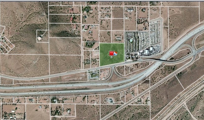
Vac Sierra Highway Vic San Gab, Acton, CA 93510

NEARBY LISTINGS FOR SALE OR LEASE
-
-
-
No Photo
-
-
View all Acton listings for sale on LoopNet.com
Property Detail
Vac Sierra Highway Vic San Gab
3057-015-051
S 1/2,SW 1/4,SE 1/4, NW 1/4 AND POR NW 1/4,NE 1/4,SW 1/4 OF SEC 28 T5N R12W
Desertorbarrenland
Los Angeles
X
California
06037C0885G
8.94 AC
2024
Antelope Valley
2025
Los Angeles
910815
Los Angeles-Long Beach-Glendale, CA
DEMOGRAPHICS near Vac Sierra Highway Vic San Gab
1 Mile
3 Mile
5 Mile
2024 Total Population
943
4,618
7,353
2029 Population
896
4,429
7,051
Pop Growth 2024-2029
(4.98%)
(4.09%)
(4.11%)
Average Age
44
45
45
2024 Total Households
345
1,669
2,633
HH Growth 2024-2029
(5.22%)
(4.37%)
(4.44%)
Median Household Inc
$129,722
$112,311
$114,121
Avg Household Size
2.70
2.70
2.70
2024 Avg HH Vehicles
3.00
3.00
3.00
Median Home Value
$720,183
$731,581
$743,620
Median Year Built
1982
1985
1984
Nearby Places
Map Layers
Map Styles
 Street
 Aerial
- Restaurants
- Banks
- Shops
- Fitness
- Groceries
PUBLIC TRANSPORTATION
COMMUTER RAIL
Vincent Grade/Acton (Antelope Valley Line - Southern California Regional Rail Authority (Metrolink))
DRIVE
WALK
Distance
Vincent Grade/Acton (Antelope Valley Line - Southern California Regional Rail Authority (Metrolink))
4 min
1.9 mi
Palmdale (Antelope Valley Line - Southern California Regional Rail Authority (Metrolink))
DRIVE
WALK
Distance
Palmdale (Antelope Valley Line - Southern California Regional Rail Authority (Metrolink))
13 min
9.6 mi
AIRPORT
Bob Hope
DRIVE
WALK
Distance
Bob Hope
48 min
40.8 mi
Freight Ports
Port of Long Beach
DRIVE
WALK
Distance
Port of Long Beach
91 min
77.2 mi
SALE & LEASE HISTORY
LISTING DATE
SALE/LEASE

Sep 05, 2017
For Sale
Nearby Properties
Address
Land Use
TOTAL SIZE
Lot Size
Zoning
Address
Land Use
TOTAL SIZE
Lot Size
Zoning
134,189 SF
11.43 AC
LCM1
Address
Land Use
TOTAL SIZE
Lot Size
Zoning
8.71 AC
LCC3DP*
Address
Land Use
TOTAL SIZE
Lot Size
Zoning
4.22 AC
LCC3DP*
Address
Land Use
TOTAL SIZE
Lot Size
Zoning
14,000 SF
3.12 AC
LCC3DP*
Address
Land Use
TOTAL SIZE
Lot Size
Zoning
3,216 SF
0.52 AC
LCC3DP*
Address
Land Use
TOTAL SIZE
Lot Size
Zoning
17,108 SF
1.80 AC
LCC4-A1100
Address
Land Use
TOTAL SIZE
Lot Size
Zoning
600 SF
1.92 AC
LCC4*
Address
Land Use
TOTAL SIZE
Lot Size
Zoning
2,628 SF
37.90 AC
LCA2 5
Address
Land Use
TOTAL SIZE
Lot Size
Zoning
22,014 SF
1.70 AC
LCA11*
Address
Land Use
TOTAL SIZE
Lot Size
Zoning
14,893 SF
1.19 AC
LCA11*
Address
Land Use
TOTAL SIZE
Lot Size
Zoning
1.81 AC
LCC4*
Address
Land Use
TOTAL SIZE
Lot Size
Zoning
2.90 AC
LCM1*
Address
Land Use
TOTAL SIZE
Lot Size
Zoning
7,379 SF
1.01 AC
LCA11*
Address
Land Use
TOTAL SIZE
Lot Size
Zoning
7.08 AC
LCM1*
Address
Land Use
TOTAL SIZE
Lot Size
Zoning
4,749 SF
3.21 AC
LCC4*
Address
Land Use
TOTAL SIZE
Lot Size
Zoning
1,659 SF
13.80 AC
LCA11*
Address
Land Use
TOTAL SIZE
Lot Size
Zoning
59.01 AC
LCA21*
Address
Land Use
TOTAL SIZE
Lot Size
Zoning
1.89 AC
E1
Address
Land Use
TOTAL SIZE
Lot Size
Zoning
744 SF
0.50 AC
LCA11*
Address
Land Use
TOTAL SIZE
Lot Size
Zoning
4,233 SF
6.43 AC
LCC4-M1*
Address
Land Use
TOTAL SIZE
Lot Size
Zoning
19.32 AC
LCA1
Address
Land Use
TOTAL SIZE
Lot Size
Zoning
7,200 SF
5 AC
LCM1*
Address
Land Use
TOTAL SIZE
Lot Size
Zoning
1.76 AC
LCC4
Address
Land Use
TOTAL SIZE
Lot Size
Zoning
1.03 AC
LCCRU
Address
Land Use
TOTAL SIZE
Lot Size
Zoning
2,581 SF
20.32 AC
LCA25*
Address
Land Use
TOTAL SIZE
Lot Size
Zoning
9.63 AC
LCA21*
Address
Land Use
TOTAL SIZE
Lot Size
Zoning
32.06 AC
LCA11-A21*
Address
Land Use
TOTAL SIZE
Lot Size
Zoning
72.27 AC
LCA21*
Address
Land Use
TOTAL SIZE
Lot Size
Zoning
6.91 AC
LCM1-A21*
The World's #1 Commercial Real Estate Marketplace
Connect with us
© 2026 CoStar Group
The information above has been obtained from sources believed reliable. While we do not doubt its accuracy we have not verified it and make no guarantee, warranty or representation about it. It is your responsibility to independently confirm its accuracy and completeness. Any projections, opinions, assumptions, or estimates used are for example only and do not represent the current or future performance of the property. The value of this transaction to you depends on tax and other factors which should be evaluated by your tax, financial, and legal advisors. You and your advisors should conduct a careful, independent investigation of the property to determine to your satisfaction the suitability of the property for your needs.